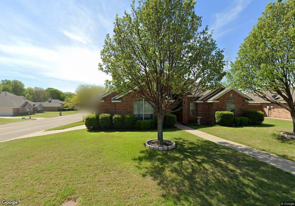
2230 Old Foundry Rd Weatherford, TX 76087
Estimated Value: $400,000 - $437,000
4
Beds
2
Baths
2,422
Sq Ft
$170/Sq Ft
Est. Value
About This Home
This home is located at 2230 Old Foundry Rd, Weatherford, TX 76087 and is currently estimated at $411,652, approximately $169 per square foot. 2230 Old Foundry Rd is a home located in Parker County with nearby schools including Martin Elementary School, Tison Middle School, and Weatherford High School.
Ownership History
Date
Name
Owned For
Owner Type
Purchase Details
Closed on
Aug 20, 2014
Sold by
Loop Todd and Loop Delores
Bought by
Brown Richard L and Brown Karen R
Current Estimated Value
Purchase Details
Closed on
Feb 23, 2007
Sold by
Autry Franklin U and Autry Kathy H
Bought by
Brown Richard L and Brown Karen R
Purchase Details
Closed on
Jun 29, 2006
Sold by
Windham Ronald P
Bought by
Brown Richard L and Brown Karen R
Purchase Details
Closed on
Feb 28, 2003
Sold by
Sandlin Homes Inc
Bought by
Brown Richard L and Brown Karen R
Purchase Details
Closed on
Nov 7, 2002
Sold by
Sandlin Brothers Jnt Venture
Bought by
Brown Richard L and Brown Karen R
Create a Home Valuation Report for This Property
The Home Valuation Report is an in-depth analysis detailing your home's value as well as a comparison with similar homes in the area
Home Values in the Area
Average Home Value in this Area
Purchase History
| Date | Buyer | Sale Price | Title Company |
|---|---|---|---|
| Brown Richard L | -- | Providence Title Company | |
| Brown Richard L | -- | -- | |
| Loop Todd | -- | Alamo Title | |
| Brown Richard L | -- | -- | |
| Autry Franklin U | -- | None Available | |
| Brown Richard L | -- | -- | |
| Brown Richard L | -- | -- |
Source: Public Records
Tax History Compared to Growth
Tax History
| Year | Tax Paid | Tax Assessment Tax Assessment Total Assessment is a certain percentage of the fair market value that is determined by local assessors to be the total taxable value of land and additions on the property. | Land | Improvement |
|---|---|---|---|---|
| 2025 | -- | $368,203 | -- | -- |
| 2024 | -- | $334,730 | -- | -- |
| 2023 | $5,845 | $304,300 | $0 | $0 |
| 2022 | $6,136 | $276,640 | $30,000 | $246,640 |
| 2021 | $6,321 | $276,640 | $30,000 | $246,640 |
| 2020 | $5,782 | $239,300 | $30,000 | $209,300 |
| 2019 | $6,111 | $239,300 | $30,000 | $209,300 |
| 2018 | $6,128 | $243,590 | $30,000 | $213,590 |
| 2017 | $5,715 | $243,590 | $30,000 | $213,590 |
| 2016 | $5,195 | $197,450 | $30,000 | $167,450 |
| 2015 | $4,395 | $197,450 | $30,000 | $167,450 |
| 2014 | $3,609 | $176,610 | $30,000 | $146,610 |
Source: Public Records
Map
Nearby Homes
- 2217 Lorrie Ln
- 2122 Louis Tr
- 513 Waterford Park Blvd
- 517 Waterford Park Blvd
- 516 Waterford Park Blvd
- 521 Waterford Park Blvd
- 520 Waterford Park Blvd
- 532 Mitchell Blvd
- 541 Waterford Park Blvd
- 536 Mitchell Blvd
- 541 Mitchell Blvd
- 540 Waterford Park Blvd
- 540 Waterford Park
- 549 Waterford Park Blvd
- 544 Waterford Park Blvd
- 557 Waterford Park Blvd
- 2300 Shamrock Ln
- 2313 Shamrock Ln
- 2317 Shamrock Ln
- 2321 Shamrock Ln
- 2226 Old Foundry Rd
- 309 Mitchell Blvd
- 2222 Old Foundry Rd
- 2229 Old Foundry Rd
- 305 Mitchell Blvd
- 322 Mitchell Blvd
- 2225 Old Foundry Rd
- 239 Shirley Cir
- 2218 Old Foundry Rd
- 318 Mitchell Blvd
- 402 Mitchell Blvd
- 2221 Old Foundry Rd
- 314 Mitchell Blvd
- 301 Mitchell Blvd
- 2234 Lorrie Ln
- 406 Mitchell Blvd
- 2230 Lorrie Ln
- 2214 Old Foundry Rd
- 235 Shirley Cir
- 2226 Lorrie Ln