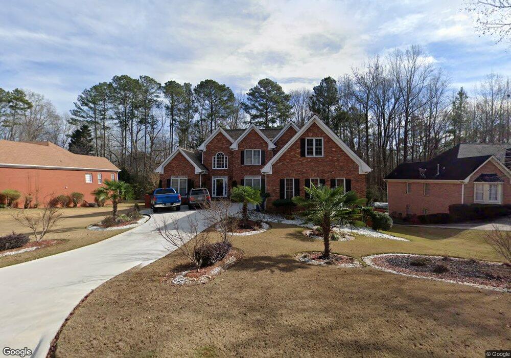
2230 Weatherstone Cir SE Conyers, GA 30094
Estimated Value: $455,000 - $487,845
4
Beds
3
Baths
5,170
Sq Ft
$91/Sq Ft
Est. Value
About This Home
This home is located at 2230 Weatherstone Cir SE, Conyers, GA 30094 and is currently estimated at $469,461, approximately $90 per square foot. 2230 Weatherstone Cir SE is a home located in Rockdale County with nearby schools including Flat Shoals Elementary School, Edwards Middle School, and Rockdale County High School.
Ownership History
Date
Name
Owned For
Owner Type
Purchase Details
Closed on
May 27, 2016
Sold by
Roppo James J
Bought by
Chevalier Dartiss and Chevalier Patrick
Current Estimated Value
Home Financials for this Owner
Home Financials are based on the most recent Mortgage that was taken out on this home.
Original Mortgage
$251,322
Outstanding Balance
$201,189
Interest Rate
3.75%
Mortgage Type
FHA
Estimated Equity
$268,272
Purchase Details
Closed on
Oct 29, 1996
Sold by
Mcstay Frank Mitzi
Bought by
Low Norbert Yaundla
Create a Home Valuation Report for This Property
The Home Valuation Report is an in-depth analysis detailing your home's value as well as a comparison with similar homes in the area
Home Values in the Area
Average Home Value in this Area
Purchase History
| Date | Buyer | Sale Price | Title Company |
|---|---|---|---|
| Chevalier Dartiss | $260,000 | -- | |
| Low Norbert Yaundla | $180,000 | -- |
Source: Public Records
Mortgage History
| Date | Status | Borrower | Loan Amount |
|---|---|---|---|
| Open | Chevalier Dartiss | $251,322 | |
| Closed | Low Norbert Yaundla | $0 |
Source: Public Records
Tax History Compared to Growth
Tax History
| Year | Tax Paid | Tax Assessment Tax Assessment Total Assessment is a certain percentage of the fair market value that is determined by local assessors to be the total taxable value of land and additions on the property. | Land | Improvement |
|---|---|---|---|---|
| 2024 | $5,222 | $206,480 | $30,920 | $175,560 |
| 2023 | $4,767 | $195,520 | $30,800 | $164,720 |
| 2022 | $3,851 | $159,840 | $24,960 | $134,880 |
| 2021 | $3,427 | $134,280 | $20,800 | $113,480 |
| 2020 | $3,120 | $118,360 | $17,760 | $100,600 |
| 2019 | $2,983 | $111,400 | $10,800 | $100,600 |
| 2018 | $2,838 | $106,080 | $10,800 | $95,280 |
| 2017 | $2,806 | $103,840 | $10,800 | $93,040 |
| 2016 | $4,784 | $104,720 | $10,800 | $93,920 |
| 2015 | $1,132 | $70,960 | $9,320 | $61,640 |
| 2014 | $882 | $68,200 | $8,000 | $60,200 |
| 2013 | -- | $88,800 | $13,600 | $75,200 |
Source: Public Records
Map
Nearby Homes
- Boston Plan at Millers Pointe
- Atlanta Plan at Millers Pointe
- Columbus Plan at Millers Pointe
- 2464 Lennox Rd SE
- 2197 Boxwood Cir
- Astrid Plan at Alder Park
- Harrison Plan at Alder Park
- Baker Plan at Alder Park
- Oliver Plan at Alder Park
- 2608 Downing Park Dr SE
- 660 Kirkus Dr SE
- 2537 Lennox Rd SE
- 340 Windsor Walk SE
- 1242 Saxony Dr SE
- 1402 Aramore Dr SE
- 1420 Hillside Place SE
- 1408 Aramore Dr SE
- 1019 Henna Ct SE
- 2631 Rolling Hills Way SE
- 309 Windsor Walk SE Unit 1
- 2240 Weatherstone Cir SE Unit 2
- 2220 Weatherstone Cir SE Unit 2
- 0 Weatherstone Cir SE Unit 7491082
- 0 Weatherstone Cir SE Unit 9035040
- 0 Weatherstone Cir SE Unit 3208191
- 0 Weatherstone Cir SE Unit 3252207
- 0 Weatherstone Cir SE Unit 3287153
- 0 Weatherstone Cir SE Unit 7072845
- 0 Weatherstone Cir SE Unit 7161363
- 0 Weatherstone Cir SE Unit 7271252
- 0 Weatherstone Cir SE Unit 8055694
- 0 Weatherstone Cir SE Unit 8230629
- 0 Weatherstone Cir SE Unit 8268404
- 0 Weatherstone Cir SE Unit 8341466
- 2250 Weatherstone Cir SE
- 2210 Weatherstone Cir SE
- 2231 Weatherstone Cir SE
- 2241 Weatherstone Cir SE
- 1914 Sheldon Ln
- 2221 Weatherstone Cir SE