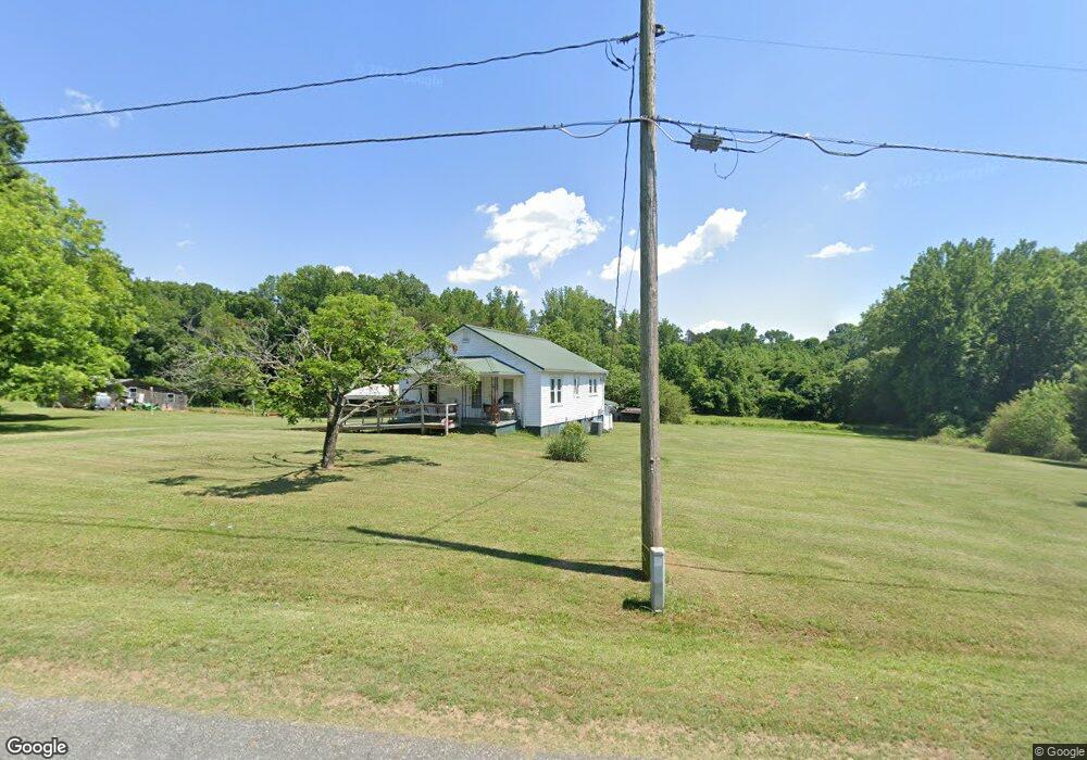
2231 Bristol Rd Statesville, NC 28677
Estimated Value: $95,000 - $196,000
2
Beds
1
Bath
1,408
Sq Ft
$104/Sq Ft
Est. Value
About This Home
This home is located at 2231 Bristol Rd, Statesville, NC 28677 and is currently estimated at $146,389, approximately $103 per square foot. 2231 Bristol Rd is a home located in Iredell County with nearby schools including N.B. Mills Elementary School, West Iredell Middle School, and West Iredell High School.
Ownership History
Date
Name
Owned For
Owner Type
Purchase Details
Closed on
Jun 24, 2005
Sold by
Harrold Linda S
Bought by
Harrold Monroe and Harrold Myra
Current Estimated Value
Home Financials for this Owner
Home Financials are based on the most recent Mortgage that was taken out on this home.
Original Mortgage
$33,787
Interest Rate
5.7%
Mortgage Type
Purchase Money Mortgage
Purchase Details
Closed on
Jun 1, 1975
Purchase Details
Closed on
Jun 1, 1950
Create a Home Valuation Report for This Property
The Home Valuation Report is an in-depth analysis detailing your home's value as well as a comparison with similar homes in the area
Home Values in the Area
Average Home Value in this Area
Purchase History
| Date | Buyer | Sale Price | Title Company |
|---|---|---|---|
| Harrold Monroe | $32,500 | -- | |
| -- | $15,000 | -- | |
| -- | -- | -- |
Source: Public Records
Mortgage History
| Date | Status | Borrower | Loan Amount |
|---|---|---|---|
| Closed | Harrold Monroe | $33,787 |
Source: Public Records
Tax History Compared to Growth
Tax History
| Year | Tax Paid | Tax Assessment Tax Assessment Total Assessment is a certain percentage of the fair market value that is determined by local assessors to be the total taxable value of land and additions on the property. | Land | Improvement |
|---|---|---|---|---|
| 2024 | $464 | $68,440 | $27,120 | $41,320 |
| 2023 | $464 | $68,440 | $27,120 | $41,320 |
| 2022 | $381 | $51,230 | $27,120 | $24,110 |
| 2021 | $377 | $51,230 | $27,120 | $24,110 |
| 2020 | $193 | $51,230 | $27,120 | $24,110 |
| 2019 | $190 | $51,230 | $27,120 | $24,110 |
| 2018 | $134 | $43,040 | $25,030 | $18,010 |
| 2017 | $134 | $43,040 | $25,030 | $18,010 |
| 2016 | $134 | $43,040 | $25,030 | $18,010 |
| 2015 | $134 | $43,040 | $25,030 | $18,010 |
| 2014 | $164 | $49,780 | $25,030 | $24,750 |
Source: Public Records
Map
Nearby Homes
- 3 Williams Ave
- 1309 Williams Rd
- 2321 Cline St
- 812 Candy Dr
- 818 Candy Dr
- 1120 Rita Ave
- 1129 Rita Ave
- 1716 Younger Ave
- Robie Plan at Bristol Terrace
- Penwell Plan at Bristol Terrace
- Hayden Plan at Bristol Terrace
- 119 Mary Locke Way
- Cali Plan at Bristol Terrace
- Aria Plan at Bristol Terrace
- Darwin Plan at Bristol Terrace
- Hamilton Plan at Bristol Terrace
- 131 Mary Locke Way
- Galen Plan at Bristol Terrace
- Aisle Plan at Bristol Terrace
- 417 Central Dr
- 2211 Bristol Rd
- 2224 Bristol Rd
- 2209 Bristol Rd
- 2208 Bristol Rd
- 2202 Bristol Rd
- 2131 Bristol Rd
- 2230 Bristol Rd
- 2250 Bristol Rd
- 2002 Ivey Ln
- 830 Speigle Ln
- 2251 Bristol Rd
- 2129 Bristol Rd
- 2000 Ivey Ln
- 2126 Bristol Rd
- 2253 Bristol Rd
- 2127 Bristol Rd
- 2127 Bristol Rd
- 820 Speigle Ln
- 904 Ivey Ln
- 902 Ivey Ln