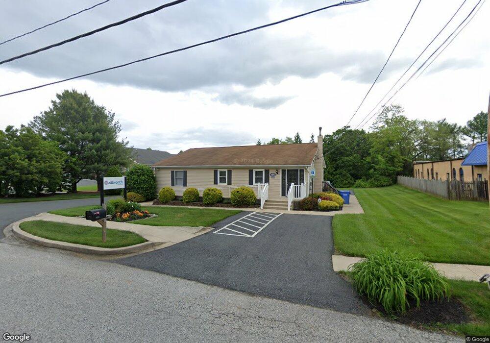
2231 Old Emmorton Rd Bel Air, MD 21015
Estimated Value: $540,870
--
Bed
--
Bath
1,886
Sq Ft
$287/Sq Ft
Est. Value
About This Home
This home is located at 2231 Old Emmorton Rd, Bel Air, MD 21015 and is currently estimated at $540,870, approximately $286 per square foot. 2231 Old Emmorton Rd is a home located in Harford County with nearby schools including Ring Factory Elementary School, Patterson Mill Middle School, and Patterson Mill High School.
Ownership History
Date
Name
Owned For
Owner Type
Purchase Details
Closed on
Jul 30, 2015
Sold by
Novak Daniel J and Novak Carol A
Bought by
2231 Old Emmorton Road Llc
Current Estimated Value
Purchase Details
Closed on
Feb 28, 2001
Sold by
Cullum George
Bought by
Novak Daniel J and Novak Carol A
Purchase Details
Closed on
Jun 11, 1996
Sold by
Hannah Alma
Bought by
Cullum George and Cullum Sharon
Purchase Details
Closed on
Apr 15, 1996
Sold by
Hannah George Allen
Bought by
Hannah Alma
Create a Home Valuation Report for This Property
The Home Valuation Report is an in-depth analysis detailing your home's value as well as a comparison with similar homes in the area
Home Values in the Area
Average Home Value in this Area
Purchase History
| Date | Buyer | Sale Price | Title Company |
|---|---|---|---|
| 2231 Old Emmorton Road Llc | -- | None Available | |
| Novak Daniel J | $207,000 | -- | |
| Cullum George | $80,000 | -- | |
| Hannah Alma | -- | -- |
Source: Public Records
Mortgage History
| Date | Status | Borrower | Loan Amount |
|---|---|---|---|
| Closed | Novak Daniel J | -- |
Source: Public Records
Tax History Compared to Growth
Tax History
| Year | Tax Paid | Tax Assessment Tax Assessment Total Assessment is a certain percentage of the fair market value that is determined by local assessors to be the total taxable value of land and additions on the property. | Land | Improvement |
|---|---|---|---|---|
| 2025 | $4,860 | $458,667 | $0 | $0 |
| 2024 | $4,671 | $445,933 | $0 | $0 |
| 2023 | $4,671 | $433,200 | $250,000 | $183,200 |
| 2022 | $4,671 | $428,567 | $0 | $0 |
| 2021 | $4,839 | $423,933 | $0 | $0 |
| 2020 | $4,839 | $419,300 | $250,000 | $169,300 |
| 2019 | $4,814 | $417,200 | $0 | $0 |
| 2018 | $4,747 | $415,100 | $0 | $0 |
| 2017 | $4,723 | $413,000 | $0 | $0 |
| 2016 | $944 | $410,800 | $0 | $0 |
| 2015 | $5,480 | $408,600 | $0 | $0 |
| 2014 | $5,480 | $406,400 | $0 | $0 |
Source: Public Records
Map
Nearby Homes
- 220 Hunters Run Terrace
- 209 Hunters Run Terrace
- 234 Hunters Run Terrace
- 2104 Cameron Ct
- 25 Oak Crest Ct
- 43 Oak Crest Ct
- 306 Fox Hound Ct
- 233 Burkwood Ct
- 2411 Grand Oaks Ct
- 202 Burkwood Ct
- 201 Burkwood Ct Unit 3B
- 130 Royal Oak Dr Unit L
- 100 Royal Oak Dr Unit I
- 2302 Bell's Tower Ct
- 2332 Darby Ct
- 2310 Bell's Tower Ct Unit 5
- 214 Maple Wreath Ct
- Parkland Plan at Bell's Tower - Bell's Tower
- 2414 Laurel Bush Rd
- 285 Maple Wreath Ct
- 2235 Old Emmorton Rd
- 2232 Old Emmorton Rd
- 2230 Old Emmorton Rd
- 2237 Old Emmorton Rd
- 2228 Old Emmorton Rd
- 2239 Old Emmorton Rd
- 2234 Old Emmorton Rd
- 201 Temple Dr
- 2227 Old Emmorton Rd Unit 112
- 2227 Old Emmorton Rd Unit 222
- 2226 Old Emmorton Rd
- 108 E Wheel Rd
- 203 Temple Dr
- 205 Temple Dr
- 200 Temple Dr
- 207 Temple Dr
- 204 Temple Dr
- 215 Point to Point Square
- 209 Temple Dr
- 213 Point to Point Square