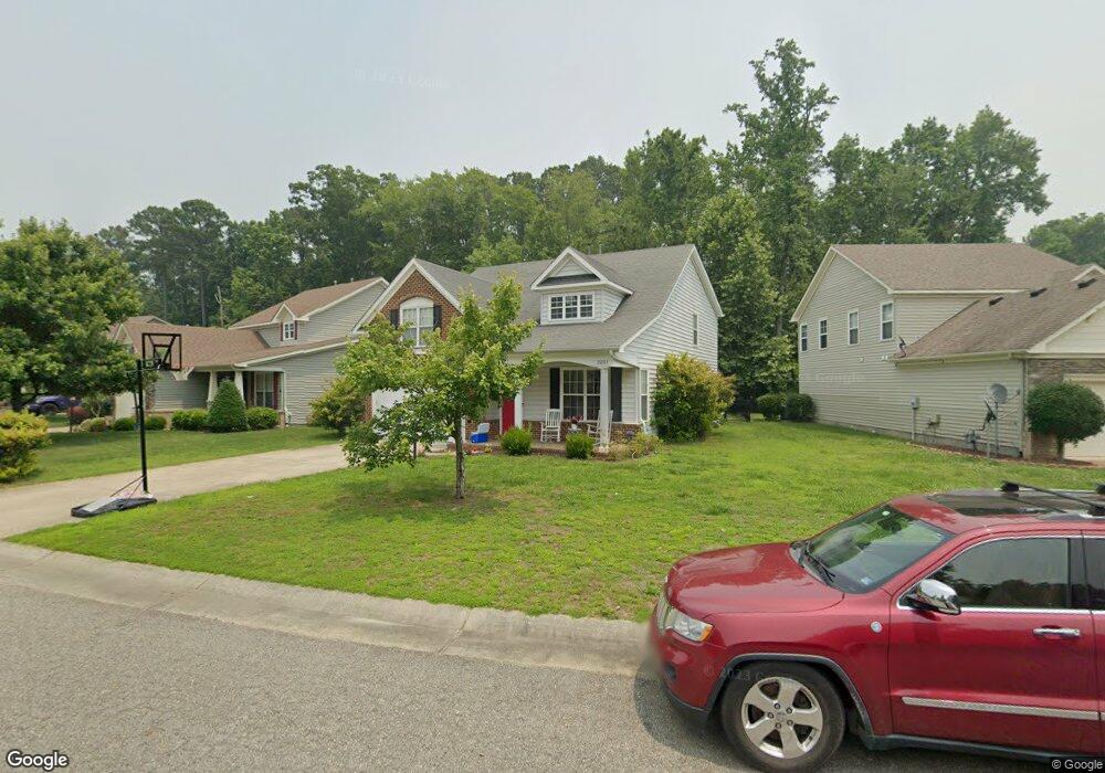
22311 Charthouse Ln Carrollton, VA 23314
Estimated Value: $426,000 - $479,000
4
Beds
3
Baths
2,735
Sq Ft
$169/Sq Ft
Est. Value
About This Home
This home is located at 22311 Charthouse Ln, Carrollton, VA 23314 and is currently estimated at $463,033, approximately $169 per square foot. 22311 Charthouse Ln is a home located in Isle of Wight County with nearby schools including Carrollton Elementary School, Smithfield Middle School, and Smithfield High School.
Ownership History
Date
Name
Owned For
Owner Type
Purchase Details
Closed on
Jul 15, 2020
Sold by
Lawson Ruth Am & Erick J
Bought by
Warf Brooke Hewitt
Current Estimated Value
Home Financials for this Owner
Home Financials are based on the most recent Mortgage that was taken out on this home.
Original Mortgage
$323,000
Outstanding Balance
$287,890
Interest Rate
3.38%
Mortgage Type
New Conventional
Estimated Equity
$175,143
Purchase Details
Closed on
Aug 1, 2007
Sold by
Tract 7 Llc
Purchase Details
Closed on
May 20, 2005
Create a Home Valuation Report for This Property
The Home Valuation Report is an in-depth analysis detailing your home's value as well as a comparison with similar homes in the area
Home Values in the Area
Average Home Value in this Area
Purchase History
| Date | Buyer | Sale Price | Title Company |
|---|---|---|---|
| Warf Brooke Hewitt | $340,000 | Old Republic National Title | |
| -- | $412,000 | -- | |
| -- | $2,001,000 | -- |
Source: Public Records
Mortgage History
| Date | Status | Borrower | Loan Amount |
|---|---|---|---|
| Open | Warf Brooke Hewitt | $323,000 |
Source: Public Records
Tax History Compared to Growth
Tax History
| Year | Tax Paid | Tax Assessment Tax Assessment Total Assessment is a certain percentage of the fair market value that is determined by local assessors to be the total taxable value of land and additions on the property. | Land | Improvement |
|---|---|---|---|---|
| 2025 | $3,281 | $423,300 | $70,000 | $353,300 |
| 2024 | $3,090 | $423,300 | $70,000 | $353,300 |
| 2023 | $3,059 | $423,300 | $70,000 | $353,300 |
| 2022 | $2,831 | $326,700 | $70,000 | $256,700 |
| 2021 | $2,831 | $326,700 | $70,000 | $256,700 |
| 2020 | $2,831 | $326,700 | $70,000 | $256,700 |
| 2019 | $2,831 | $326,700 | $70,000 | $256,700 |
| 2018 | $2,687 | $309,800 | $70,000 | $239,800 |
| 2016 | $2,705 | $309,800 | $70,000 | $239,800 |
| 2015 | $2,357 | $309,800 | $70,000 | $239,800 |
| 2014 | $2,357 | $268,800 | $70,000 | $198,800 |
| 2013 | -- | $268,800 | $70,000 | $198,800 |
Source: Public Records
Map
Nearby Homes
- 22346 Tradewinds Dr
- 3.42AC Smiths Neck Rd
- 13032 Lighthouse Ln
- 1105 Rivers Arch
- 12464 Grand Square Ln
- 1002 Rivers Arch
- 1509 Broad Water Arch
- 902 Rivers Arch
- 301 Blue Heron Trail
- 410 Marsh Hawk Trail
- 2002 James River Trail
- 13435 Prince Andrew Trail
- Caroline Plan at South Harbor - Towns 55 Plus
- 13554 S Village Way
- 13309 Regent Park Walk
- 13461 Prince Andrew Trail
- 13436 Prince Andrew Trail
- Palladio 2 Story Plan at South Harbor - Single-Family 55 Plus
- Bramante 2 Story Plan at South Harbor - Single-Family 55 Plus
- Palladio Ranch Plan at South Harbor - Single-Family 55 Plus
- 22317 Charthouse Ln
- 22317 Charthouse Ln
- 22323 Charthouse Ln
- 22299 Charthouse Ln
- 13136 Meridian Place
- 13139 Starboard Cir
- 22329 Charthouse Ln
- 22293 Charthouse Ln
- 22293 Charthouse Ln
- 13128 Meridian Place
- 13128 Meridian Place Unit Pl
- 13127 Starboard Cir
- 22335 Charthouse Ln
- 13137 Meridian Place
- 22287 Charthouse Ln
- 13163 Windward Place
- 13122 Meridian Place
- 13121 Starboard Cir
- 13131 Meridian Place
- 22341 Charthouse Ln