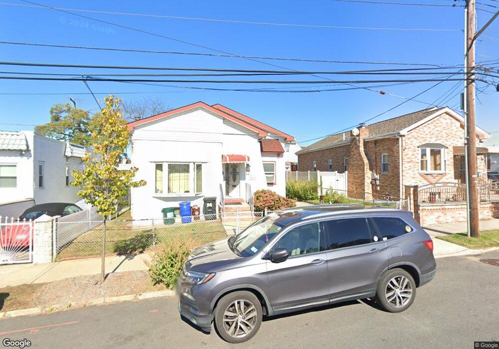
22315 133rd Ave Springfield Gardens, NY 11413
Laurelton NeighborhoodEstimated Value: $579,953 - $773,000
--
Bed
--
Bath
1,094
Sq Ft
$641/Sq Ft
Est. Value
About This Home
This home is located at 22315 133rd Ave, Springfield Gardens, NY 11413 and is currently estimated at $701,738, approximately $641 per square foot. 22315 133rd Ave is a home located in Queens County with nearby schools including P.S. 132 - Ralph Bunche, Is 59 Springfield Gardens, and Success Academy Springfield Gardens.
Ownership History
Date
Name
Owned For
Owner Type
Purchase Details
Closed on
Dec 30, 1994
Sold by
Millard Ralph A and Millard Glennie L
Bought by
Millard Glennie L
Current Estimated Value
Home Financials for this Owner
Home Financials are based on the most recent Mortgage that was taken out on this home.
Original Mortgage
$119,000
Interest Rate
9.18%
Create a Home Valuation Report for This Property
The Home Valuation Report is an in-depth analysis detailing your home's value as well as a comparison with similar homes in the area
Home Values in the Area
Average Home Value in this Area
Purchase History
| Date | Buyer | Sale Price | Title Company |
|---|---|---|---|
| Millard Glennie L | -- | -- | |
| Millard Glennie L | -- | -- |
Source: Public Records
Mortgage History
| Date | Status | Borrower | Loan Amount |
|---|---|---|---|
| Closed | Millard Glennie L | $119,000 |
Source: Public Records
Tax History Compared to Growth
Tax History
| Year | Tax Paid | Tax Assessment Tax Assessment Total Assessment is a certain percentage of the fair market value that is determined by local assessors to be the total taxable value of land and additions on the property. | Land | Improvement |
|---|---|---|---|---|
| 2025 | $5,467 | $30,337 | $10,831 | $19,506 |
| 2024 | $4,229 | $28,620 | $12,249 | $16,371 |
| 2023 | $5,142 | $27,000 | $9,925 | $17,075 |
| 2022 | $3,853 | $31,860 | $12,660 | $19,200 |
| 2021 | $4,094 | $32,040 | $12,660 | $19,380 |
| 2020 | $5,055 | $32,100 | $12,660 | $19,440 |
| 2019 | $4,696 | $30,540 | $12,660 | $17,880 |
| 2018 | $4,289 | $22,500 | $12,660 | $9,840 |
| 2017 | $4,458 | $23,340 | $12,660 | $10,680 |
| 2016 | $4,244 | $23,340 | $12,660 | $10,680 |
| 2015 | $2,525 | $21,496 | $11,830 | $9,666 |
| 2014 | $2,525 | $20,304 | $11,415 | $8,889 |
Source: Public Records
Map
Nearby Homes
- 131-35 222nd St
- 133-23 225th St
- 131-20 224th St
- 133-22 226th St
- 22310 131st Ave
- 131-41 226th St Unit 60
- 133-15 220th St
- 131-18 226th St
- 134-15 221st St
- 134-16 221st St
- 223-12 134th Rd
- 21931 133rd Ave
- 13062 225th St
- 22126 134th Rd
- 220-27 134th Rd
- 21917 132nd Rd
- 130-43 224th St
- 220-24 134th Rd
- 218-36 133rd Rd
- 13512 223rd St
- 22317 133rd Ave
- 22309 133rd Ave
- 131-72 224th St
- 13172 224th St
- 22305 133rd Ave
- 13170 224th St
- 224-01 133rd Ave
- 22301 133rd Ave
- 13173 223rd St
- 13166 224th St
- 22401 133rd Ave
- 22314 133rd Ave
- 223-14 133rd Ave
- 22310 133rd Ave
- 13171 223rd St
- 22318 133rd Ave
- 13162 224th St
- 22306 133rd Ave
- 133-20 224th St
- 133-20 NE 224 St