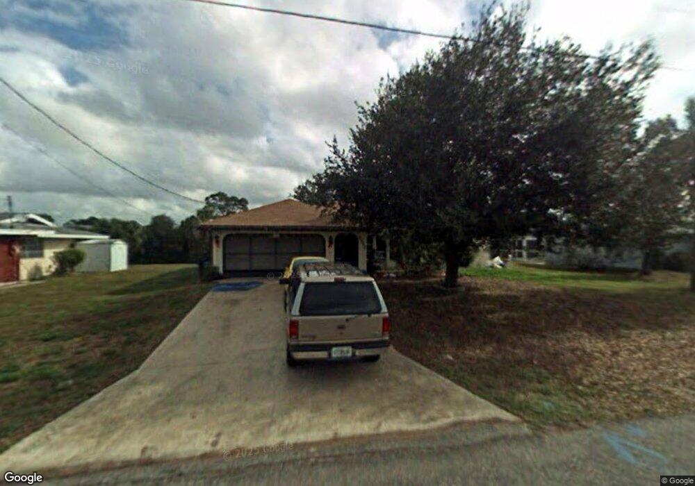
2232 Barksdale St Port Charlotte, FL 33948
Estimated Value: $262,000 - $409,000
3
Beds
2
Baths
1,279
Sq Ft
$259/Sq Ft
Est. Value
About This Home
This home is located at 2232 Barksdale St, Port Charlotte, FL 33948 and is currently estimated at $330,865, approximately $258 per square foot. 2232 Barksdale St is a home located in Charlotte County with nearby schools including Liberty Elementary School, Murdock Middle School, and Port Charlotte High School.
Ownership History
Date
Name
Owned For
Owner Type
Purchase Details
Closed on
Nov 12, 2004
Sold by
Thompson Patricia
Bought by
Sasseville Roger R and Sasseville Mary Ellen
Current Estimated Value
Purchase Details
Closed on
Sep 20, 1995
Sold by
Larsen Lawrence C and Larsen Beatrice M
Bought by
Thompson Richard L and Thompson Patricia M
Home Financials for this Owner
Home Financials are based on the most recent Mortgage that was taken out on this home.
Original Mortgage
$60,000
Interest Rate
7.74%
Create a Home Valuation Report for This Property
The Home Valuation Report is an in-depth analysis detailing your home's value as well as a comparison with similar homes in the area
Home Values in the Area
Average Home Value in this Area
Purchase History
| Date | Buyer | Sale Price | Title Company |
|---|---|---|---|
| Sasseville Roger R | $290,000 | Premier Title Of Florida | |
| Thompson Richard L | $115,000 | -- |
Source: Public Records
Mortgage History
| Date | Status | Borrower | Loan Amount |
|---|---|---|---|
| Previous Owner | Thompson Richard L | $60,000 |
Source: Public Records
Tax History Compared to Growth
Tax History
| Year | Tax Paid | Tax Assessment Tax Assessment Total Assessment is a certain percentage of the fair market value that is determined by local assessors to be the total taxable value of land and additions on the property. | Land | Improvement |
|---|---|---|---|---|
| 2023 | $1,941 | $141,252 | $0 | $0 |
| 2022 | $1,917 | $137,138 | $0 | $0 |
| 2021 | $1,896 | $133,073 | $0 | $0 |
| 2020 | $1,846 | $131,236 | $0 | $0 |
| 2019 | $1,754 | $128,285 | $0 | $0 |
| 2018 | $1,585 | $125,893 | $0 | $0 |
| 2017 | $1,562 | $123,304 | $0 | $0 |
| 2016 | $1,547 | $120,768 | $0 | $0 |
| 2015 | $1,768 | $114,945 | $0 | $0 |
| 2014 | $1,741 | $114,033 | $0 | $0 |
Source: Public Records
Map
Nearby Homes
- 2059 Cannolot Blvd
- 2051 Cannolot Blvd
- 2267 Cannolot Blvd
- 2281 Barksdale St
- 18275 Troon Ave
- 18161 Windswept Ave
- 2399 Bendway Dr
- 18316 Monmouth Ave
- 2331 Cannolot Blvd
- 18323 Yale Ave
- 18088 Windingvail Ave
- 18183 Windingvail Ave
- 2424 Auburn Blvd
- 18323 Troon Ave
- 2123 Cannolot Blvd
- 18071 Windswept Ave
- 2113 Barksdale St
- 2145 Winningway St
- 2324 Fintonrod St
- 18354 Locklane Ave
- 2224 Barksdale St
- 2240 Barksdale St
- 2248 Barksdale St
- 2257 Barksdale St
- 18208 Summerdown Ave
- 18209 Summerdown Ave
- 2235 Cannolot Blvd
- 2243 Cannolot Blvd
- 2251 Cannolot Blvd
- 2219 Cannolot Blvd
- 18198 Summerdown Ave
- 2200 Barksdale St
- 2264 Barksdale St
- 2259 Cannolot Blvd
- 2051 & 2059 Cannolot Blvd
- 2019 Cannolot Blvd
- 2139 Cannolot Blvd
- 2211 Cannolot Blvd
- 18191 Summerdown Ave
- 18190 Summerdown Ave