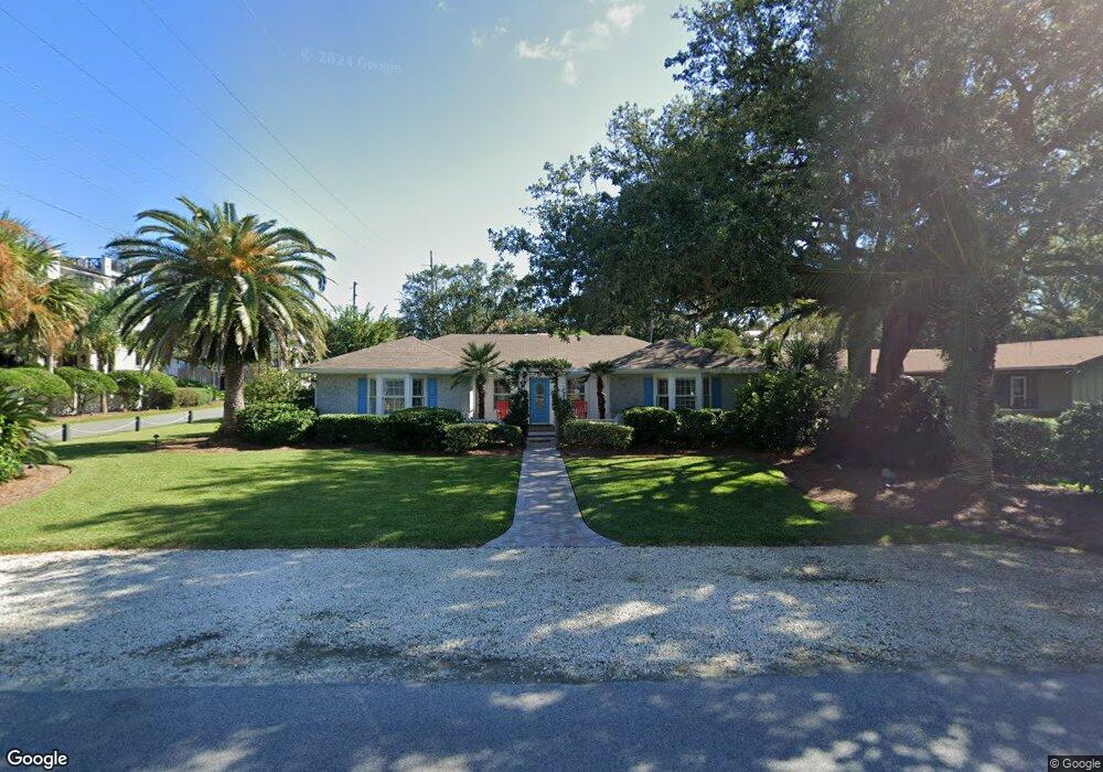
2232 Ocean Rd Brunswick, GA 31522
Estimated Value: $1,299,000 - $2,287,000
4
Beds
3
Baths
1,818
Sq Ft
$974/Sq Ft
Est. Value
About This Home
This home is located at 2232 Ocean Rd, Brunswick, GA 31522 and is currently estimated at $1,771,377, approximately $974 per square foot. 2232 Ocean Rd is a home located in Glynn County with nearby schools including St. Simons Elementary School, Glynn Middle School, and Glynn Academy.
Ownership History
Date
Name
Owned For
Owner Type
Purchase Details
Closed on
Aug 23, 2019
Sold by
Roberta Davis Revocable Trust
Bought by
Gesner Thomas Andrew
Current Estimated Value
Home Financials for this Owner
Home Financials are based on the most recent Mortgage that was taken out on this home.
Original Mortgage
$540,000
Outstanding Balance
$470,974
Interest Rate
3.5%
Mortgage Type
New Conventional
Estimated Equity
$1,300,403
Purchase Details
Closed on
Nov 1, 2010
Sold by
Davis Gerard H
Bought by
Davis Gerard H and Farmer Sima F
Purchase Details
Closed on
Mar 7, 2006
Sold by
Davis Gerard H
Bought by
Davis Roberta
Create a Home Valuation Report for This Property
The Home Valuation Report is an in-depth analysis detailing your home's value as well as a comparison with similar homes in the area
Home Values in the Area
Average Home Value in this Area
Purchase History
| Date | Buyer | Sale Price | Title Company |
|---|---|---|---|
| Gesner Thomas Andrew | $675,001 | -- | |
| Davis Gerard H | -- | -- | |
| Davis Roberta | -- | -- |
Source: Public Records
Mortgage History
| Date | Status | Borrower | Loan Amount |
|---|---|---|---|
| Open | Gesner Thomas Andrew | $540,000 |
Source: Public Records
Tax History Compared to Growth
Tax History
| Year | Tax Paid | Tax Assessment Tax Assessment Total Assessment is a certain percentage of the fair market value that is determined by local assessors to be the total taxable value of land and additions on the property. | Land | Improvement |
|---|---|---|---|---|
| 2025 | $15,947 | $635,880 | $489,600 | $146,280 |
| 2024 | $14,464 | $576,720 | $432,000 | $144,720 |
| 2023 | $14,297 | $576,720 | $432,000 | $144,720 |
| 2022 | $6,778 | $265,280 | $201,600 | $63,680 |
| 2021 | $6,954 | $264,080 | $201,600 | $62,480 |
| 2020 | $7,020 | $264,080 | $201,600 | $62,480 |
| 2019 | $7,276 | $273,880 | $201,600 | $72,280 |
| 2018 | $7,276 | $273,880 | $201,600 | $72,280 |
| 2017 | $7,276 | $273,880 | $201,600 | $72,280 |
| 2016 | $5,661 | $230,680 | $158,400 | $72,280 |
| 2015 | $5,684 | $230,680 | $158,400 | $72,280 |
| 2014 | $5,684 | $230,680 | $158,400 | $72,280 |
Source: Public Records
Map
Nearby Homes
- 4318 13th St
- 2022 Bruce Cir
- 4318 7th St
- 1909 Dixon Ln
- 1709 Dixon Ln
- 1626 Bruce Dr
- 1604 Bruce Dr
- 103 Cater St
- 135 Stewart St
- 207 Military Rd
- 118 Grand Oaks Ln
- 6 Coast Cottage Ln
- 17 Sea Oats Ln
- 11822 Old Demere Rd
- 5 and 7 Sea Oats Ln
- 1528 Ocean Blvd
- 240 Peachtree St
- 524 Wesley Oak Cir
- 113 Peachtree St
- 1524 Wood Ave Unit 303
- 2232 Ocean Rd
- 4340 15th St
- 2224 Ocean Rd
- 4329 15th St
- 4333 Fifteenth St
- 4333 15th St
- 2301 Pelican St
- 4333 Fifteenth St East Beach
- 4342 14th St
- 15Th 15th St
- 4334 14th St
- 2303 Pelican St
- 4334 Fourteenth St Beach E
- 4334 Fourteenth Street Beach E
- 4328 Fifteenth St
- 4334 14th St
- 4327 15th St
- 4340 Fifteenth St
- 2301 Ocean Rd
- 2305 Ocean Rd