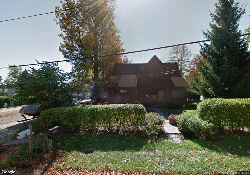
22327 Maple St Cassopolis, MI 49031
Estimated Value: $290,660 - $394,000
4
Beds
2
Baths
2,572
Sq Ft
$134/Sq Ft
Est. Value
About This Home
This home is located at 22327 Maple St, Cassopolis, MI 49031 and is currently estimated at $343,915, approximately $133 per square foot. 22327 Maple St is a home located in Cass County with nearby schools including Sam Adams Elementary School, Cassopolis Middle School, and Cassopolis Ross Beatty High School.
Ownership History
Date
Name
Owned For
Owner Type
Purchase Details
Closed on
Feb 13, 2026
Sold by
Mannell Mary Eileen
Bought by
Mannell Mary Eileen and Mannell Kelly
Current Estimated Value
Purchase Details
Closed on
Jul 24, 2019
Sold by
Staley Mark R
Bought by
Mannell Mary Eileen and Staley Mary Eileen
Home Financials for this Owner
Home Financials are based on the most recent Mortgage that was taken out on this home.
Original Mortgage
$75,500
Interest Rate
3.7%
Mortgage Type
Commercial
Create a Home Valuation Report for This Property
The Home Valuation Report is an in-depth analysis detailing your home's value as well as a comparison with similar homes in the area
Purchase History
| Date | Buyer | Sale Price | Title Company |
|---|---|---|---|
| Mannell Mary Eileen | -- | None Listed On Document | |
| Mannell Mary Eileen | -- | None Available |
Source: Public Records
Mortgage History
| Date | Status | Borrower | Loan Amount |
|---|---|---|---|
| Previous Owner | Mannell Mary Eileen | $75,500 |
Source: Public Records
Tax History
| Year | Tax Paid | Tax Assessment Tax Assessment Total Assessment is a certain percentage of the fair market value that is determined by local assessors to be the total taxable value of land and additions on the property. | Land | Improvement |
|---|---|---|---|---|
| 2025 | $1,912 | $139,500 | $139,500 | $0 |
| 2024 | $695 | $142,700 | $142,700 | $0 |
| 2023 | $663 | $129,400 | $0 | $0 |
| 2022 | $631 | $105,900 | $0 | $0 |
| 2021 | $1,716 | $91,700 | $0 | $0 |
| 2020 | $1,708 | $88,900 | $0 | $0 |
| 2019 | $1,679 | $87,000 | $0 | $0 |
| 2018 | $581 | $82,300 | $0 | $0 |
| 2017 | $569 | $83,800 | $0 | $0 |
| 2016 | $564 | $81,000 | $0 | $0 |
| 2015 | -- | $85,300 | $0 | $0 |
| 2011 | -- | $109,491 | $0 | $0 |
Source: Public Records
Map
Nearby Homes
- 22301 Forest Ave
- 22345 Woodland St
- 804 Sherman Ln
- 61321 Francis Dr
- 22279 Loupee Dr
- 709 Park Shore Dr
- 61271 Lenawee Rd
- Tract 4 Deep Woods Dr
- Tract 3 Deep Woods Dr
- Tract 1 Deep Woods Dr
- Tract 6 Brookside Ct
- Tract 5 Brookside Ct
- Tract 7 Brookside Ct
- Tract #2 Deep Woods Dr
- 313 S East St
- 61100 Quinnesec Rd
- 402 E Jefferson St
- 21687 Shiawassee Dr
- 111 Reed St
- 0 Hilltop Ln
- 22363 Maple St
- 22359 Maple St
- 22362 Maple St
- 22370 Maple St
- 22408 Maple St
- 22352 Forest Ave
- 22317 Maple St
- 22328 Forest Ave
- 22302 Walnut St
- 22294 Maple St
- 22339 Forest Ave
- 61440 Walnut St
- 61440 Walnut St
- 22323 Forest Ave
- 22323 Forest Ave
- 22256 Ash St
- 61426 Walnut St
- 22319 Forest Ave
- 61424 Park St
- 61406 Walnut St
Your Personal Tour Guide
Ask me questions while you tour the home.