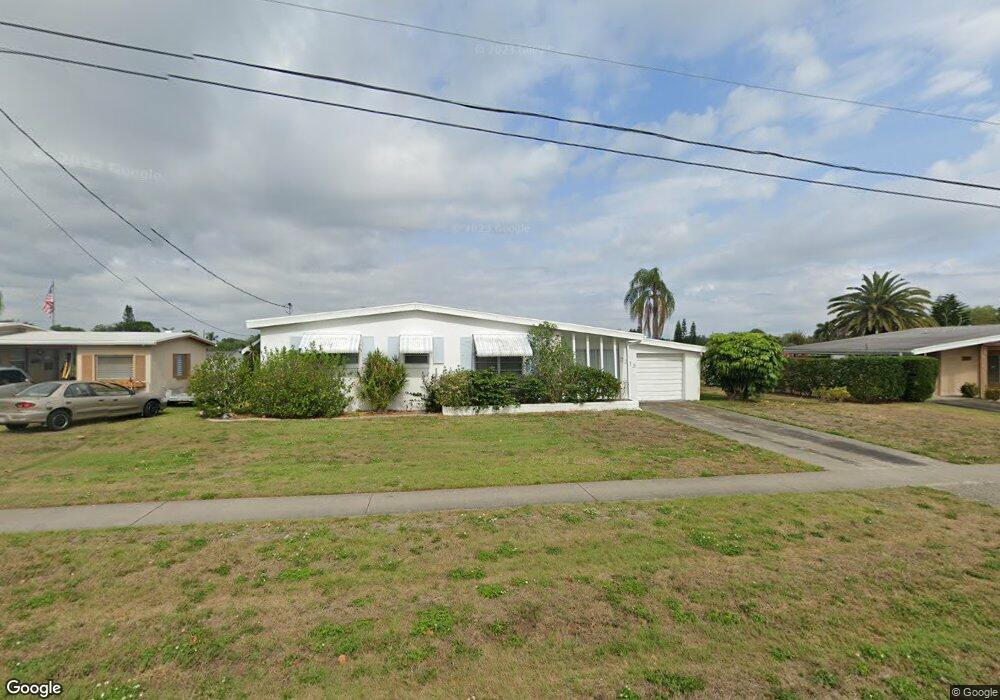
2233 Aaron St Port Charlotte, FL 33952
Estimated Value: $189,034 - $207,000
3
Beds
2
Baths
1,209
Sq Ft
$166/Sq Ft
Est. Value
About This Home
This home is located at 2233 Aaron St, Port Charlotte, FL 33952 and is currently estimated at $200,509, approximately $165 per square foot. 2233 Aaron St is a home located in Charlotte County with nearby schools including Peace River Elementary School, Port Charlotte Middle School, and Port Charlotte High School.
Ownership History
Date
Name
Owned For
Owner Type
Purchase Details
Closed on
Aug 1, 2000
Sold by
Donlon John J and Donlon Joann
Bought by
Duet Donald J and Duet Mary Anne D
Current Estimated Value
Purchase Details
Closed on
Jul 28, 2000
Sold by
Donlon Edward J
Bought by
Duet Donald J and Duet Mary Anne D
Purchase Details
Closed on
Jul 27, 2000
Sold by
Duet Donald J and Duet Mary Anne D
Bought by
Duet Donald J and Duet Mary Anne D
Purchase Details
Closed on
Jul 2, 2000
Sold by
Ruehl Arthur V
Bought by
Duet Donald J and Duet Mary Anne D
Create a Home Valuation Report for This Property
The Home Valuation Report is an in-depth analysis detailing your home's value as well as a comparison with similar homes in the area
Home Values in the Area
Average Home Value in this Area
Purchase History
| Date | Buyer | Sale Price | Title Company |
|---|---|---|---|
| Duet Donald J | $11,500 | -- | |
| Duet Donald J | $5,800 | -- | |
| Duet Donald J | $11,500 | -- | |
| Duet Donald J | $5,800 | -- | |
| Duet Donald J | $11,500 | -- |
Source: Public Records
Tax History Compared to Growth
Tax History
| Year | Tax Paid | Tax Assessment Tax Assessment Total Assessment is a certain percentage of the fair market value that is determined by local assessors to be the total taxable value of land and additions on the property. | Land | Improvement |
|---|---|---|---|---|
| 2023 | $2,673 | $88,668 | $0 | $0 |
| 2022 | $2,412 | $147,808 | $15,262 | $132,546 |
| 2021 | $2,116 | $105,986 | $11,870 | $94,116 |
| 2020 | $1,847 | $79,374 | $10,853 | $68,521 |
| 2019 | $1,732 | $78,158 | $10,853 | $67,305 |
| 2018 | $1,529 | $72,186 | $10,446 | $61,740 |
| 2017 | $1,412 | $59,992 | $9,293 | $50,699 |
| 2016 | $1,343 | $45,500 | $0 | $0 |
| 2015 | $1,282 | $41,364 | $0 | $0 |
| 2014 | $1,145 | $37,604 | $0 | $0 |
Source: Public Records
Map
Nearby Homes
- 21242 Coulton Ave
- 21227 Gladis Ave
- 21275 Austin Ave
- 21266 Coulton Ave
- 21274 Coulton Ave
- 21274 Gladis Ave
- 21203 Meehan Ave
- 21162 Meehan Ave
- 21150 Gertrude Ave Unit G3
- 21150 Gertrude Ave Unit 4
- 21150 Gertrude Ave Unit S4
- 21150 Gertrude Ave Unit 1
- 21150 Gertrude Ave Unit O3
- 21150 Gertrude Ave Unit A3
- 21290 Glendale Ave
- 21330 Meehan Ave
- 21267 Gertrude Ave Unit 114
- 21267 Gertrude Ave Unit 113
- 21267 Gertrude Ave Unit 210
- 2395 Harbor Blvd Unit 314
- 2241 Aaron St
- 2225 Aaron St
- 2249 Aaron St
- 2217 Aaron St
- 2246 Aaron St
- 2257 Aaron St
- 2209 Aaron St
- 21264 Percy Ave
- 21258 Austin Ave
- 21267 Percy Ave
- 2265 Aaron St
- 2201 Aaron St
- 21243 Austin Ave
- 2210 Aaron St
- 21266 Austin Ave
- 21274 Percy Ave
- 21251 Austin Ave
- 21275 Percy Ave
- 21259 Austin Ave
- 21275 Hepner Ave