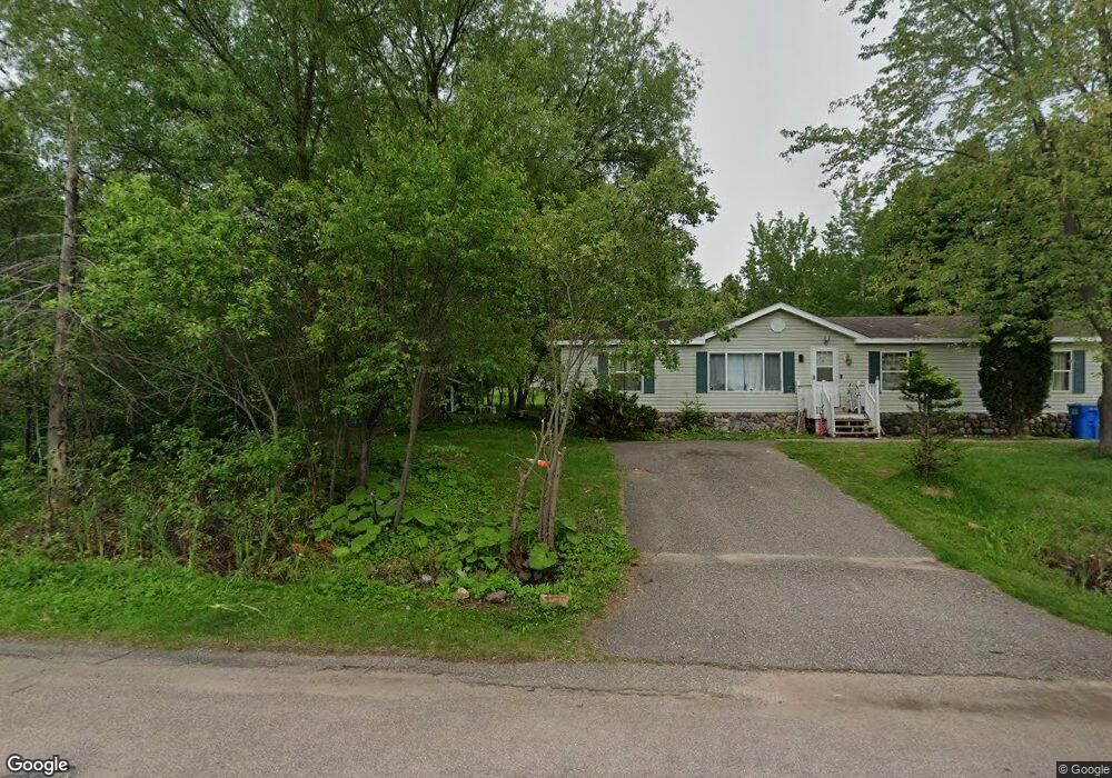
2233 Diorite St Marquette, MI 49855
Trowbridge Park NeighborhoodEstimated Value: $356,494 - $443,000
--
Bed
--
Bath
1,680
Sq Ft
$238/Sq Ft
Est. Value
About This Home
This home is located at 2233 Diorite St, Marquette, MI 49855 and is currently estimated at $399,624, approximately $237 per square foot. 2233 Diorite St is a home located in Marquette County with nearby schools including Sandy Knoll School, Bothwell Middle School, and Marquette Senior High School.
Ownership History
Date
Name
Owned For
Owner Type
Purchase Details
Closed on
Feb 24, 2025
Sold by
First Bank Upper Michigan
Bought by
Bates Dahli
Current Estimated Value
Purchase Details
Closed on
May 23, 2024
Sold by
Marquette County Sheriffs Department
Bought by
First Bank Upper Michigan
Purchase Details
Closed on
Sep 9, 2020
Sold by
Daryl Bates
Bought by
Bates Dahli and Goodman Alan C
Home Financials for this Owner
Home Financials are based on the most recent Mortgage that was taken out on this home.
Original Mortgage
$126,000
Interest Rate
2.8%
Mortgage Type
New Conventional
Purchase Details
Closed on
May 22, 1995
Bought by
Bates Daryl
Create a Home Valuation Report for This Property
The Home Valuation Report is an in-depth analysis detailing your home's value as well as a comparison with similar homes in the area
Home Values in the Area
Average Home Value in this Area
Purchase History
| Date | Buyer | Sale Price | Title Company |
|---|---|---|---|
| Bates Dahli | -- | None Listed On Document | |
| First Bank Upper Michigan | $123,395 | None Listed On Document | |
| Bates Dahli | $150,000 | Odea Nordeen Burink And Picken | |
| Bates Daryl | $5,000 | -- |
Source: Public Records
Mortgage History
| Date | Status | Borrower | Loan Amount |
|---|---|---|---|
| Previous Owner | Bates Dahli | $126,000 |
Source: Public Records
Tax History Compared to Growth
Tax History
| Year | Tax Paid | Tax Assessment Tax Assessment Total Assessment is a certain percentage of the fair market value that is determined by local assessors to be the total taxable value of land and additions on the property. | Land | Improvement |
|---|---|---|---|---|
| 2025 | $11 | $186,500 | $0 | $0 |
| 2024 | $11 | $164,400 | $0 | $0 |
| 2023 | $709 | $124,000 | $0 | $0 |
| 2022 | $1,931 | $95,200 | $0 | $0 |
| 2021 | $1,904 | $99,300 | $0 | $0 |
| 2020 | $1,883 | $95,200 | $0 | $0 |
| 2019 | $1,823 | $93,700 | $0 | $0 |
| 2018 | $1,765 | $96,800 | $0 | $0 |
| 2017 | $1,683 | $92,200 | $0 | $0 |
| 2016 | $1,657 | $87,100 | $0 | $0 |
| 2015 | -- | $87,100 | $0 | $0 |
| 2014 | -- | $79,800 | $0 | $0 |
| 2012 | -- | $71,900 | $0 | $0 |
Source: Public Records
Map
Nearby Homes
- 590 Erie Ave
- 2093 Orchard St
- 2273 Allen St
- 2363 Allen St
- 1932 Orchard St
- 1902 Orchard St
- 2232 Center St
- 2132 Montgomery St
- 1439 N Mc Clellan Ave
- 1411 West Ave
- 1612 Gray St
- 104 Forest Ridge Dr
- 1507 W Fair Ave
- 109 Forest Ridge Dr
- 19 Elder Dr
- 1917 Langford Dr
- 301 Garfield Ave
- 1908 Langford Dr
- 1509 Lincoln Ave
- 1518 Birch Ave