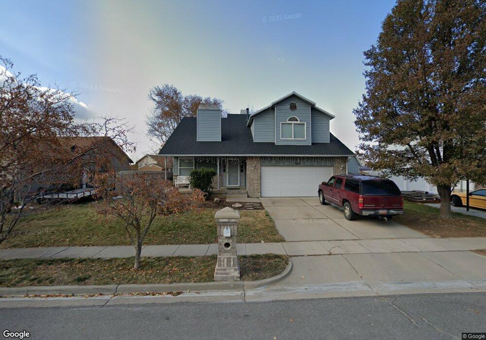
2233 N 1965 E Layton, UT 84040
Estimated Value: $550,763 - $562,000
4
Beds
4
Baths
2,689
Sq Ft
$207/Sq Ft
Est. Value
About This Home
This home is located at 2233 N 1965 E, Layton, UT 84040 and is currently estimated at $557,441, approximately $207 per square foot. 2233 N 1965 E is a home located in Davis County with nearby schools including Sarah Jane Adams Elementary School, North Layton Junior High School, and Northridge High School.
Ownership History
Date
Name
Owned For
Owner Type
Purchase Details
Closed on
Sep 29, 2016
Sold by
Negi Harish and Negi Swati
Bought by
Brooking Jeremy and Brooking Teria
Current Estimated Value
Purchase Details
Closed on
Jul 3, 2013
Sold by
Negi Harish and Negi Swati
Bought by
Negi Harish and Negi Swati
Home Financials for this Owner
Home Financials are based on the most recent Mortgage that was taken out on this home.
Original Mortgage
$171,000
Interest Rate
3.62%
Mortgage Type
Adjustable Rate Mortgage/ARM
Purchase Details
Closed on
Jun 9, 2005
Sold by
Tomsick John D and Tomsick Sami
Bought by
Haviland Kelly and Haviland Wendy
Home Financials for this Owner
Home Financials are based on the most recent Mortgage that was taken out on this home.
Original Mortgage
$143,920
Interest Rate
5.72%
Mortgage Type
Fannie Mae Freddie Mac
Create a Home Valuation Report for This Property
The Home Valuation Report is an in-depth analysis detailing your home's value as well as a comparison with similar homes in the area
Home Values in the Area
Average Home Value in this Area
Purchase History
| Date | Buyer | Sale Price | Title Company |
|---|---|---|---|
| Brooking Jeremy | -- | Northwest Title | |
| Negi Harish | $29,575 | None Available | |
| Negi Harish | -- | None Available | |
| Haviland Kelly | -- | Cardon Land Title |
Source: Public Records
Mortgage History
| Date | Status | Borrower | Loan Amount |
|---|---|---|---|
| Previous Owner | Negi Harish | $171,000 | |
| Previous Owner | Haviland Kelly | $143,920 |
Source: Public Records
Tax History
| Year | Tax Paid | Tax Assessment Tax Assessment Total Assessment is a certain percentage of the fair market value that is determined by local assessors to be the total taxable value of land and additions on the property. | Land | Improvement |
|---|---|---|---|---|
| 2025 | $2,976 | $286,550 | $102,764 | $183,786 |
| 2024 | $2,841 | $276,100 | $129,840 | $146,260 |
| 2023 | $2,802 | $483,000 | $183,248 | $299,752 |
| 2022 | $2,931 | $276,650 | $97,561 | $179,089 |
| 2021 | $2,632 | $369,000 | $147,315 | $221,685 |
| 2020 | $2,400 | $322,000 | $114,768 | $207,232 |
| 2019 | $2,352 | $311,000 | $103,484 | $207,516 |
| 2018 | $2,137 | $283,000 | $77,163 | $205,837 |
| 2016 | $1,916 | $133,100 | $41,314 | $91,786 |
| 2015 | $1,858 | $122,430 | $41,314 | $81,116 |
| 2014 | $1,743 | $117,125 | $41,314 | $75,811 |
| 2013 | -- | $105,289 | $17,143 | $88,146 |
Source: Public Records
Map
Nearby Homes
- 2273 N 1975 E
- 2189 N 1950 E
- 2340 N 2050 E
- 3142 E Thorley Dr
- 2202 N 2300 E
- 1444 E 2400 N
- 2096 N 1450 E
- 1540 E Primrose Ln
- 1907 N Bridge Ct
- 2597 N 2300 E
- 1465 E Sego Lily Ct
- 1843 Hayes Dr
- 1935 Deere Valley Dr
- 1731 E 2825 N
- 1785 E 2825 N
- 2826 N 1600 E
- 1447 E 2700 N
- 1476 Kays Creek Dr
- 1930 N Camellia Way E Unit 407
- 1120 E 2200 N
- 2251 N 1965 E
- 2219 N 1965 E
- 1958 E Sunset Dr
- 1956 E Sunset Dr
- 2205 N 1965 E
- 2236 N 1965 E
- 1962 E Sunset Dr
- 2254 N 1965 E
- 2220 N 1965 E
- 2278 N 1965 E
- 2202 N 1965 E
- 2191 N 1965 E
- 1954 E Sunset Dr
- 1955 E Sunset Dr
- 1961 E Sunset Dr
- 2289 N 1975 E
- 2186 N 1965 E
- 1963 E Sunset Dr
- 2194 N 1950 E
- 2177 N 1965 E
Your Personal Tour Guide
Ask me questions while you tour the home.