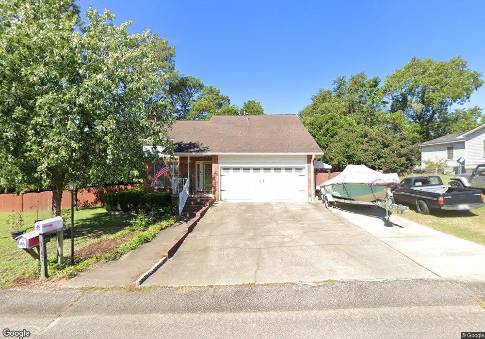
2234 Carroll Dr West Columbia, SC 29169
Estimated Value: $226,000 - $269,000
3
Beds
3
Baths
2,035
Sq Ft
$125/Sq Ft
Est. Value
About This Home
This home is located at 2234 Carroll Dr, West Columbia, SC 29169 and is currently estimated at $255,339, approximately $125 per square foot. 2234 Carroll Dr is a home located in Lexington County with nearby schools including Cayce Elementary, Cyril B. Busbee Creative Arts Academy, and Brookland-Cayce High School.
Ownership History
Date
Name
Owned For
Owner Type
Purchase Details
Closed on
Sep 13, 2024
Sold by
Brazell Tarah D and Coolidge Paul B
Bought by
Coolidge Paul B
Current Estimated Value
Purchase Details
Closed on
Apr 14, 2016
Sold by
Martin Lois Rae and Martin Lois
Bought by
Coolidge Paul B and Brazell Tarah D
Home Financials for this Owner
Home Financials are based on the most recent Mortgage that was taken out on this home.
Original Mortgage
$142,500
Interest Rate
4.21%
Mortgage Type
New Conventional
Create a Home Valuation Report for This Property
The Home Valuation Report is an in-depth analysis detailing your home's value as well as a comparison with similar homes in the area
Home Values in the Area
Average Home Value in this Area
Purchase History
| Date | Buyer | Sale Price | Title Company |
|---|---|---|---|
| Coolidge Paul B | $70,000 | None Listed On Document | |
| Coolidge Paul B | $150,000 | None Available |
Source: Public Records
Mortgage History
| Date | Status | Borrower | Loan Amount |
|---|---|---|---|
| Previous Owner | Coolidge Paul B | $142,500 |
Source: Public Records
Tax History Compared to Growth
Tax History
| Year | Tax Paid | Tax Assessment Tax Assessment Total Assessment is a certain percentage of the fair market value that is determined by local assessors to be the total taxable value of land and additions on the property. | Land | Improvement |
|---|---|---|---|---|
| 2024 | $1,147 | $6,000 | $1,200 | $4,800 |
| 2023 | $1,147 | $6,000 | $1,200 | $4,800 |
| 2022 | $1,158 | $6,000 | $1,200 | $4,800 |
| 2020 | $1,112 | $6,000 | $1,200 | $4,800 |
| 2019 | $1,059 | $5,600 | $600 | $5,000 |
| 2018 | $1,070 | $8,400 | $900 | $7,500 |
| 2017 | $627 | $6,025 | $600 | $5,425 |
| 2016 | $655 | $6,025 | $600 | $5,425 |
| 2014 | $552 | $6,542 | $600 | $5,942 |
| 2013 | -- | $6,540 | $600 | $5,940 |
Source: Public Records
Map
Nearby Homes
- 1210 Decatur St
- 826 Jefferson St
- 2312 Rainbow Dr
- 706 Westside Dr
- 2405 Rainbow Dr
- TBD Woodfield Jupiter & Daisey Track
- 725 Brooks Ave
- 2024 Platt Springs Rd
- 153 Cavendish Dr
- 151 Cavendish Dr
- 157 Cavendish Dr
- 0 Highway 302 Hwy Unit 589442
- 309 Hammond Ave
- Oak Plan at Faith Hills
- 1832 Wadsworth Dr
- 212 Alexandria St
- 135 Silver Run Place
- 116 Silver Run Place
- 1802 D Ave
- 1911 Toole St
- 2125 Steele Dr
- 1003 Westhaven Dr
- 1005 Westhaven Dr
- 1001 Westhaven Dr
- 1007 Westhaven Dr
- 2114 Woodside Ct
- 2114 Steele Dr
- 1002 Westhaven Dr
- 2117 Steele Dr
- 1000 Westhaven Dr
- 1004 Westhaven Dr
- 2110 Steele Dr
- 2217 Carroll Dr
- 1011 Westhaven Dr
- 1006 Westhaven Dr
- 2118 Steele Dr
- 1008 Westhaven Dr
- 1013 Westhaven Dr
- 2106 Steele Dr
- 2213 Carroll Dr