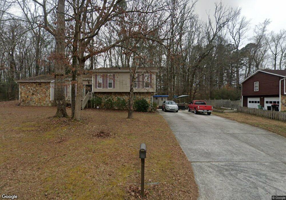
2235 Brookstone Dr Lithia Springs, GA 30122
Lithia Springs NeighborhoodEstimated Value: $274,000 - $315,000
4
Beds
3
Baths
2,348
Sq Ft
$127/Sq Ft
Est. Value
About This Home
This home is located at 2235 Brookstone Dr, Lithia Springs, GA 30122 and is currently estimated at $297,481, approximately $126 per square foot. 2235 Brookstone Dr is a home located in Douglas County with nearby schools including Sweetwater Elementary School, Factory Shoals Middle School, and Lithia Springs Comprehensive High School.
Ownership History
Date
Name
Owned For
Owner Type
Purchase Details
Closed on
Apr 19, 2013
Sold by
Hall Connie E
Bought by
Green Bobby and Lundy Revonica L
Current Estimated Value
Home Financials for this Owner
Home Financials are based on the most recent Mortgage that was taken out on this home.
Original Mortgage
$81,000
Outstanding Balance
$57,485
Interest Rate
3.59%
Mortgage Type
New Conventional
Estimated Equity
$239,996
Create a Home Valuation Report for This Property
The Home Valuation Report is an in-depth analysis detailing your home's value as well as a comparison with similar homes in the area
Home Values in the Area
Average Home Value in this Area
Purchase History
| Date | Buyer | Sale Price | Title Company |
|---|---|---|---|
| Green Bobby | $102,900 | -- |
Source: Public Records
Mortgage History
| Date | Status | Borrower | Loan Amount |
|---|---|---|---|
| Open | Green Bobby | $81,000 |
Source: Public Records
Tax History Compared to Growth
Tax History
| Year | Tax Paid | Tax Assessment Tax Assessment Total Assessment is a certain percentage of the fair market value that is determined by local assessors to be the total taxable value of land and additions on the property. | Land | Improvement |
|---|---|---|---|---|
| 2024 | $3,416 | $108,560 | $22,040 | $86,520 |
| 2023 | $3,416 | $108,560 | $22,040 | $86,520 |
| 2022 | $2,488 | $76,400 | $15,200 | $61,200 |
| 2021 | $1,867 | $57,240 | $8,520 | $48,720 |
| 2020 | $1,898 | $57,240 | $8,520 | $48,720 |
| 2019 | $1,733 | $55,960 | $8,520 | $47,440 |
| 2018 | $1,700 | $54,640 | $8,520 | $46,120 |
| 2017 | $1,542 | $48,600 | $8,520 | $40,080 |
| 2016 | $1,651 | $51,160 | $8,520 | $42,640 |
| 2015 | $1,383 | $33,624 | $5,760 | $27,864 |
| 2014 | $1,383 | $41,160 | $6,680 | $34,480 |
| 2013 | -- | $36,000 | $6,680 | $29,320 |
Source: Public Records
Map
Nearby Homes
- 2182 Ann Ln
- 1815 Lee Rd
- 2436 Falls River Dr
- 2275 Chestnut Log Loop
- 1940 Lee
- 2322 Chestnut Log Loop
- 2499 Chestnut Log Loop
- 3570 Briar Dr
- 8816 Sibella Ct
- 1774 Trail Creek Dr
- 3652 Sweetbriar Cir
- 1535 Olde Oak Dr
- 3646 Briar Dr
- 0 W Lake Vulcan Dr Unit 10587241
- 3686 Sweetbriar Cir
- LOT 27 Chestnut Ln
- 8684 Hickory Ln
- 3790 Sweetbriar Cir
- 2344 Mount Vernon Rd
- 7368 Mount Vernon Rd
- 2245 Brookstone Dr Unit 1
- 2225 Brookstone Dr
- 2255 Brookstone Dr
- 1730 Clearstone Dr
- 2215 Brookstone Dr
- 1735 Clearstone Dr
- 2230 Brookstone Dr
- 2200 Cedar Terrace Rd
- 2265 Brookstone Dr Unit 1
- 2205 Brookstone Dr
- 2260 Brookstone Dr Unit 1
- 2220 Brookstone Dr
- 1725 Clearstone Dr Unit 2
- 2171 Ann Ln
- 2210 Brookstone Dr
- 2270 Brookstone Dr
- 2275 Brookstone Dr Unit 47
- 2275 Brookstone Dr
- 2275 Brookstone Dr Unit 1
- 1720 Clearstone Dr