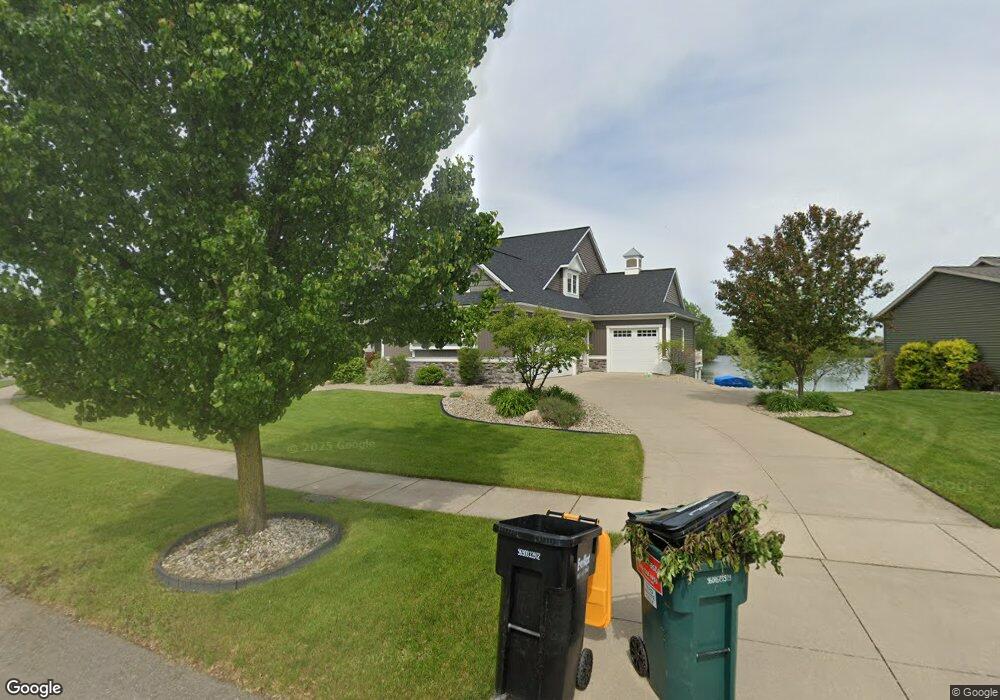
2235 Byron Shores Dr SW Byron Center, MI 49315
Estimated Value: $846,000 - $1,213,000
--
Bed
2
Baths
2,790
Sq Ft
$345/Sq Ft
Est. Value
About This Home
This home is located at 2235 Byron Shores Dr SW, Byron Center, MI 49315 and is currently estimated at $961,739, approximately $344 per square foot. 2235 Byron Shores Dr SW is a home with nearby schools including Marshall Elementary School, Robert L. Nickels Intermediate School, and Byron Center West Middle School.
Ownership History
Date
Name
Owned For
Owner Type
Purchase Details
Closed on
May 25, 2021
Sold by
Hustak Keith and Hustak Melissa
Bought by
Hustak Keith and Hustak Melissa
Current Estimated Value
Purchase Details
Closed on
Jan 20, 2016
Sold by
Hustale Keith and Hustale Melissa
Bought by
Hustak Keith and Hustak Melissa
Home Financials for this Owner
Home Financials are based on the most recent Mortgage that was taken out on this home.
Original Mortgage
$417,000
Outstanding Balance
$329,792
Interest Rate
3.79%
Mortgage Type
New Conventional
Estimated Equity
$631,947
Purchase Details
Closed on
Nov 23, 2011
Sold by
Prdl Llc
Bought by
Hustale Keith and Hustale Melissa
Home Financials for this Owner
Home Financials are based on the most recent Mortgage that was taken out on this home.
Original Mortgage
$411,350
Interest Rate
4.11%
Mortgage Type
Construction
Create a Home Valuation Report for This Property
The Home Valuation Report is an in-depth analysis detailing your home's value as well as a comparison with similar homes in the area
Home Values in the Area
Average Home Value in this Area
Purchase History
| Date | Buyer | Sale Price | Title Company |
|---|---|---|---|
| Hustak Keith | -- | None Available | |
| Hustak Keith | -- | None Available | |
| Hustale Keith | $85,150 | None Available |
Source: Public Records
Mortgage History
| Date | Status | Borrower | Loan Amount |
|---|---|---|---|
| Open | Hustak Keith | $417,000 | |
| Closed | Hustale Keith | $411,350 |
Source: Public Records
Tax History Compared to Growth
Tax History
| Year | Tax Paid | Tax Assessment Tax Assessment Total Assessment is a certain percentage of the fair market value that is determined by local assessors to be the total taxable value of land and additions on the property. | Land | Improvement |
|---|---|---|---|---|
| 2025 | $5,879 | $456,600 | $0 | $0 |
| 2024 | $5,879 | $421,100 | $0 | $0 |
| 2023 | $5,623 | $378,300 | $0 | $0 |
| 2022 | $7,837 | $347,200 | $0 | $0 |
| 2021 | $7,627 | $308,900 | $0 | $0 |
| 2020 | $5,175 | $306,400 | $0 | $0 |
| 2019 | $7,443 | $299,600 | $0 | $0 |
| 2018 | $7,290 | $285,000 | $47,500 | $237,500 |
| 2017 | $7,096 | $254,100 | $0 | $0 |
| 2016 | $6,838 | $240,600 | $0 | $0 |
| 2015 | $6,721 | $240,600 | $0 | $0 |
| 2013 | -- | $216,600 | $0 | $0 |
Source: Public Records
Map
Nearby Homes
- 6617 Northfield St SW
- 1818 Northfield Ct SW
- 2245 Pleasant Pond Dr SW
- 1969 Northfield Ct SW
- 1901 Northfield Ct SW
- Whitby Plan at Kuiper's Meadow - Cottage Series
- Pentwater Plan at Kuiper's Meadow - Landmark Series
- Harbor Springs Plan at Kuiper's Meadow - Landmark Series
- Sequoia Plan at Kuiper's Meadow - Woodland Series
- Bay Harbor Plan at Kuiper's Meadow - Landmark Series
- Elmwood Plan at Kuiper's Meadow - Woodland Series
- Maplewood Plan at Kuiper's Meadow - Woodland Series
- Camden Plan at Kuiper's Meadow - Cottage Series
- Cedarwood Plan at Kuiper's Meadow - Woodland Series
- Sycamore Plan at Kuiper's Meadow - Woodland Series
- Redwood Plan at Kuiper's Meadow - Woodland Series
- Oakwood Plan at Kuiper's Meadow - Woodland Series
- Northport Plan at Kuiper's Meadow - Landmark Series
- Chestnut Plan at Kuiper's Meadow - Woodland Series
- 1839 Northfield Ct SW
- 2229 Byron Shores Dr SW
- 2239 Byron Shores Dr SW
- 2221 Byron Shores Dr SW
- 2243 Byron Shores Dr SW
- 2230 Byron Shores Dr SW
- 2226 Byron Shores Dr SW
- 2238 Byron Shores Dr SW
- 2215 Byron Shores Dr SW
- 2249 Byron Shores Dr SW
- 2242 Byron Shores Dr SW
- 2222 Byron Shores Dr SW
- 2246 Byron Shores Dr SW
- 2218 Byron Shores Dr SW
- 2211 Byron Shores Dr SW
- 2253 Byron Shores Dr SW
- 2214 Byron Shores Dr SW
- 2207 Byron Shores Dr SW
- 7010 Country Springs Dr SW
- 7015 Country Springs Dr SW
- 2210 Byron Shores Dr SW