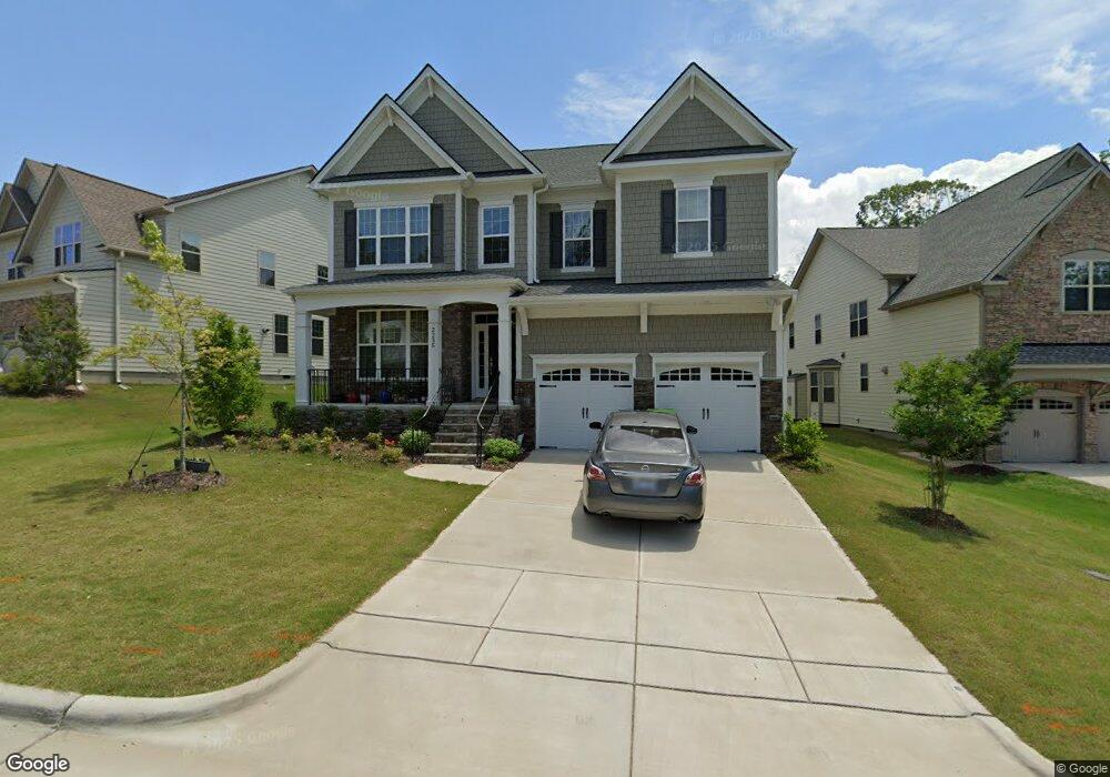
2235 Lorelai Ln Cary, NC 27519
Green Level NeighborhoodEstimated Value: $815,000 - $1,005,000
Studio
1
Bath
3,116
Sq Ft
$290/Sq Ft
Est. Value
About This Home
This home is located at 2235 Lorelai Ln, Cary, NC 27519 and is currently estimated at $903,164, approximately $289 per square foot. 2235 Lorelai Ln is a home with nearby schools including White Oak Elementary School, Mills Park Middle School, and Green Level High School.
Ownership History
Date
Name
Owned For
Owner Type
Purchase Details
Closed on
Oct 3, 2024
Sold by
Annem Siva Naga Prasad and Dhana Lakshmi
Bought by
Siva Naga Prasad Annem And Dhana Lakshmi Anne and Annem
Current Estimated Value
Purchase Details
Closed on
Mar 20, 2020
Sold by
Toll Nc Ii Lp
Bought by
Annem Siva Naga Prasad and Annem Dhana Lakshmi
Home Financials for this Owner
Home Financials are based on the most recent Mortgage that was taken out on this home.
Original Mortgage
$434,474
Interest Rate
3.4%
Mortgage Type
New Conventional
Create a Home Valuation Report for This Property
The Home Valuation Report is an in-depth analysis detailing your home's value as well as a comparison with similar homes in the area
Home Values in the Area
Average Home Value in this Area
Purchase History
| Date | Buyer | Sale Price | Title Company |
|---|---|---|---|
| Siva Naga Prasad Annem And Dhana Lakshmi Anne | -- | None Listed On Document | |
| Siva Naga Prasad Annem And Dhana Lakshmi Anne | -- | None Listed On Document | |
| Annem Siva Naga Prasad | $543,500 | None Available |
Source: Public Records
Mortgage History
| Date | Status | Borrower | Loan Amount |
|---|---|---|---|
| Previous Owner | Annem Siva Naga Prasad | $434,474 |
Source: Public Records
Tax History
| Year | Tax Paid | Tax Assessment Tax Assessment Total Assessment is a certain percentage of the fair market value that is determined by local assessors to be the total taxable value of land and additions on the property. | Land | Improvement |
|---|---|---|---|---|
| 2025 | $7,064 | $806,834 | $210,000 | $596,834 |
| 2024 | $6,906 | $806,834 | $210,000 | $596,834 |
Source: Public Records
Map
Nearby Homes
- 837 Katahdin Way
- 453 Hillman Bend
- 479 Clark Creek Ln
- 7723 Roberts Rd
- 309 Amiable Loop
- 2536 Silas Peak Ln
- 424 Euphoria Cir
- 100 Ludbrook Ct
- 702 Unison Ct
- 2613 Beckwith Rd
- 7256 Morris Acres Rd
- 2583 Silas Peak Ln
- 793 Larkspur Bowl Way
- 2590 Silas Peak Ln
- 2151 Grouse Ski Cir
- 2147 Grouse Ski Cir
- 2145 Grouse Ski Cir
- 1805 Dunwick Ct
- 7242 Morris Acres Rd
- 520 Alliance Cir
- 2241 Lorelai Ln
- 2229 Lorelai Ln
- 2229 Lorelai Ln
- 410 Rensworth Ct
- 2245 Lorelai Ln
- 2225 Lorelai Ln
- 2232 Lorelai Ln Unit 95
- 2240 Lorelai Ln Unit 93
- 416 Rensworth Ct
- 2232 Lorelai Ln Unit 95
- 2236 Lorelai Ln
- 2240 Lorelai Ln Unit 93
- 2249 Lorelai Ln
- 2228 Lorelai Ln
- 2244 Lorelai Ln
- 2224 Lorelai Ln Unit 97
- 2224 Lorelai Ln Unit 97
- 2248 Lorelai Ln Unit 91
- 2248 Lorelai Ln Unit 91
- 2217 Lorelai Ln
Your Personal Tour Guide
Ask me questions while you tour the home.