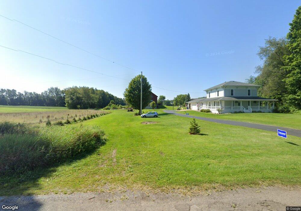
22350 B Dr S Marshall, MI 49068
Estimated Value: $286,172 - $499,000
3
Beds
4
Baths
2,400
Sq Ft
$158/Sq Ft
Est. Value
About This Home
This home is located at 22350 B Dr S, Marshall, MI 49068 and is currently estimated at $379,043, approximately $157 per square foot. 22350 B Dr S is a home located in Calhoun County with nearby schools including Harrington Elementary School, Marshall High School, and Cooks Prairie Baptist School.
Ownership History
Date
Name
Owned For
Owner Type
Purchase Details
Closed on
Dec 17, 2010
Sold by
Tucker Brent A and Tucker Jacquelynn E
Bought by
Fedewa Andrew W and Fedewa Sandra L
Current Estimated Value
Home Financials for this Owner
Home Financials are based on the most recent Mortgage that was taken out on this home.
Original Mortgage
$225,625
Outstanding Balance
$151,176
Interest Rate
4.5%
Mortgage Type
New Conventional
Estimated Equity
$227,867
Create a Home Valuation Report for This Property
The Home Valuation Report is an in-depth analysis detailing your home's value as well as a comparison with similar homes in the area
Home Values in the Area
Average Home Value in this Area
Purchase History
We collect this data history from publicly available records. To have your information removed, we recommend requesting removal directly through your county’s website.
| Date | Buyer | Sale Price | Title Company |
|---|---|---|---|
| Fedewa Andrew W | $237,500 | Chicago Title |
Source: Public Records
Mortgage History
We collect this data history from publicly available records. To have your information removed, we recommend requesting removal directly through your county’s website.
| Date | Status | Borrower | Loan Amount |
|---|---|---|---|
| Open | Fedewa Andrew W | $225,625 |
Source: Public Records
Tax History
| Year | Tax Paid | Tax Assessment Tax Assessment Total Assessment is a certain percentage of the fair market value that is determined by local assessors to be the total taxable value of land and additions on the property. | Land | Improvement |
|---|---|---|---|---|
| 2025 | $3,959 | $125,270 | $0 | $0 |
| 2024 | $1,373 | $124,340 | $0 | $0 |
| 2023 | -- | $116,690 | $0 | $0 |
| 2022 | $1,245 | $116,870 | $0 | $0 |
| 2021 | $3,434 | $112,720 | $0 | $0 |
| 2020 | $3,434 | $148,510 | $0 | $0 |
| 2019 | $0 | $139,110 | $0 | $0 |
| 2018 | $0 | $109,480 | $10,920 | $98,560 |
| 2017 | $0 | $103,350 | $0 | $0 |
| 2016 | $0 | $96,330 | $0 | $0 |
| 2015 | -- | $100,320 | $35,543 | $64,777 |
| 2014 | -- | $94,800 | $35,543 | $59,257 |
Source: Public Records
Map
Nearby Homes
- 24 Mile Rd
- 19501 B Dr S
- 308 State St
- 0 W Winter St
- 8100 22 1 2 Mile Rd
- 0 Mill St
- 13976 20 Mile Rd
- 10505 18 1 2 Mile Rd
- 18511 Homer Rd
- 18493 Homer Rd
- 0 Homer Rd
- 0 27 Mile Rd
- Michigan W Michigan Ave E
- 15252 27 Mile Rd
- 908 Cram Ln
- 903 Cram Ln
- VL W Michigan Ave
- 1000 Industrial Blvd
- 1002 Austin Ave
- VL Partello Rd
Your Personal Tour Guide
Ask me questions while you tour the home.