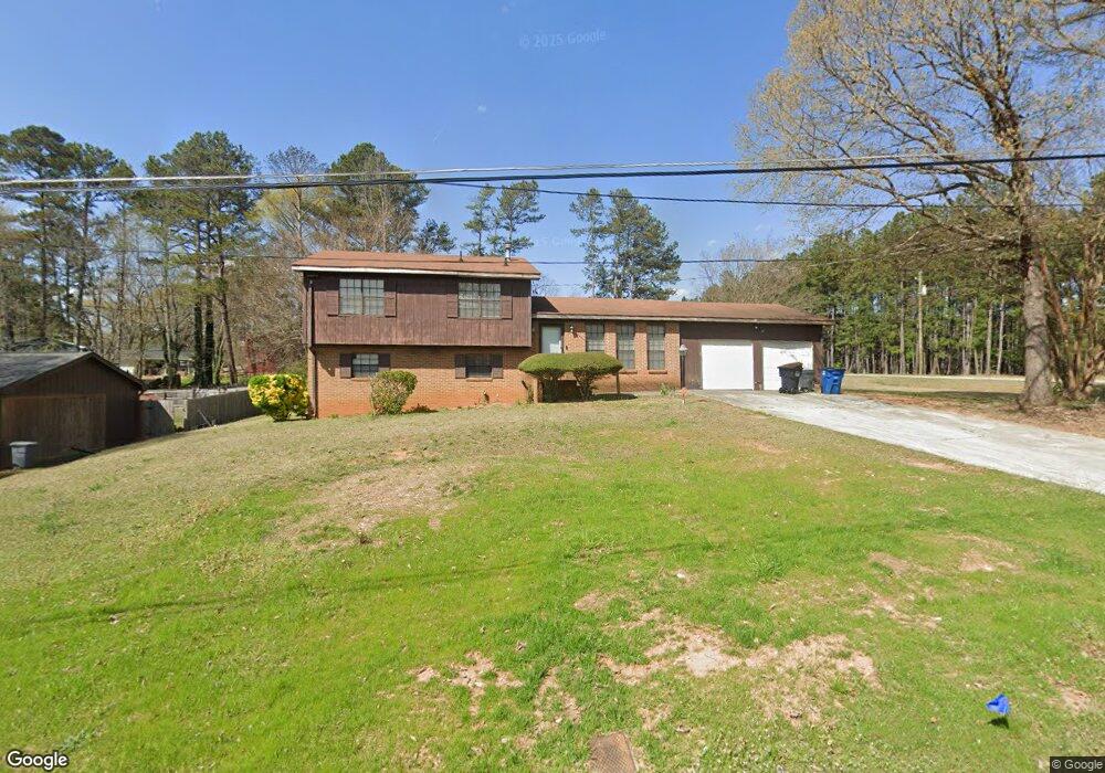
2236 Apache Dr Unit 2 Jonesboro, GA 30236
Estimated Value: $209,000 - $235,275
3
Beds
2
Baths
1,283
Sq Ft
$174/Sq Ft
Est. Value
About This Home
This home is located at 2236 Apache Dr Unit 2, Jonesboro, GA 30236 and is currently estimated at $222,819, approximately $173 per square foot. 2236 Apache Dr Unit 2 is a home located in Clayton County with nearby schools including Arnold Elementary School, M. D. Roberts Middle School, and Jonesboro High School.
Ownership History
Date
Name
Owned For
Owner Type
Purchase Details
Closed on
Nov 3, 1998
Sold by
Stephens Doris W
Bought by
Broadnax Patrick L and Broadnax Margaret J
Current Estimated Value
Home Financials for this Owner
Home Financials are based on the most recent Mortgage that was taken out on this home.
Original Mortgage
$92,148
Interest Rate
7.51%
Mortgage Type
FHA
Create a Home Valuation Report for This Property
The Home Valuation Report is an in-depth analysis detailing your home's value as well as a comparison with similar homes in the area
Home Values in the Area
Average Home Value in this Area
Purchase History
| Date | Buyer | Sale Price | Title Company |
|---|---|---|---|
| Broadnax Patrick L | $95,000 | -- |
Source: Public Records
Mortgage History
| Date | Status | Borrower | Loan Amount |
|---|---|---|---|
| Previous Owner | Broadnax Patrick L | $92,148 |
Source: Public Records
Tax History
| Year | Tax Paid | Tax Assessment Tax Assessment Total Assessment is a certain percentage of the fair market value that is determined by local assessors to be the total taxable value of land and additions on the property. | Land | Improvement |
|---|---|---|---|---|
| 2025 | $2,747 | $80,800 | $8,800 | $72,000 |
| 2024 | $2,760 | $79,840 | $8,800 | $71,040 |
| 2023 | $2,670 | $73,960 | $8,800 | $65,160 |
| 2022 | $2,412 | $70,560 | $8,800 | $61,760 |
| 2021 | $1,678 | $51,600 | $8,800 | $42,800 |
| 2020 | $1,604 | $49,233 | $8,800 | $40,433 |
| 2019 | $1,586 | $48,197 | $7,200 | $40,997 |
| 2018 | $1,429 | $44,336 | $7,200 | $37,136 |
| 2017 | $1,171 | $37,924 | $7,200 | $30,724 |
| 2016 | $885 | $30,878 | $7,200 | $23,678 |
| 2015 | $762 | $0 | $0 | $0 |
| 2014 | $840 | $30,207 | $7,200 | $23,007 |
Source: Public Records
Map
Nearby Homes
- 8224 Freestone Dr
- 8214 Freestone Dr
- 8202 Freestone Dr
- 2116 Indian Hill Rd
- 8228 Lullwater Ct
- 0 Highway 138 E Unit 7689114
- 0 Highway 138 E Unit 10460006
- 0 Highway 138 E Unit 10650191
- 0 Highway 138 E Unit 10638505
- 2229 Martin Way
- 7940 Rand Rd
- 8294 Winston Way
- 7942 Rand Rd
- 8391 Winston Way Unit 1
- 8392 Winston Way
- 2070 Spivey Village Trace
- 7972 Woods Ln Unit IX
- 8566 Shoreline Dr Unit IV
- 8234 Dawn Dr Unit 6
- 1907 Spivey Village Cir
- 2224 Apache Dr Unit 32
- 8197 Crane Rd
- 2237 Apache Dr
- 2216 Apache Dr
- 2225 Apache Dr
- 2239 Haida Ln
- 2227 Haida Ln Unit 2
- 2213 Haida Ln
- 2211 Apache Dr
- 2226 Omaha Ct
- 2206 Apache Dr Unit 2
- 2203 Haida Ln
- 2218 Omaha Ct
- 2232 Omaha Ct
- 2197 Haida Ln
- 2236 Haida Ln
- 2224 Haida Ln Unit 2
- 2214 Haida Ln
- 8241 Creek St
- 2204 Haida Ln
Your Personal Tour Guide
Ask me questions while you tour the home.