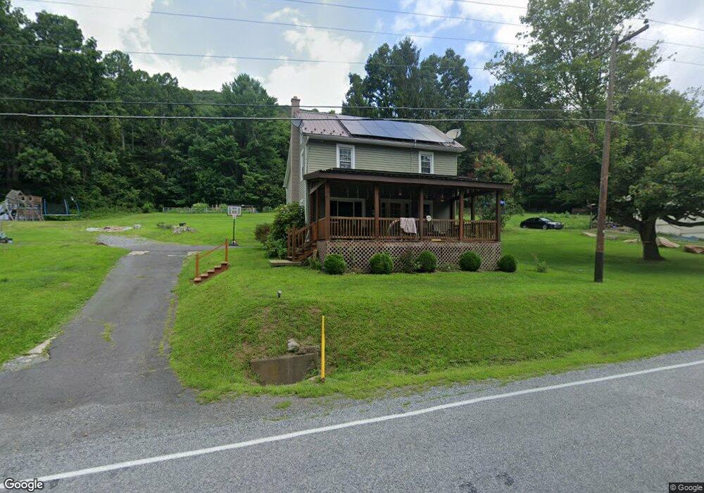
2237 Upper Rd Shamokin, PA 17872
Estimated Value: $162,000 - $197,000
3
Beds
2
Baths
1,402
Sq Ft
$129/Sq Ft
Est. Value
About This Home
This home is located at 2237 Upper Rd, Shamokin, PA 17872 and is currently estimated at $181,517, approximately $129 per square foot. 2237 Upper Rd is a home located in Northumberland County with nearby schools including Line Mountain Elementary School, Line Mountain Middle School, and Line Mountain Junior/Senior High School.
Ownership History
Date
Name
Owned For
Owner Type
Purchase Details
Closed on
Oct 31, 2023
Sold by
Strause Samuel A and Delong Megan
Bought by
Wary Brian Glenn and Wary Wendy
Current Estimated Value
Home Financials for this Owner
Home Financials are based on the most recent Mortgage that was taken out on this home.
Original Mortgage
$144,500
Outstanding Balance
$141,821
Interest Rate
7.18%
Mortgage Type
New Conventional
Estimated Equity
$39,696
Purchase Details
Closed on
Mar 21, 2022
Sold by
Strause Samuel A and Delong Megan
Bought by
Strause Samuel A and Delong Megan
Home Financials for this Owner
Home Financials are based on the most recent Mortgage that was taken out on this home.
Original Mortgage
$538,000
Interest Rate
3.55%
Mortgage Type
Credit Line Revolving
Purchase Details
Closed on
Sep 27, 2017
Sold by
Varney Craig A and Varney Alicia N
Bought by
Strause Samuel A and Delong Megan
Home Financials for this Owner
Home Financials are based on the most recent Mortgage that was taken out on this home.
Original Mortgage
$100,000
Interest Rate
3.89%
Mortgage Type
Future Advance Clause Open End Mortgage
Purchase Details
Closed on
Feb 7, 2008
Sold by
Marateck Sanford S
Bought by
Mowery Titus R and Mowery Julianan
Create a Home Valuation Report for This Property
The Home Valuation Report is an in-depth analysis detailing your home's value as well as a comparison with similar homes in the area
Purchase History
| Date | Buyer | Sale Price | Title Company |
|---|---|---|---|
| Wary Brian Glenn | $170,000 | None Listed On Document | |
| Strause Samuel A | -- | None Listed On Document | |
| Strause Samuel A | $125,000 | None Available | |
| Mowery Titus R | -- | None Available |
Source: Public Records
Mortgage History
| Date | Status | Borrower | Loan Amount |
|---|---|---|---|
| Open | Wary Brian Glenn | $144,500 | |
| Previous Owner | Strause Samuel A | $538,000 | |
| Previous Owner | Strause Samuel A | $100,000 |
Source: Public Records
Tax History
| Year | Tax Paid | Tax Assessment Tax Assessment Total Assessment is a certain percentage of the fair market value that is determined by local assessors to be the total taxable value of land and additions on the property. | Land | Improvement |
|---|---|---|---|---|
| 2025 | $1,046 | $8,810 | $2,220 | $6,590 |
| 2024 | $1,002 | $8,810 | $2,220 | $6,590 |
| 2023 | $1,002 | $8,810 | $2,220 | $6,590 |
| 2022 | $1,002 | $8,810 | $2,220 | $6,590 |
| 2021 | $1,002 | $8,810 | $2,220 | $6,590 |
| 2020 | $1,002 | $8,810 | $2,220 | $6,590 |
| 2019 | $974 | $8,810 | $2,220 | $6,590 |
| 2018 | $953 | $8,810 | $2,220 | $6,590 |
| 2017 | $901 | $8,810 | $2,220 | $6,590 |
| 2016 | -- | $8,000 | $2,220 | $5,780 |
| 2015 | -- | $8,000 | $2,220 | $5,780 |
| 2014 | -- | $8,000 | $2,220 | $5,780 |
Source: Public Records
Map
Nearby Homes
- LOT# 3 Blacks Ln
- LOT#2 Blacks Ln
- 576 E Shamokin St
- 783 Trevorton Rd
- 377 Trevorton Rd
- 234 Trevorton Rd
- 0 Hedge Ln
- 100 W Shamokin St
- 223 E Market St
- 120 Dans Way
- 417 W Shamokin St
- 347 W Market St
- 444 W Market St
- 901 W Coal St
- 1714 W Pine St
- 1610 W Willow St
- 231 N 7th St
- 225 S 11th St
- 1839 Trevorton Rd
- 1728 W Walnut St
Your Personal Tour Guide
Ask me questions while you tour the home.