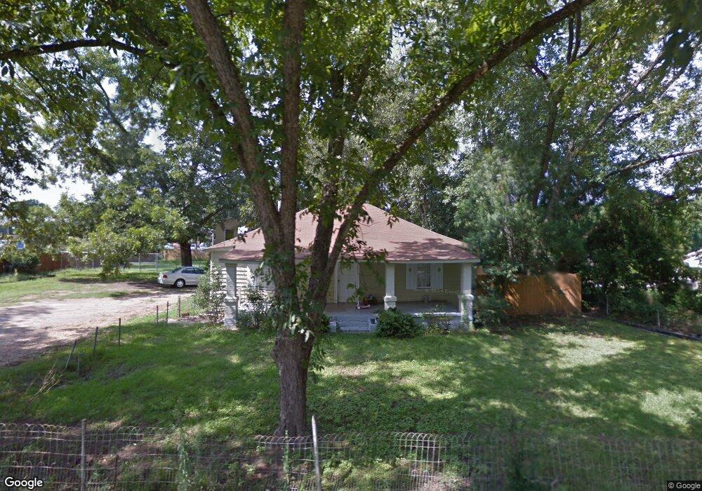
2239 Allen Rd Macon, GA 31216
Estimated Value: $95,910 - $298,000
2
Beds
1
Bath
1,299
Sq Ft
$130/Sq Ft
Est. Value
About This Home
This home is located at 2239 Allen Rd, Macon, GA 31216 and is currently estimated at $168,978, approximately $130 per square foot. 2239 Allen Rd is a home located in Bibb County with nearby schools including Porter Elementary School, Rutland Middle School, and Rutland High School.
Ownership History
Date
Name
Owned For
Owner Type
Purchase Details
Closed on
Aug 14, 2018
Sold by
Dodd William A
Bought by
Smith Larry Eugene
Current Estimated Value
Purchase Details
Closed on
Aug 4, 2008
Sold by
Bailey Ryan E and Bailey Donna A
Bought by
Dodd William A
Home Financials for this Owner
Home Financials are based on the most recent Mortgage that was taken out on this home.
Original Mortgage
$75,000
Interest Rate
6.31%
Mortgage Type
Purchase Money Mortgage
Purchase Details
Closed on
Sep 28, 2000
Bought by
Bailey Donna A and Bailey Ryan E
Create a Home Valuation Report for This Property
The Home Valuation Report is an in-depth analysis detailing your home's value as well as a comparison with similar homes in the area
Home Values in the Area
Average Home Value in this Area
Purchase History
| Date | Buyer | Sale Price | Title Company |
|---|---|---|---|
| Smith Larry Eugene | $1,000 | None Available | |
| Dodd William A | $70,000 | None Available | |
| Bailey Donna A | $57,000 | -- |
Source: Public Records
Mortgage History
| Date | Status | Borrower | Loan Amount |
|---|---|---|---|
| Previous Owner | Dodd William A | $75,000 |
Source: Public Records
Tax History Compared to Growth
Tax History
| Year | Tax Paid | Tax Assessment Tax Assessment Total Assessment is a certain percentage of the fair market value that is determined by local assessors to be the total taxable value of land and additions on the property. | Land | Improvement |
|---|---|---|---|---|
| 2025 | $405 | $23,489 | $2,074 | $21,415 |
| 2024 | $419 | $23,489 | $2,074 | $21,415 |
| 2023 | $488 | $23,489 | $2,074 | $21,415 |
| 2022 | $468 | $20,525 | $3,625 | $16,900 |
| 2021 | $514 | $20,525 | $3,625 | $16,900 |
| 2020 | $494 | $19,720 | $3,625 | $16,095 |
| 2019 | $853 | $19,720 | $3,625 | $16,095 |
| 2018 | $1,929 | $26,177 | $3,625 | $22,552 |
| 2017 | $981 | $26,177 | $3,625 | $22,552 |
| 2016 | $906 | $26,178 | $3,625 | $22,552 |
| 2015 | $1,282 | $26,178 | $3,625 | $22,552 |
| 2014 | $428 | $26,178 | $3,625 | $22,552 |
Source: Public Records
Map
Nearby Homes
- 2154 Allen Rd
- 116 Allentown Ct
- 344 Browning Pointe Rd
- 321 Browning Pointe Rd
- 106 Maries Garden Trail
- 116 Fred Ct
- 2960 Regina Dr
- 149 Lew Dr
- 2728 Nowell Dr
- 2800 S Estates Rd
- 268 Amanda Dr
- 261 Amanda Dr
- 1850 Barnes Ferry Rd
- Plan 2700 at The Abberley
- 301 Stockton Cir
- 2841 Liberty Church Rd
- 120 Abberley Ln
- 326 Stockton Cir
- 2255 Allen Rd
- 2225 Allen Rd
- 2238 Allen Rd
- 2230 Allen Rd
- 2220 Allen Rd
- 5924 Hawkinsville Rd
- E Allen Rd
- 1230 Allen Rd
- 2210 Allen Rd
- 2239 Andrea Dr
- 2206 Allen Rd
- 2225 Andrea Dr
- 6030 Hawkinsville Rd
- 2311 Allen Rd
- 2230 Andrea Dr
- 2190 Allen Rd
- 2332 Allen Rd
- 6041 Edwards Dr
- 6029 Hawkinsville Rd
- 2340 Allen Rd