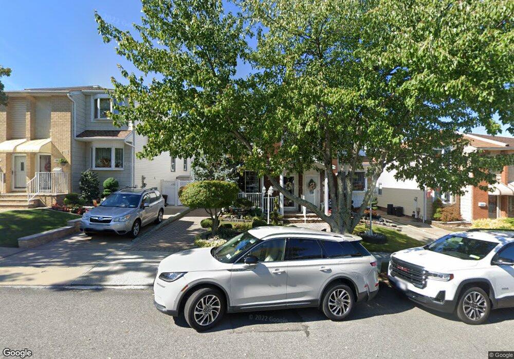
224 Brookfield Ave Staten Island, NY 10308
Great Kills NeighborhoodEstimated Value: $656,694 - $755,000
--
Bed
4
Baths
1,584
Sq Ft
$453/Sq Ft
Est. Value
About This Home
This home is located at 224 Brookfield Ave, Staten Island, NY 10308 and is currently estimated at $718,174, approximately $453 per square foot. 224 Brookfield Ave is a home located in Richmond County with nearby schools including P.S. 32 The Gifford School, I.S. 075 Frank D. Paulo, and Susan E Wagner High School.
Ownership History
Date
Name
Owned For
Owner Type
Purchase Details
Closed on
Oct 4, 2016
Sold by
Britz David M and Britz Irene M
Bought by
Britz Michael A and Britz Marisa C
Current Estimated Value
Purchase Details
Closed on
Sep 6, 2000
Sold by
Colacurto Philip and Colacurto Barbara
Bought by
Fragomeni Frank and Fragomeni Lucy
Create a Home Valuation Report for This Property
The Home Valuation Report is an in-depth analysis detailing your home's value as well as a comparison with similar homes in the area
Home Values in the Area
Average Home Value in this Area
Purchase History
| Date | Buyer | Sale Price | Title Company |
|---|---|---|---|
| Britz Michael A | -- | Commonwealth Land Title Insu | |
| Fragomeni Frank | $244,000 | Stewart Title |
Source: Public Records
Tax History Compared to Growth
Tax History
| Year | Tax Paid | Tax Assessment Tax Assessment Total Assessment is a certain percentage of the fair market value that is determined by local assessors to be the total taxable value of land and additions on the property. | Land | Improvement |
|---|---|---|---|---|
| 2025 | $4,828 | $41,460 | $4,546 | $36,914 |
| 2024 | $4,840 | $39,360 | $4,518 | $34,842 |
| 2023 | $4,882 | $30,240 | $4,186 | $26,054 |
| 2022 | $4,662 | $37,080 | $5,880 | $31,200 |
| 2021 | $4,642 | $35,340 | $5,880 | $29,460 |
| 2020 | $4,342 | $33,360 | $5,880 | $27,480 |
| 2019 | $3,975 | $31,200 | $5,880 | $25,320 |
| 2018 | $3,861 | $25,200 | $5,730 | $19,470 |
| 2017 | $4,202 | $24,660 | $5,880 | $18,780 |
| 2016 | $4,215 | $23,580 | $5,880 | $17,700 |
| 2015 | $3,309 | $22,260 | $4,816 | $17,444 |
| 2014 | $3,309 | $21,000 | $4,920 | $16,080 |
Source: Public Records
Map
Nearby Homes
- 234 Brookfield Ave
- 339 Abingdon Ave
- 248 Abingdon Ave
- 360 Barlow Ave Unit 32
- 360 Barlow Ave Unit 12
- 37 E Stroud Ave
- 223 Abingdon Ave
- 919 Armstrong Ave
- 271 Doane Ave
- 270 Leverett Ave
- 969 Armstrong Ave
- 63 Genesee Ave
- 96 Genesee Ave
- 12 Lexington Ln
- 72 Eric Ln
- 20 Michael Ct
- 510 Leverett Ave
- 74 E Brandis Ave
- 151 Abingdon Ave
- 57 Middle Loop Rd
- 226 Brookfield Ave
- 222 Brookfield Ave
- 220 Brookfield Ave
- 228 Brookfield Ave
- 216 Brookfield Ave
- 230 Brookfield Ave
- 214 Brookfield Ave
- 232 Brookfield Ave
- 285 Abingdon Ave
- 287 Abingdon Ave
- 283 Abingdon Ave
- 289 Abingdon Ave
- 279 Abingdon Ave
- 293 Abingdon Ave
- 212 Brookfield Ave
- 277 Abingdon Ave
- 295 Abingdon Ave
- 275 Abingdon Ave
- 238 Brookfield Ave
- 210 Brookfield Ave