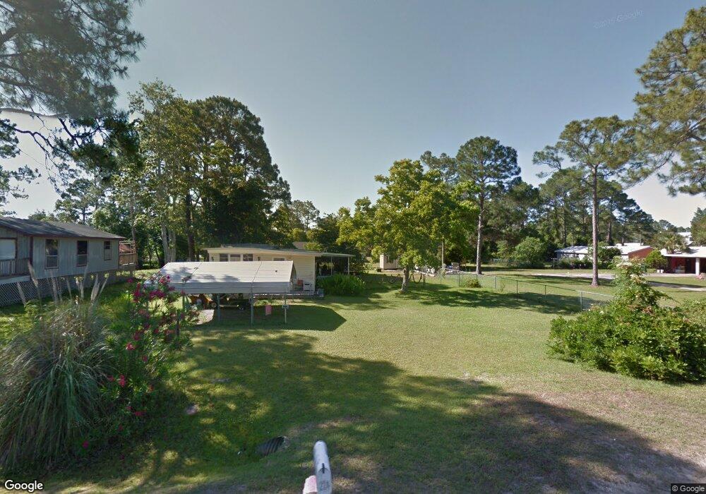
224 Canal St Port St. Joe, FL 32456
Estimated Value: $384,000
--
Bed
1
Bath
1,344
Sq Ft
$286/Sq Ft
Est. Value
About This Home
This home is located at 224 Canal St, Port St. Joe, FL 32456 and is currently estimated at $384,000, approximately $285 per square foot. 224 Canal St is a home located in Gulf County.
Ownership History
Date
Name
Owned For
Owner Type
Purchase Details
Closed on
Apr 26, 2024
Sold by
Norris Jamie and Jones Jahn
Bought by
Dixson Ciara and Bible Chelsea Leigh
Current Estimated Value
Home Financials for this Owner
Home Financials are based on the most recent Mortgage that was taken out on this home.
Original Mortgage
$135,000
Outstanding Balance
$120,962
Interest Rate
6.79%
Mortgage Type
Credit Line Revolving
Estimated Equity
$263,038
Purchase Details
Closed on
Aug 25, 2010
Sold by
Dixson Elaine Q
Bought by
Weaver Shirley and Dixson Michael
Purchase Details
Closed on
Jul 6, 2010
Sold by
Dixson Marvin E
Bought by
Dixson Elaine
Create a Home Valuation Report for This Property
The Home Valuation Report is an in-depth analysis detailing your home's value as well as a comparison with similar homes in the area
Home Values in the Area
Average Home Value in this Area
Purchase History
| Date | Buyer | Sale Price | Title Company |
|---|---|---|---|
| Dixson Ciara | $100 | Florida Land Title & Trust | |
| Dixson Ciara | $100 | Florida Land Title & Trust | |
| Weaver Shirley | -- | Attorney | |
| Dixson Elaine | -- | Attorney |
Source: Public Records
Mortgage History
| Date | Status | Borrower | Loan Amount |
|---|---|---|---|
| Open | Dixson Ciara | $135,000 | |
| Closed | Dixson Ciara | $135,000 |
Source: Public Records
Tax History Compared to Growth
Tax History
| Year | Tax Paid | Tax Assessment Tax Assessment Total Assessment is a certain percentage of the fair market value that is determined by local assessors to be the total taxable value of land and additions on the property. | Land | Improvement |
|---|---|---|---|---|
| 2024 | $1,465 | $170,000 | $170,000 | -- |
| 2023 | $1,496 | $170,000 | $170,000 | $0 |
| 2022 | $1,379 | $150,000 | $150,000 | $0 |
| 2021 | $918 | $72,000 | $72,000 | $0 |
| 2020 | $871 | $68,000 | $68,000 | $0 |
| 2019 | $830 | $66,000 | $66,000 | $0 |
| 2018 | $938 | $71,941 | $0 | $0 |
| 2017 | $898 | $72,245 | $0 | $0 |
| 2016 | $828 | $62,327 | $0 | $0 |
| 2015 | $742 | $52,339 | $0 | $0 |
| 2014 | $669 | $52,352 | $0 | $0 |
Source: Public Records
Map
Nearby Homes
- 178 S Canal Dr
- 156 S Canal Dr
- 164 S Canal Dr
- 162 S Canal Dr Unit Lot 2- Ar
- 156 S Canal Dr Unit 1-ar
- 158 S Canal Dr Unit 2-br
- 164 S Canal Dr Unit 1-br
- 333 Firehouse Rd
- 7 Whippoorwill Ave
- 536 N Canal Dr
- 976 S Long St
- Lot 1 Palmetto Dr
- TBD S Long St
- 105 Chapel Ln
- 3640 Cr 386 S
- 181 Marshall Ln
- 121 Yellowfin Dr Unit Lot 5
- 137 Yellowfin Dr Unit Lot 4
- Lot 12 Pleasant Rest Rd
- Lot 11 Pleasant Rest Rd
- 274 S Canal Dr Unit 278
- 274 S Canal Dr
- 167 Post Office Ln Unit 1-br
- 167 Post Office Ln
- 167 Post Office Ln
- 130 Post Office Ln
- 0 Post Office Ln
- 312 S Canal Dr
- TBD S Canal Dr Unit 1-br
- 441 Florida St
- 445 Floating Bridge Rd
- 350 S Canal Dr
- 445 Florida St
- 0 Floating Bridge Rd
- 220 N Canal Dr
- 379 Firehouse Rd
- 191 Whippoorwill Ave
- 1 Mallard St
- 280 N Canal Dr