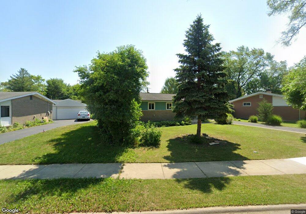
224 E Normandy Dr Addison, IL 60101
Estimated Value: $263,566 - $324,000
Studio
--
Bath
1,080
Sq Ft
$277/Sq Ft
Est. Value
About This Home
This home is located at 224 E Normandy Dr, Addison, IL 60101 and is currently estimated at $299,642, approximately $277 per square foot. 224 E Normandy Dr is a home located in DuPage County with nearby schools including Fullerton Elementary School, Indian Trail Jr High School, and Addison Trail High School.
Ownership History
Date
Name
Owned For
Owner Type
Purchase Details
Closed on
Aug 31, 2023
Sold by
Stano Andrzej and Stano Barbara
Bought by
Andrew Stano And Barbara T Stano Living Trust and Stano
Current Estimated Value
Purchase Details
Closed on
Nov 17, 1994
Sold by
Kalbas Michael A and Kalbas Michele M
Bought by
Stano Andrzej and Stano Barbara
Home Financials for this Owner
Home Financials are based on the most recent Mortgage that was taken out on this home.
Original Mortgage
$100,000
Interest Rate
9%
Create a Home Valuation Report for This Property
The Home Valuation Report is an in-depth analysis detailing your home's value as well as a comparison with similar homes in the area
Home Values in the Area
Average Home Value in this Area
Purchase History
| Date | Buyer | Sale Price | Title Company |
|---|---|---|---|
| Andrew Stano And Barbara T Stano Living Trust | -- | None Listed On Document | |
| Stano Andrzej | $126,000 | First American Title Insuran |
Source: Public Records
Mortgage History
| Date | Status | Borrower | Loan Amount |
|---|---|---|---|
| Previous Owner | Stano Andrzej | $100,000 |
Source: Public Records
Tax History
| Year | Tax Paid | Tax Assessment Tax Assessment Total Assessment is a certain percentage of the fair market value that is determined by local assessors to be the total taxable value of land and additions on the property. | Land | Improvement |
|---|---|---|---|---|
| 2024 | $2,775 | $86,937 | $39,433 | $47,504 |
| 2023 | $2,898 | $79,920 | $36,250 | $43,670 |
| 2022 | $3,268 | $74,720 | $33,830 | $40,890 |
| 2021 | $3,277 | $71,570 | $32,400 | $39,170 |
| 2020 | $3,337 | $68,550 | $31,030 | $37,520 |
| 2019 | $4,277 | $65,920 | $29,840 | $36,080 |
| 2018 | $3,602 | $62,750 | $28,400 | $34,350 |
| 2017 | $3,683 | $59,970 | $27,140 | $32,830 |
| 2016 | $4,345 | $55,370 | $25,060 | $30,310 |
| 2015 | $4,221 | $51,150 | $23,150 | $28,000 |
| 2014 | $4,081 | $49,370 | $21,220 | $28,150 |
| 2013 | $4,001 | $50,370 | $21,650 | $28,720 |
Source: Public Records
Map
Nearby Homes
- 128 S Michigan Ave
- 29 S Iowa Ave
- 204 S Iowa Ave
- 2 N Wisconsin Ave
- 14 N Wisconsin Ave
- 200 Addison Rd
- 45 N Wisconsin Ave
- 163 S Ruga Ct
- 434 S Yale Ave
- 133 E Lake St
- 225 N State St
- 215 S Hale St Unit 9B
- 215 E Oak St
- 10 N Adams Dr
- 215 W Lake Park Dr
- 437 E Lorraine Ave
- 238 N Hillcrest Ave
- 102 S Adeline Ave
- 427 W Natoma Ave
- 902 E Krage Dr
- 226 E Normandy Dr
- 220 E Normandy Dr
- 230 E Normandy Dr
- 229 E Myrick Ave
- 241 E La Porte Dr
- 223 E Normandy Dr
- 225 E Normandy Dr
- 237 E La Porte Dr
- 232 E Normandy Dr
- 245 E La Porte Dr
- 227 E Normandy Dr
- 209 E Myrick Ave
- 238 E Normandy Dr
- 218 E Myrick Ave
- 247 E La Porte Dr
- 224 E Myrick Ave
- 228 E Myrick Ave
- 229 E Normandy Dr
- 109 S Michigan Ave
- 244 E Normandy Dr
Your Personal Tour Guide
Ask me questions while you tour the home.