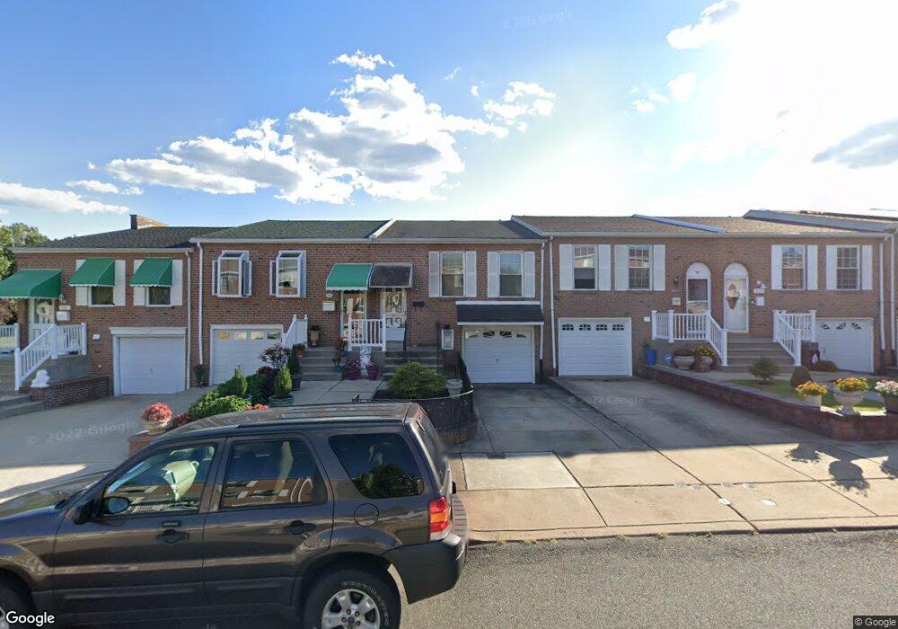
224 Lawnbrook Rd Philadelphia, PA 19154
Northeast Philadelphia NeighborhoodEstimated Value: $276,587 - $340,000
--
Bed
1
Bath
900
Sq Ft
$346/Sq Ft
Est. Value
About This Home
This home is located at 224 Lawnbrook Rd, Philadelphia, PA 19154 and is currently estimated at $311,147, approximately $345 per square foot. 224 Lawnbrook Rd is a home located in Philadelphia County with nearby schools including A. L. Fitzpatrick School, George Washington High School, and Our Lady of Calvary School.
Ownership History
Date
Name
Owned For
Owner Type
Purchase Details
Closed on
Jul 31, 2001
Sold by
Obrien James J
Bought by
Daley Michael P
Current Estimated Value
Home Financials for this Owner
Home Financials are based on the most recent Mortgage that was taken out on this home.
Original Mortgage
$90,000
Outstanding Balance
$34,183
Interest Rate
7.1%
Estimated Equity
$276,964
Create a Home Valuation Report for This Property
The Home Valuation Report is an in-depth analysis detailing your home's value as well as a comparison with similar homes in the area
Home Values in the Area
Average Home Value in this Area
Purchase History
| Date | Buyer | Sale Price | Title Company |
|---|---|---|---|
| Daley Michael P | $112,500 | Stewart Title Guaranty Compa |
Source: Public Records
Mortgage History
| Date | Status | Borrower | Loan Amount |
|---|---|---|---|
| Open | Daley Michael P | $90,000 |
Source: Public Records
Tax History Compared to Growth
Tax History
| Year | Tax Paid | Tax Assessment Tax Assessment Total Assessment is a certain percentage of the fair market value that is determined by local assessors to be the total taxable value of land and additions on the property. | Land | Improvement |
|---|---|---|---|---|
| 2026 | $3,281 | $282,300 | $56,460 | $225,840 |
| 2025 | $3,281 | $282,300 | $56,460 | $225,840 |
| 2024 | $3,281 | $282,300 | $56,460 | $225,840 |
| 2023 | $3,281 | $234,400 | $46,880 | $187,520 |
| 2022 | $2,651 | $189,400 | $46,880 | $142,520 |
| 2021 | $2,741 | $0 | $0 | $0 |
| 2020 | $2,741 | $0 | $0 | $0 |
| 2019 | $2,581 | $0 | $0 | $0 |
| 2018 | $2,427 | $0 | $0 | $0 |
| 2017 | $2,427 | $0 | $0 | $0 |
| 2016 | $2,007 | $0 | $0 | $0 |
| 2015 | $1,922 | $0 | $0 | $0 |
| 2014 | -- | $173,400 | $41,441 | $131,959 |
| 2012 | -- | $21,376 | $2,559 | $18,817 |
Source: Public Records
Map
Nearby Homes
- 4161 Orchard Ln
- 1126 Evelyn Ave
- 1103 Colonial Ave
- 238 Dimarco Dr
- 1236 Whittier Ave
- 4374 Deerpath Ln
- 11731 Dimarco Dr
- 10932 Templeton Dr
- 10908 Templeton Dr
- 3627 N Hereford Ln
- 3623 N Hereford Ln
- 3583 Nottingham Ln
- 3581 Nottingham Ln
- 3599C Nottingham Ln
- 827 Mitchell Ave
- 3713 Clarendon Ave
- 3750 Clarendon Ave Unit 3
- 3566 Gloucester Ln
- 11913 Millbrook Rd
- 0 Kings Ln
- 222 Lawnbrook Rd
- 220 Lawnbrook Rd
- 226 Lawnbrook Rd
- 131 Dimarco Dr
- 218 Lawnbrook Rd
- 216 Lawnbrook Rd
- 133 Dimarco Dr
- 214 Lawnbrook Rd
- 212 Lawnbrook Rd
- 135 Dimarco Dr
- 210 Lawnbrook Rd
- 137 Dimarco Dr
- 227 Lawnbrook Rd
- 229 Lawnbrook Rd
- 231 Lawnbrook Rd
- 223 Lawnbrook Rd
- 219 Lawnbrook Rd
- 233 Lawnbrook Rd
- 217 Lawnbrook Rd
- 139 Dimarco Dr