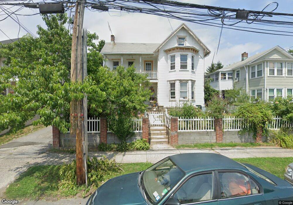
224 Locust Ave Port Chester, NY 10573
Estimated Value: $866,256 - $937,000
5
Beds
3
Baths
3,614
Sq Ft
$246/Sq Ft
Est. Value
About This Home
This home is located at 224 Locust Ave, Port Chester, NY 10573 and is currently estimated at $888,064, approximately $245 per square foot. 224 Locust Ave is a home located in Westchester County with nearby schools including Port Chester Middle School, Port Chester Senior High School, and Corpus Christi Holy Rosary School.
Ownership History
Date
Name
Owned For
Owner Type
Purchase Details
Closed on
Dec 20, 2007
Sold by
Flores Zoila A
Bought by
Flores Zoila A and Flores Monserrate
Current Estimated Value
Purchase Details
Closed on
May 18, 2004
Sold by
Hernandez Delfin N and Hernandez Yolanda B
Bought by
Flores Zoila A
Home Financials for this Owner
Home Financials are based on the most recent Mortgage that was taken out on this home.
Original Mortgage
$467,800
Interest Rate
6.65%
Mortgage Type
Unknown
Create a Home Valuation Report for This Property
The Home Valuation Report is an in-depth analysis detailing your home's value as well as a comparison with similar homes in the area
Home Values in the Area
Average Home Value in this Area
Purchase History
| Date | Buyer | Sale Price | Title Company |
|---|---|---|---|
| Flores Zoila A | -- | None Available | |
| Flores Zoila A | $520,000 | First American Title Ins Co |
Source: Public Records
Mortgage History
| Date | Status | Borrower | Loan Amount |
|---|---|---|---|
| Previous Owner | Flores Zoila A | $467,800 |
Source: Public Records
Tax History Compared to Growth
Tax History
| Year | Tax Paid | Tax Assessment Tax Assessment Total Assessment is a certain percentage of the fair market value that is determined by local assessors to be the total taxable value of land and additions on the property. | Land | Improvement |
|---|---|---|---|---|
| 2024 | $15,935 | $701,900 | $137,700 | $564,200 |
| 2023 | $15,066 | $656,000 | $131,200 | $524,800 |
| 2022 | $13,033 | $618,900 | $131,200 | $487,700 |
| 2021 | $13,898 | $521,300 | $131,200 | $390,100 |
| 2020 | $14,453 | $511,100 | $131,200 | $379,900 |
| 2019 | $18,715 | $487,100 | $131,000 | $356,100 |
| 2018 | $10,147 | $447,800 | $132,300 | $315,500 |
| 2017 | $1,989 | $476,900 | $122,400 | $354,500 |
| 2016 | $17,801 | $451,700 | $116,600 | $335,100 |
| 2015 | -- | $462,600 | $128,200 | $334,400 |
| 2014 | -- | $327,100 | $98,200 | $228,900 |
| 2013 | -- | $327,100 | $98,200 | $228,900 |
Source: Public Records
Map
Nearby Homes
- 315 King St Unit 1L
- 315 King St Unit 6A
- 315 King St Unit 1B
- 315 King St Unit 2H
- 315 King St Unit 5C
- 315 King St Unit 5B
- 325 King St Unit 2G
- 325 King St Unit 4D
- 325 King St Unit 6J
- 16 Rollhaus Place
- 1 Landmark Square Unit 233
- 1 Landmark Square Unit 411
- 1 Landmark Square Unit 530
- 1 Landmark Square Unit 613
- 1 Landmark Square Unit 235
- 1 Landmark Square Unit 302
- 412 Orchard St
- 374 King St
- 28 Summer St
- 340 Locust Ave
- 230 Locust Ave
- 222 Locust Ave
- 234 Locust Ave
- 218 Locust Ave
- 323 Willett Ave
- 319 Willett Ave
- 325 Willett Ave
- 238 Locust Ave
- 214 Locust Ave
- 225 Locust Ave
- 313 Willett Ave
- 210 Locust Ave
- 309 Willett Ave
- 242 Locust Ave
- 235 Locust Ave
- 208 Locust Ave
- 191 Highland St
- 233 Locust Ave
- 193 Highland St
- 337 Willett Ave