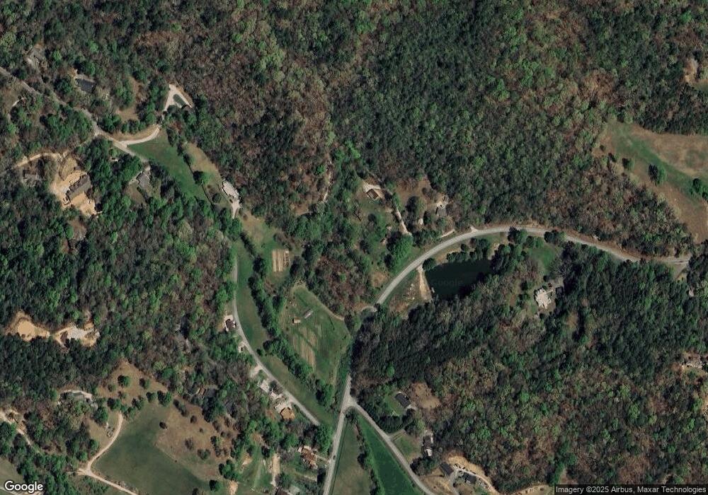
Estimated Value: $244,000 - $360,000
2
Beds
2
Baths
1,320
Sq Ft
$218/Sq Ft
Est. Value
About This Home
This home is located at 224 Mill Gap Ln, Tiger, GA 30576 and is currently estimated at $287,963, approximately $218 per square foot. 224 Mill Gap Ln is a home located in Rabun County with nearby schools including Rabun County Primary School, Rabun County High School, and Great Oaks Montessori .
Ownership History
Date
Name
Owned For
Owner Type
Purchase Details
Closed on
Aug 10, 2021
Sold by
Anderson Barbara Mashburn
Bought by
Anderson Barbara Dorathea Mashbu and Barbara D M Anderson Rev Tr
Current Estimated Value
Purchase Details
Closed on
May 1, 1997
Bought by
Anderson Barbara Mashburn
Purchase Details
Closed on
Feb 1, 1989
Purchase Details
Closed on
Aug 1, 1987
Purchase Details
Closed on
Jun 1, 1986
Create a Home Valuation Report for This Property
The Home Valuation Report is an in-depth analysis detailing your home's value as well as a comparison with similar homes in the area
Home Values in the Area
Average Home Value in this Area
Purchase History
| Date | Buyer | Sale Price | Title Company |
|---|---|---|---|
| Anderson Barbara Dorathea Mashbu | -- | -- | |
| Anderson Barbara Dorathea Mashbu | -- | -- | |
| Anderson Barbara Mashburn | -- | -- | |
| Anderson Barbara Mashburn | -- | -- | |
| -- | -- | -- | |
| -- | -- | -- | |
| -- | -- | -- | |
| -- | -- | -- | |
| -- | $2,300 | -- | |
| -- | $2,300 | -- |
Source: Public Records
Tax History Compared to Growth
Tax History
| Year | Tax Paid | Tax Assessment Tax Assessment Total Assessment is a certain percentage of the fair market value that is determined by local assessors to be the total taxable value of land and additions on the property. | Land | Improvement |
|---|---|---|---|---|
| 2024 | $871 | $54,286 | $7,953 | $46,333 |
| 2023 | $746 | $40,769 | $7,485 | $33,284 |
| 2022 | $738 | $40,302 | $7,018 | $33,284 |
| 2021 | $747 | $39,834 | $6,550 | $33,284 |
| 2020 | $773 | $39,834 | $6,550 | $33,284 |
| 2019 | $778 | $39,834 | $6,550 | $33,284 |
| 2018 | $781 | $39,834 | $6,550 | $33,284 |
| 2017 | $749 | $39,834 | $6,550 | $33,284 |
| 2016 | $751 | $39,834 | $6,550 | $33,284 |
| 2015 | $767 | $39,842 | $6,550 | $33,292 |
| 2014 | $771 | $39,840 | $6,548 | $33,292 |
Source: Public Records
Map
Nearby Homes
- 0 Woodall Rd
- 488 Northridge
- 445 Joe Davis Rd
- 38 Old Blue Trail
- 9 Golf Dr
- 39 Antebellum Ln Unit 101
- 0 Jericho Ln Unit 10498084
- 407 Hillside Dr
- 5 W Pinecrest Dr
- 112 Clayton Dr
- 144 David Dr
- 2036 Highway 76 W
- 146 David Dr
- 55 Arrendale Dr
- 276 Dunlap St
- 893 Old 441 S
- 7 Dry Pond Dr
- 335 S Main St
- 29 Cool Spring Ln
- 55 Cool Spring Ln
- 204 Woodall Rd
- 63 Mill Gap Ln
- 0 Woodall Dr Unit 7381249
- 0 Woodall Dr Unit 7291174
- 0 Woodall Dr Unit 8254039
- 0 Woodall Dr Unit 8201347
- 0 Woodall Dr Unit 8631985
- 0 Woodall Dr Unit 7642308
- 3 Brandon SW Unit 1
- 125 Woodall Rd
- 3 Brandon Trail
- 3 Brandon Trail Unit 1
- 308 Woodall Rd
- 271 Woodall Rd
- 30 Brandon Trail
- 87 Woodall Rd
- 301 Woodall Rd
- 301 Woodall Rd
- 301 Woodall Rd Unit 2
- 63 Eastwood Trail
