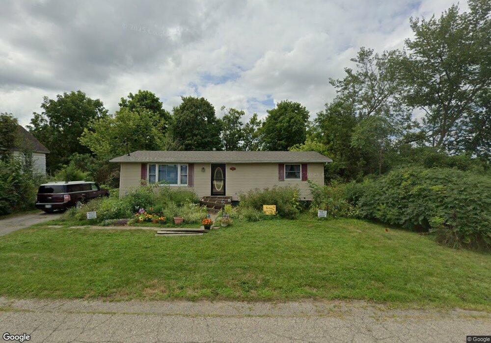
224 N Comstock St Addison, MI 49220
Estimated Value: $139,000 - $168,000
2
Beds
2
Baths
1,008
Sq Ft
$152/Sq Ft
Est. Value
About This Home
This home is located at 224 N Comstock St, Addison, MI 49220 and is currently estimated at $153,667, approximately $152 per square foot. 224 N Comstock St is a home located in Lenawee County with nearby schools including Addison Elementary School, Addison Middle School, and Addison High School.
Ownership History
Date
Name
Owned For
Owner Type
Purchase Details
Closed on
Oct 5, 2006
Sold by
Fannie Mae
Bought by
Ruoff Frederick B and Ruoff Peggy A
Current Estimated Value
Home Financials for this Owner
Home Financials are based on the most recent Mortgage that was taken out on this home.
Original Mortgage
$74,500
Outstanding Balance
$44,554
Interest Rate
6.5%
Mortgage Type
New Conventional
Estimated Equity
$109,113
Purchase Details
Closed on
Feb 1, 2006
Sold by
Indymac Bank Fsb
Bought by
Federal National Mortgage Association
Create a Home Valuation Report for This Property
The Home Valuation Report is an in-depth analysis detailing your home's value as well as a comparison with similar homes in the area
Purchase History
| Date | Buyer | Sale Price | Title Company |
|---|---|---|---|
| Ruoff Frederick B | $74,500 | Fidelity National Title | |
| Federal National Mortgage Association | -- | None Available |
Source: Public Records
Mortgage History
| Date | Status | Borrower | Loan Amount |
|---|---|---|---|
| Open | Ruoff Frederick B | $74,500 |
Source: Public Records
Tax History
| Year | Tax Paid | Tax Assessment Tax Assessment Total Assessment is a certain percentage of the fair market value that is determined by local assessors to be the total taxable value of land and additions on the property. | Land | Improvement |
|---|---|---|---|---|
| 2025 | $1,053 | $65,500 | $0 | $0 |
| 2024 | $8 | $56,900 | $0 | $0 |
| 2023 | -- | $45,100 | $0 | $0 |
| 2022 | $965 | $45,300 | $0 | $0 |
| 2021 | $1,302 | $38,200 | $0 | $0 |
| 2020 | $1,272 | $41,100 | $0 | $0 |
| 2019 | $103,572 | $41,100 | $0 | $0 |
| 2018 | $1,247 | $39,878 | $0 | $0 |
| 2017 | $1,206 | $40,154 | $0 | $0 |
| 2016 | $1,195 | $39,417 | $0 | $0 |
| 2014 | -- | $57,058 | $0 | $0 |
Source: Public Records
Map
Nearby Homes
- 16001 Addison Rd
- 6482 Sorby Hwy
- 0
- VL Manitou Beach Road Proposed
- 4955 N Somerset Rd
- 9265 Devils Lake Hwy
- 13840 N Adams Rd
- 360 Park St
- 8676 Cherry Point Dr
- 348 Lenawee St
- 13820 N Adams Rd
- 8164 Clarks Cove
- 7841 Devils Lake Hwy
- 6820 Devils Lake Hwy
- 17475 U S 223
- 10911 Devils Lake Hwy
- 4276 Echo Cove
- 8000 Parkhurst Hwy Unit Carroll Dr ((1175)
- 5935 Tower Dr
- Lots 4 & 5 Elm Park Dr
- 216 Walnut St
- 216 Walnut St Unit Walnut
- 202 Walnut St
- 118 N Jackson St
- 108 N Jackson St
- 118 N Comstock St
- 200 E Main St
- N Talbot Unit 220 N TALBOT
- 215 E Main St
- 211 E Main St
- 211 E Main St
- 211 E Main St Unit 11
- 211 E Main St Unit 9
- 211 E Main St
- 216 N Talbot St
- 216 N Talbot St
- 216 N Talbot St Unit 220 N. Talbot
- 124 E Main St
- 120 E Main St
- 110 E Main St
Your Personal Tour Guide
Ask me questions while you tour the home.