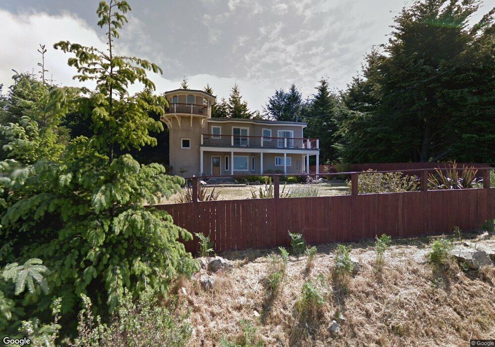
224 Parsons Rd Whitethorn, CA 95589
Estimated Value: $512,000 - $573,413
About This Home
This home is located at 224 Parsons Rd, Whitethorn, CA 95589 and is currently estimated at $557,103, approximately $213 per square foot. 224 Parsons Rd is a home located in Humboldt County.
Ownership History
We collect this data history from publicly available records. To have your information removed, we recommend requesting removal directly through your county’s website.
Purchase Details
Home Financials for this Owner
Home Financials are based on the most recent Mortgage that was taken out on this home.Purchase Details
Purchase Details
Purchase Details
Home Values in the Area
Average Home Value in this Area
Purchase History
We collect this data history from publicly available records. To have your information removed, we recommend requesting removal directly through your county’s website.
| Date | Buyer | Sale Price | Title Company |
|---|---|---|---|
| $350,000 | Fidelity National Title | ||
| -- | None Listed On Document | ||
| $33,000 | Fidelity National | ||
| -- | -- |
Mortgage History
We collect this data history from publicly available records. To have your information removed, we recommend requesting removal directly through your county’s website.
| Date | Status | Borrower | Loan Amount |
|---|---|---|---|
| Open | $270,000 |
Tax History
We collect this data history from publicly available records. To have your information removed, we recommend requesting removal directly through your county’s website.
| Year | Tax Paid | Tax Assessment Tax Assessment Total Assessment is a certain percentage of the fair market value that is determined by local assessors to be the total taxable value of land and additions on the property. | Land | Improvement |
|---|---|---|---|---|
| 2025 | $5,303 | $474,090 | $83,661 | $390,429 |
| 2024 | $5,303 | $464,795 | $82,021 | $382,774 |
| 2023 | $5,324 | $455,682 | $80,413 | $375,269 |
| 2022 | $5,244 | $446,748 | $78,837 | $367,911 |
| 2021 | $5,052 | $437,990 | $77,292 | $360,698 |
| 2020 | $5,206 | $433,500 | $76,500 | $357,000 |
| 2019 | $5,083 | $425,000 | $75,000 | $350,000 |
| 2018 | $6,203 | $526,846 | $41,998 | $484,848 |
| 2017 | $5,865 | $516,517 | $41,175 | $475,342 |
| 2016 | $5,831 | $506,390 | $40,368 | $466,022 |
| 2015 | $5,801 | $498,784 | $39,762 | $459,022 |
| 2014 | $5,458 | $489,015 | $38,984 | $450,031 |
Map
- 261 Parsons Rd
- 195 Parsons Rd
- 450 Hillside Dr
- 1085 Hillside Dr
- 7431 Shelter Cove Rd
- 2715 Toth Rd
- 175 Hillside Dr
- 62 Highview Cir
- 65 Carson Ct
- 85 Carson Ct
- 86 & 112 Rawhide Ct
- 1071 Hillside Dr
- 769 Lindley Loop
- 306 & 324 Telegraph Creek Rd
- 268 Oak Dr
- 191 Redwood Rd
- 8936 Shelter Cove Rd
- 20 & 40 Allen Ct
- 141 Cove Point W
- 432 Knob Hill Dr
Ask me questions while you tour the home.