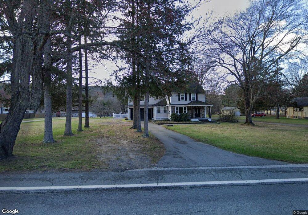
224 Route 209 Unit US Port Jervis, NY 12771
Estimated Value: $253,000 - $480,000
3
Beds
2
Baths
1,376
Sq Ft
$254/Sq Ft
Est. Value
About This Home
This home is located at 224 Route 209 Unit US, Port Jervis, NY 12771 and is currently estimated at $349,506, approximately $254 per square foot. 224 Route 209 Unit US is a home located in Orange County with nearby schools including Port Jervis High School and New Life Christian Day School.
Ownership History
Date
Name
Owned For
Owner Type
Purchase Details
Closed on
May 21, 2002
Sold by
Kampka Luanna M and Sauschuck Mitchell J
Bought by
Sauschuck Mitchell J and Sauschuck Luanna M
Current Estimated Value
Home Financials for this Owner
Home Financials are based on the most recent Mortgage that was taken out on this home.
Original Mortgage
$98,000
Outstanding Balance
$39,366
Interest Rate
6.24%
Mortgage Type
Purchase Money Mortgage
Estimated Equity
$310,140
Purchase Details
Closed on
Jun 5, 1997
Sold by
Bohan William and Hosking William E
Bought by
Kampka Luanna M and Sauschuck Mitchell J
Create a Home Valuation Report for This Property
The Home Valuation Report is an in-depth analysis detailing your home's value as well as a comparison with similar homes in the area
Home Values in the Area
Average Home Value in this Area
Purchase History
| Date | Buyer | Sale Price | Title Company |
|---|---|---|---|
| Sauschuck Mitchell J | -- | -- | |
| Kampka Luanna M | $66,000 | -- |
Source: Public Records
Mortgage History
| Date | Status | Borrower | Loan Amount |
|---|---|---|---|
| Open | Sauschuck Mitchell J | $98,000 |
Source: Public Records
Tax History Compared to Growth
Tax History
| Year | Tax Paid | Tax Assessment Tax Assessment Total Assessment is a certain percentage of the fair market value that is determined by local assessors to be the total taxable value of land and additions on the property. | Land | Improvement |
|---|---|---|---|---|
| 2024 | $5,561 | $85,500 | $18,500 | $67,000 |
| 2023 | $5,561 | $85,500 | $18,500 | $67,000 |
| 2022 | $5,514 | $85,500 | $18,500 | $67,000 |
| 2021 | $5,439 | $85,500 | $18,500 | $67,000 |
| 2020 | $4,693 | $85,500 | $18,500 | $67,000 |
| 2019 | $4,767 | $85,500 | $18,500 | $67,000 |
| 2018 | $4,767 | $85,500 | $18,500 | $67,000 |
| 2017 | $4,680 | $85,500 | $18,500 | $67,000 |
| 2016 | $4,698 | $85,500 | $18,500 | $67,000 |
| 2015 | -- | $85,500 | $18,500 | $67,000 |
| 2014 | -- | $85,500 | $18,500 | $67,000 |
Source: Public Records
Map
Nearby Homes
- 220 Route 209
- 220 Route 209 Unit US
- 203 Route 209 Unit US
- 201 Route 209 Unit US
- 209 Route 209 Unit US
- 239 Route 209 Unit US
- 237 Route 209 Unit US
- 235 Route 209 Unit US
- 233 Route 209 Unit US
- 219 Route 209 Unit US
- 217 Route 209 Unit US
- 213 Route 209 Unit US
- 235 Route 209
- 217 Route 209
- 228 Us Highway 209
- 8 Hobson Rd
- 218 U S 209
- 218 Us Hwy 209
- 218 Route 209 Unit US
- 218 Route 209