Estimated Value: $276,000
5
Beds
3
Baths
2,500
Sq Ft
$110/Sq Ft
Est. Value
About This Home
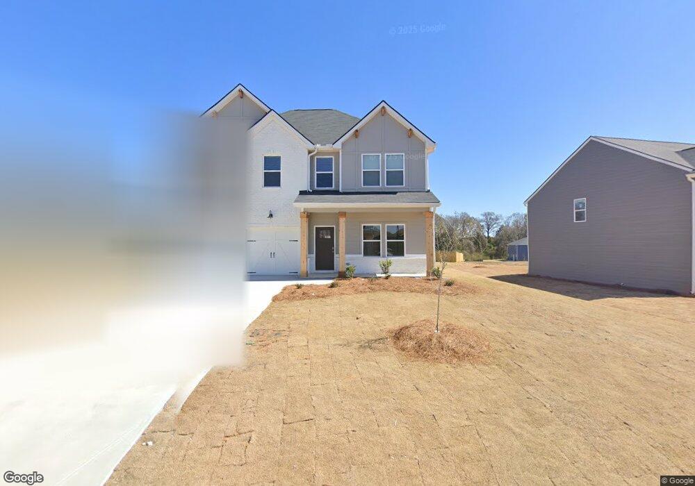
This home is located at 224 Rusty Plow Ln, Perry, GA 31069 and is currently estimated at $276,000, approximately $110 per square foot. 224 Rusty Plow Ln is a home located in Houston County with nearby schools including Tucker Elementary School, Perry Middle School, and Perry High School.
Ownership History
Date
Name
Owned For
Owner Type
Purchase Details
Closed on
Feb 28, 2025
Sold by
Dfh Liberty Llc
Bought by
Ventour Properties Llc
Current Estimated Value
Home Financials for this Owner
Home Financials are based on the most recent Mortgage that was taken out on this home.
Original Mortgage
$247,792
Interest Rate
6.72%
Mortgage Type
New Conventional
Purchase Details
Closed on
Jan 24, 2025
Sold by
Liberty Communities Llc
Bought by
Ventour Properties Llc
Home Financials for this Owner
Home Financials are based on the most recent Mortgage that was taken out on this home.
Original Mortgage
$247,792
Interest Rate
6.72%
Mortgage Type
New Conventional
Purchase Details
Closed on
Jan 23, 2025
Sold by
Liberty Communities Llc
Bought by
Dfh Liberty Llc
Home Financials for this Owner
Home Financials are based on the most recent Mortgage that was taken out on this home.
Original Mortgage
$247,792
Interest Rate
6.72%
Mortgage Type
New Conventional
Create a Home Valuation Report for This Property
The Home Valuation Report is an in-depth analysis detailing your home's value as well as a comparison with similar homes in the area
Home Values in the Area
Average Home Value in this Area
Purchase History
| Date | Buyer | Sale Price | Title Company |
|---|---|---|---|
| Ventour Properties Llc | -- | None Listed On Document | |
| Ventour Properties Llc | $330,400 | None Listed On Document | |
| Ventour Properties Llc | $330,400 | None Listed On Document | |
| Dfh Liberty Llc | $2,106,800 | None Listed On Document |
Source: Public Records
Mortgage History
| Date | Status | Borrower | Loan Amount |
|---|---|---|---|
| Previous Owner | Ventour Properties Llc | $247,792 |
Source: Public Records
Tax History
| Year | Tax Paid | Tax Assessment Tax Assessment Total Assessment is a certain percentage of the fair market value that is determined by local assessors to be the total taxable value of land and additions on the property. | Land | Improvement |
|---|---|---|---|---|
| 2025 | $3,998 | $121,640 | $14,000 | $107,640 |
| 2024 | $514 | $14,000 | $14,000 | $0 |
Source: Public Records
Map
Nearby Homes
- 324 Rusty Plow Ln
- 240 Rusty Plow Ln Unit 30
- 112 Agriculture Ln
- 82 Agriculture Ln
- 648 Encore Dr Unit 84
- 648 Encore Dr
- 301 Rusty Plow Ln
- 301 Rusty Plow Ln Unit 11
- 214 Cattle Dr
- 212 Cattle Dr
- 201 Cattle Dr
- 216 Cattle Dr
- 207 Cattle Dr
- 203 Cattle Dr
- 303 Rusty Plow Ln
- 303 Rusty Plow Ln Unit 12
- 213 Agriculture Ln Unit 10
- 211 Agriculture Ln Unit 9
- 211 Agriculture Ln
- 305 Rusty Plow Ln
- 224 Rusty Plow Ln
- 224 Rusty Plow Ln Unit 45
- 222 Rusty Plow Ln
- 222 Rusty Plow Ln
- 222 Rusty Plow Ln Unit 50
- 233 Rusty Plow Ln
- 103 Corn Field Cir
- 216 Rusty Plow Ln
- 107 Cornfield Cir
- 107 Cornfield Cir Unit 52
- 102 Cornfield Cir
- 106 Cornfield Cir Unit 57
- 102 Cornfield Cir Unit 59
- 109 Cornfield Cir
- 109 Cornfield Cir Unit 53
- 111 Cornfield Cir Unit 54
- 213 Rusty Plow Ln
- 104 Cornfield Cir Unit 58
- 104 Cornfield Cir
- 211 Rusty Plow Ln Unit 9
Your Personal Tour Guide
Ask me questions while you tour the home.