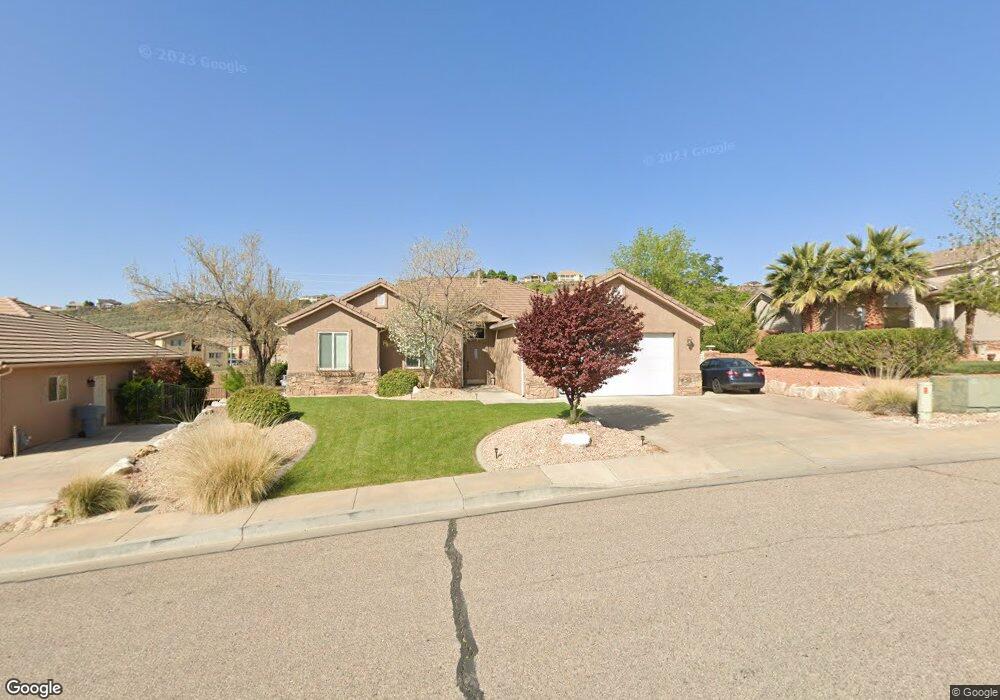
224 S 2020 East Cir Saint George, UT 84790
Estimated Value: $470,000 - $491,000
3
Beds
2
Baths
1,816
Sq Ft
$264/Sq Ft
Est. Value
About This Home
This home is located at 224 S 2020 East Cir, Saint George, UT 84790 and is currently estimated at $479,295, approximately $263 per square foot. 224 S 2020 East Cir is a home located in Washington County with nearby schools including Panorama School, Fossil Ridge Intermediate School, and Pine View Middle School.
Ownership History
Date
Name
Owned For
Owner Type
Purchase Details
Closed on
Nov 10, 2010
Sold by
The Secretary Of Housing & Urban Develop
Bought by
Mountain West Entrust Ira and Craig A Wilson Ira
Current Estimated Value
Purchase Details
Closed on
May 7, 2010
Sold by
Bac Home Loans Servicing Lp
Bought by
Secretary Of Housing & Urban Development
Purchase Details
Closed on
May 6, 2010
Sold by
Sullivan Eric G and Sullivan Dallas
Bought by
Bac Home Loans Servicing Lp and Countrywide Home Loans Servicing Lp
Purchase Details
Closed on
May 3, 2007
Sold by
Cowdell Brittany M and Cowdell Joseph K
Bought by
Sullivan Eric G and Sullivan Dallas
Home Financials for this Owner
Home Financials are based on the most recent Mortgage that was taken out on this home.
Original Mortgage
$276,658
Interest Rate
6.17%
Mortgage Type
FHA
Create a Home Valuation Report for This Property
The Home Valuation Report is an in-depth analysis detailing your home's value as well as a comparison with similar homes in the area
Home Values in the Area
Average Home Value in this Area
Purchase History
| Date | Buyer | Sale Price | Title Company |
|---|---|---|---|
| Mountain West Entrust Ira | -- | Monument Title Insurance Inc | |
| Secretary Of Housing & Urban Development | -- | Accommodation | |
| Bac Home Loans Servicing Lp | $298,971 | Lsi Title Agency Inc | |
| Sullivan Eric G | -- | Equity Title |
Source: Public Records
Mortgage History
| Date | Status | Borrower | Loan Amount |
|---|---|---|---|
| Previous Owner | Sullivan Eric G | $276,658 |
Source: Public Records
Tax History Compared to Growth
Tax History
| Year | Tax Paid | Tax Assessment Tax Assessment Total Assessment is a certain percentage of the fair market value that is determined by local assessors to be the total taxable value of land and additions on the property. | Land | Improvement |
|---|---|---|---|---|
| 2025 | $1,742 | $255,530 | $64,350 | $191,180 |
| 2023 | $1,811 | $270,545 | $57,200 | $213,345 |
| 2022 | $1,931 | $271,370 | $57,475 | $213,895 |
| 2021 | $1,736 | $363,700 | $88,000 | $275,700 |
| 2020 | $1,589 | $313,600 | $66,000 | $247,600 |
| 2019 | $1,548 | $298,500 | $66,000 | $232,500 |
| 2018 | $1,461 | $145,475 | $0 | $0 |
| 2017 | $1,453 | $140,470 | $0 | $0 |
| 2016 | $1,506 | $134,585 | $0 | $0 |
| 2015 | $1,447 | $124,080 | $0 | $0 |
| 2014 | $1,330 | $114,785 | $0 | $0 |
Source: Public Records
Map
Nearby Homes
- 236 S 2020 Cir E
- 2054 E 140 S
- 88 S 2060 E
- 232 S Acantilado Cir
- 9 S 2060 E
- 1908 E 40 S
- 0 S Mall Dr
- 145 N Mall Dr Unit 10
- 0 Null Unit 25-258376
- 210 N Mall Dr Unit 56
- 210 N Mall Dr Unit 86
- 1684 E 290 S
- 2911 E Snowberry Dr Unit 56
- 2911 E Snowberry Dr
- 5670 S Carnelian Pkwy
- 5664 S Carnelian Pkwy
- 1804 E 580 Cir S
- 0 Paisley Way Unit 24-253758
- 316 S 2450 E Unit 34
- 0 Tagans Way Unit 24-253776
- 224 S 2020 Cir E
- 236 S 2020 East Cir
- 212 S 2020 East Cir
- 212 S 2020 Cir E
- 2010 2010 E
- 2010 2010 E
- 2010 2010 E
- 0 2010 E
- 248 S 2020 East Cir
- 233 S 2020 East Cir
- 233 S 2020 Cir E
- 217 S 2020 East Cir
- 217 S 2020 Cir E
- 204 S 2020 East Cir
- 204 S 2020 Cir E
- 247 S 2020 East Cir
- 201 S 2020 Cir E
- 201 S 2020 East Cir
- 209 S 2020 Cir E
- 260 S 2020 Cir E