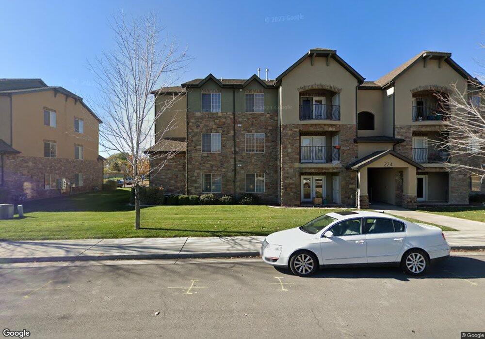
224 S 550 W Unit B1 Springville, UT 84663
Westfields North NeighborhoodEstimated Value: $307,000 - $355,000
3
Beds
2
Baths
1,340
Sq Ft
$246/Sq Ft
Est. Value
About This Home
This home is located at 224 S 550 W Unit B1, Springville, UT 84663 and is currently estimated at $329,045, approximately $245 per square foot. 224 S 550 W Unit B1 is a home located in Utah County with nearby schools including Westside Elementary School, Springville Junior High School, and Springville High School.
Ownership History
Date
Name
Owned For
Owner Type
Purchase Details
Closed on
Sep 27, 2007
Sold by
Livingston Construction & Development Ll
Bought by
Bartholomew Ray B and Bartholomew Ann C
Current Estimated Value
Purchase Details
Closed on
Nov 1, 2006
Sold by
Duck Creek Development Llc
Bought by
Livingston Construction & Development Ll
Home Financials for this Owner
Home Financials are based on the most recent Mortgage that was taken out on this home.
Original Mortgage
$1,050,000
Interest Rate
6.3%
Mortgage Type
Purchase Money Mortgage
Create a Home Valuation Report for This Property
The Home Valuation Report is an in-depth analysis detailing your home's value as well as a comparison with similar homes in the area
Home Values in the Area
Average Home Value in this Area
Purchase History
| Date | Buyer | Sale Price | Title Company |
|---|---|---|---|
| Bartholomew Ray B | -- | Century Title Company | |
| Livingston Construction & Development Ll | -- | Century Title Company |
Source: Public Records
Mortgage History
| Date | Status | Borrower | Loan Amount |
|---|---|---|---|
| Previous Owner | Livingston Construction & Development Ll | $1,050,000 |
Source: Public Records
Tax History Compared to Growth
Tax History
| Year | Tax Paid | Tax Assessment Tax Assessment Total Assessment is a certain percentage of the fair market value that is determined by local assessors to be the total taxable value of land and additions on the property. | Land | Improvement |
|---|---|---|---|---|
| 2025 | $1,642 | $300,000 | $33,300 | $266,700 |
| 2024 | $1,642 | $162,965 | $0 | $0 |
| 2023 | $1,672 | $167,475 | $0 | $0 |
| 2022 | $1,674 | $164,670 | $0 | $0 |
| 2021 | $1,440 | $220,200 | $26,400 | $193,800 |
| 2020 | $1,401 | $207,800 | $24,900 | $182,900 |
| 2019 | $1,259 | $189,800 | $26,000 | $163,800 |
| 2018 | $1,148 | $165,000 | $21,000 | $144,000 |
| 2017 | $1,111 | $84,700 | $0 | $0 |
| 2016 | $1,016 | $75,900 | $0 | $0 |
| 2015 | $868 | $66,110 | $0 | $0 |
| 2014 | $759 | $57,310 | $0 | $0 |
Source: Public Records
Map
Nearby Homes
- 224 S 550 W Unit B-2
- 248 S 550 W Unit C-11
- 358 S 550 W Unit D1
- 532 W 300 S Unit B
- 544 W 300 S Unit C
- 506 W 300 S Unit C
- 344 S 500 W Unit C
- 496 W 350 S Unit C
- 487 W 350 S Unit D
- 33 N 650 W
- 317 S 450 W Unit C
- 1092 W 200 S
- 550 S 400 W
- 643 W 650 S
- 330 W 100 S
- 311 W Center St
- 52 N 1100 W
- 231 N 750 W
- 729 S Harrison Dr
- 721 S Harrison Dr Unit 30
- 224 S 550 W Unit B1
- 224 S 550 W Unit B1
- 224 S 550 W Unit B9
- 224 S 550 W Unit B8
- 224 S 550 W Unit B7
- 224 S 550 W Unit B6
- 224 S 550 W Unit B5
- 224 S 550 W Unit B4
- 224 S 550 W Unit B3
- 224 S 550 W Unit B2
- 224 S 550 W Unit B1
- 224 S 550 W Unit B-12
- 224 S 550 W Unit B11
- 224 S 550 W Unit B6
- 224 S 550 W Unit B10
- 224 S 550 W
- 248 S 550 W Unit C1
- 248 S 550 W Unit C1
- 248 S 550 W Unit C1
- 248 S 550 W Unit C9