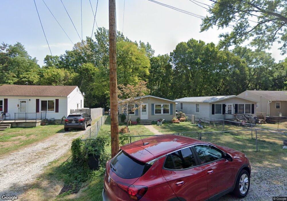
224 S Baker Ave Lancaster, OH 43130
Estimated Value: $199,000 - $227,000
3
Beds
2
Baths
960
Sq Ft
$221/Sq Ft
Est. Value
About This Home
This home is located at 224 S Baker Ave, Lancaster, OH 43130 and is currently estimated at $212,616, approximately $221 per square foot. 224 S Baker Ave is a home located in Fairfield County with nearby schools including General Sherman Junior High School, Lancaster High School, and St Mary Elementary School.
Ownership History
Date
Name
Owned For
Owner Type
Purchase Details
Closed on
Aug 5, 1997
Sold by
Spencer Roy E
Bought by
Patricia L Knox
Current Estimated Value
Home Financials for this Owner
Home Financials are based on the most recent Mortgage that was taken out on this home.
Original Mortgage
$59,407
Outstanding Balance
$9,038
Interest Rate
7.71%
Mortgage Type
FHA
Estimated Equity
$203,578
Purchase Details
Closed on
Jul 1, 1991
Sold by
Brobeck Mark J
Bought by
Spencer Roy E
Create a Home Valuation Report for This Property
The Home Valuation Report is an in-depth analysis detailing your home's value as well as a comparison with similar homes in the area
Home Values in the Area
Average Home Value in this Area
Purchase History
| Date | Buyer | Sale Price | Title Company |
|---|---|---|---|
| Patricia L Knox | $59,500 | -- | |
| Spencer Roy E | $27,500 | -- |
Source: Public Records
Mortgage History
| Date | Status | Borrower | Loan Amount |
|---|---|---|---|
| Open | Patricia L Knox | $59,407 |
Source: Public Records
Tax History Compared to Growth
Tax History
| Year | Tax Paid | Tax Assessment Tax Assessment Total Assessment is a certain percentage of the fair market value that is determined by local assessors to be the total taxable value of land and additions on the property. | Land | Improvement |
|---|---|---|---|---|
| 2024 | $4,138 | $46,030 | $7,420 | $38,610 |
| 2023 | $1,710 | $46,030 | $7,420 | $38,610 |
| 2022 | $1,720 | $46,030 | $7,420 | $38,610 |
| 2021 | $1,284 | $32,190 | $5,740 | $26,450 |
| 2020 | $1,231 | $32,190 | $5,740 | $26,450 |
| 2019 | $1,172 | $32,190 | $5,740 | $26,450 |
| 2018 | $872 | $25,030 | $4,020 | $21,010 |
| 2017 | $873 | $22,740 | $3,820 | $18,920 |
| 2016 | $850 | $22,740 | $3,820 | $18,920 |
| 2015 | $881 | $22,850 | $3,820 | $19,030 |
| 2014 | $840 | $22,850 | $3,820 | $19,030 |
| 2013 | $840 | $22,850 | $3,820 | $19,030 |
Source: Public Records
Map
Nearby Homes
- 114-116 S Cedar Ave
- 1318 Cedar Hill Rd
- 1511 Cedar Hill Rd
- 896 Elizabeth Dr
- 1715 W Walnut St
- 117 N Pierce Ave
- 136 Sherman Ave
- 140 Sherman Ave
- 215 Harrison Ave
- 404 Garfield Ave
- 517 Busby Ave
- 147 Shawnee Dr
- 1721 Union St
- 308 Hunter Ave
- 429 Harrison Ave
- 510 W Wheeling St
- 1829 Shoshone Dr
- 539 N Ohio Ave
- 238 N George St
- 1270 Mary Francis Ct
- 220 S Baker Ave
- 230 S Baker Ave
- 230 S Baker Ave
- 216 S Baker Ave
- 234 S Baker Ave
- 212 S Baker Ave
- 231 S Baker Ave
- 210 S Baker Ave
- 227 S Baker Ave
- 227 S Baker Ave
- 210 S Baker Ave
- 246 S Baker Ave
- 239 S Baker Ave
- 206 S Baker Ave
- 221 S Baker Ave
- 245 S Baker Ave
- 201 S Baker Ave
- 220 S Cedar Ave
- 228 S Cedar Ave
- 228 S Cedar Ave