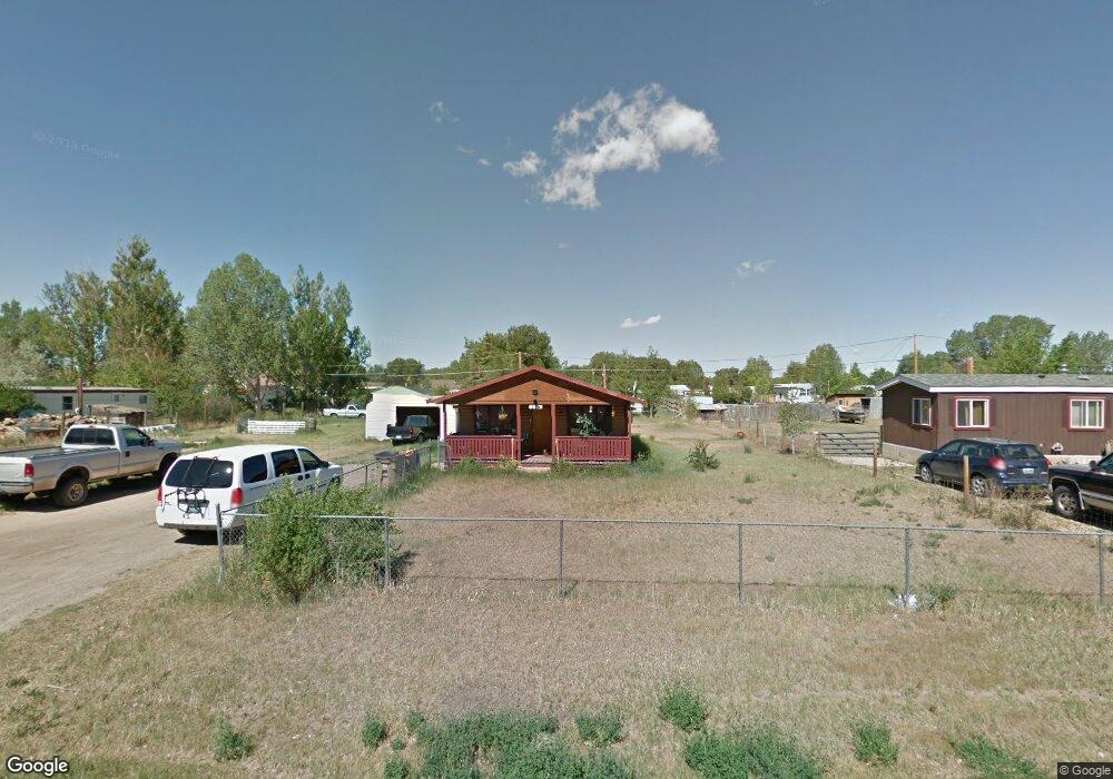
224 S Buchanan St Laramie, WY 82070
Estimated Value: $216,000 - $313,000
3
Beds
1
Bath
1,128
Sq Ft
$237/Sq Ft
Est. Value
About This Home
This home is located at 224 S Buchanan St, Laramie, WY 82070 and is currently estimated at $267,457, approximately $237 per square foot. 224 S Buchanan St is a home located in Albany County with nearby schools including Velma Linford Elementary School, Laramie Middle School, and Laramie High School.
Ownership History
Date
Name
Owned For
Owner Type
Purchase Details
Closed on
Dec 18, 2015
Sold by
Shaffer Joan Corbly
Bought by
Roberson Shell
Current Estimated Value
Home Financials for this Owner
Home Financials are based on the most recent Mortgage that was taken out on this home.
Original Mortgage
$121,250
Outstanding Balance
$95,920
Interest Rate
3.88%
Mortgage Type
New Conventional
Estimated Equity
$171,537
Purchase Details
Closed on
Feb 25, 2010
Sold by
Dupont Jeff and Barber Kevin
Bought by
Shaffer Joan Corbly
Home Financials for this Owner
Home Financials are based on the most recent Mortgage that was taken out on this home.
Original Mortgage
$151,400
Interest Rate
5.05%
Mortgage Type
VA
Create a Home Valuation Report for This Property
The Home Valuation Report is an in-depth analysis detailing your home's value as well as a comparison with similar homes in the area
Home Values in the Area
Average Home Value in this Area
Purchase History
| Date | Buyer | Sale Price | Title Company |
|---|---|---|---|
| Roberson Shell | -- | First American Title | |
| Shaffer Joan Corbly | -- | -- |
Source: Public Records
Mortgage History
| Date | Status | Borrower | Loan Amount |
|---|---|---|---|
| Open | Roberson Shell | $121,250 | |
| Previous Owner | Shaffer Joan Corbly | $151,400 |
Source: Public Records
Tax History Compared to Growth
Tax History
| Year | Tax Paid | Tax Assessment Tax Assessment Total Assessment is a certain percentage of the fair market value that is determined by local assessors to be the total taxable value of land and additions on the property. | Land | Improvement |
|---|---|---|---|---|
| 2025 | $1,347 | $14,290 | $4,147 | $10,143 |
| 2024 | $1,347 | $18,448 | $5,317 | $13,131 |
| 2023 | $1,328 | $18,198 | $5,317 | $12,881 |
| 2022 | $1,145 | $15,684 | $5,317 | $10,367 |
| 2021 | $1,046 | $14,333 | $5,317 | $9,016 |
| 2020 | $994 | $13,622 | $4,888 | $8,734 |
| 2019 | $951 | $13,029 | $4,888 | $8,141 |
| 2018 | $1,014 | $13,892 | $4,290 | $9,602 |
| 2017 | $1,013 | $13,882 | $4,290 | $9,592 |
| 2016 | $1,015 | $13,906 | $4,580 | $9,326 |
| 2015 | $1,096 | $15,016 | $6,748 | $8,268 |
| 2014 | $1,069 | $14,649 | $0 | $0 |
Source: Public Records
Map
Nearby Homes
- 370 S Buchanan St
- 2075 Jefferson St
- 2166 W Wyoming Ave Unit 29
- 2166 W Wyoming Ave Unit 25
- 427 S Pierce St
- 174 N Colorado Ave
- 529 S Pierce St
- 541 S Johnson St
- 153 N Adams St
- 1012 A-B S Colorado Ave
- 627 S Colorado Ave
- 262 N Taylor St Unit 5
- 1990 Truman St
- 1866 Truman St
- 2260 Franklin St Unit 27
- 2260 Franklin St Unit 38
- 1416 S Colorado Ave
- 1414 S Colorado Ave
- 1412 S Colorado Ave
- 1410 S Colorado Ave
- 220 S Buchanan St
- 227 S Buchanan St
- 1969 Monroe St
- 233 S Buchanan St
- 1964 Jefferson St
- 1952 W Jefferson St
- 235 S Lincoln St
- 217 S Lincoln St
- 306 S Buchanan St
- 1970 Monroe St
- 312 S Buchanan St
- 1872 Monroe St
- 305 S Lincoln St
- 1863 Monroe St
- 1870 Jefferson St
- 2059 Monroe St
- 230 S Lincoln St
- 315 S Buchanan St
- 218 S Pierce St
- 316 S Buchanan St