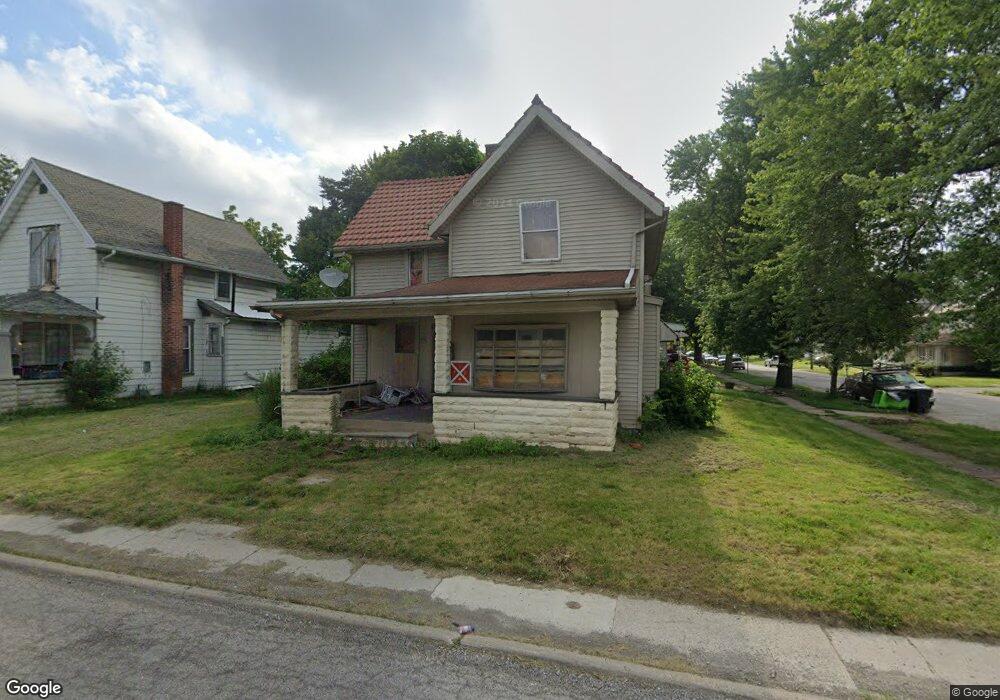
224 S Poplar St Fostoria, OH 44830
Estimated Value: $90,202
3
Beds
1
Bath
1,534
Sq Ft
$59/Sq Ft
Est. Value
About This Home
This home is located at 224 S Poplar St, Fostoria, OH 44830 and is currently estimated at $90,202, approximately $58 per square foot. 224 S Poplar St is a home located in Seneca County with nearby schools including Fostoria Intermediate Elementary School and Fostoria Junior/Senior High School.
Ownership History
Date
Name
Owned For
Owner Type
Purchase Details
Closed on
Sep 9, 2024
Sold by
Sheriff Of Seneca County
Bought by
Seneca County Land Reutilization Corporation
Current Estimated Value
Purchase Details
Closed on
Jun 8, 2006
Sold by
Phillips Randy W
Bought by
Hill Toni
Home Financials for this Owner
Home Financials are based on the most recent Mortgage that was taken out on this home.
Original Mortgage
$36,960
Interest Rate
9.9%
Mortgage Type
Adjustable Rate Mortgage/ARM
Purchase Details
Closed on
May 8, 2003
Sold by
Burkett Charlotte A and Burkett Larry A
Bought by
Urban Jeremy K
Purchase Details
Closed on
Oct 20, 1999
Sold by
Burkett Charlotte A and Burkett Larry A
Bought by
Burkett Charlotte A and Burkett Larry A
Purchase Details
Closed on
Jan 22, 1996
Sold by
Baker Eugene L
Bought by
Burkett Charlotte A and Burkett Larry A
Create a Home Valuation Report for This Property
The Home Valuation Report is an in-depth analysis detailing your home's value as well as a comparison with similar homes in the area
Home Values in the Area
Average Home Value in this Area
Purchase History
| Date | Buyer | Sale Price | Title Company |
|---|---|---|---|
| Seneca County Land Reutilization Corporation | -- | None Listed On Document | |
| Seneca County Land Reutilization Corporation | -- | None Listed On Document | |
| Hill Toni | $46,200 | Heartland Title | |
| Urban Jeremy K | $9,000 | -- | |
| Burkett Charlotte A | -- | -- | |
| Burkett Charlotte A | $5,000 | -- |
Source: Public Records
Mortgage History
| Date | Status | Borrower | Loan Amount |
|---|---|---|---|
| Previous Owner | Hill Toni | $36,960 |
Source: Public Records
Tax History Compared to Growth
Tax History
| Year | Tax Paid | Tax Assessment Tax Assessment Total Assessment is a certain percentage of the fair market value that is determined by local assessors to be the total taxable value of land and additions on the property. | Land | Improvement |
|---|---|---|---|---|
| 2024 | $102 | $13,740 | $1,300 | $12,440 |
| 2023 | $357 | $13,740 | $1,300 | $12,440 |
| 2022 | $919 | $14,190 | $1,160 | $13,030 |
| 2021 | $936 | $14,190 | $1,160 | $13,030 |
| 2020 | $334 | $14,193 | $1,159 | $13,034 |
| 2019 | $329 | $12,705 | $1,036 | $11,669 |
| 2018 | $334 | $12,705 | $1,036 | $11,669 |
| 2017 | $511 | $12,705 | $1,036 | $11,669 |
| 2016 | $698 | $11,316 | $1,166 | $10,150 |
| 2015 | $595 | $11,316 | $1,166 | $10,150 |
| 2014 | $928 | $11,316 | $1,166 | $10,150 |
| 2013 | $1,021 | $12,299 | $1,267 | $11,032 |
Source: Public Records
Map
Nearby Homes
- 0 W South Route 12
- 321 Mcdougal St
- 412 E Center St
- 306 E High St
- 203 N Union St
- 348 W South St
- 540 N Poplar St
- 514 E Lytle St
- 520 N Union St
- 633 Maple St
- 0 Bradner St
- 509 College Ave
- 211 Summit St
- 723 N Union St
- 481 Beverly Dr
- 711 Circle Dr
- 461 W Lytle St
- 461 W Lytle St Unit 106
- 461 W Lytle St Unit 145
- 703 Glenwood Ave
- 206 E South St
- 218 S Poplar St
- 210 E South St
- 214 E South St
- 210 S Poplar St
- 304 S Poplar St
- 207 E South St
- 214 S Poplar St
- 156 E South St
- 308 S Poplar St
- 203 Columbus Ave
- 220 E South St
- 201 E Tiffin St
- 221 E South St
- 310 S Poplar St
- 213 E South St
- 226 E South St
- 225 E South St
- 0 Columbus Ave Lot 24
- 0 Columbus Ave Lot 21