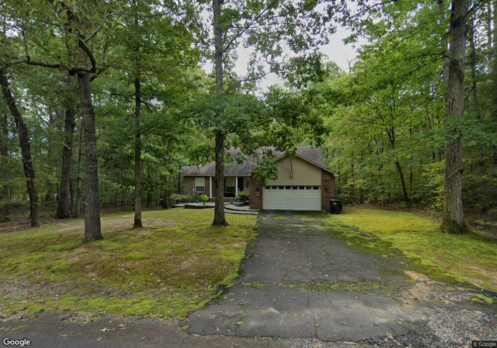
224 Springbrook Dr Hot Springs National Park, AR 71913
Estimated Value: $291,067 - $363,000
--
Bed
2
Baths
1,869
Sq Ft
$182/Sq Ft
Est. Value
About This Home
This home is located at 224 Springbrook Dr, Hot Springs National Park, AR 71913 and is currently estimated at $339,267, approximately $181 per square foot. 224 Springbrook Dr is a home located in Garland County with nearby schools including Malvern Elementary School, Wilson Intermediate School, and Malvern Junior High School.
Ownership History
Date
Name
Owned For
Owner Type
Purchase Details
Closed on
Oct 17, 2016
Sold by
Smith Michael J and Smith Maklisha R
Bought by
Miller Waldo B and Miller Carol A
Current Estimated Value
Home Financials for this Owner
Home Financials are based on the most recent Mortgage that was taken out on this home.
Original Mortgage
$153,728
Interest Rate
3.44%
Purchase Details
Closed on
Dec 20, 2007
Sold by
Pelech Walter L and Pelech Pamela W
Bought by
Smith Michael J and Smith Maklisha R
Home Financials for this Owner
Home Financials are based on the most recent Mortgage that was taken out on this home.
Original Mortgage
$175,000
Interest Rate
6.3%
Purchase Details
Closed on
Sep 28, 1999
Sold by
Not Provided
Bought by
Not Provided
Purchase Details
Closed on
Nov 30, 1995
Sold by
Not Provided
Bought by
Burrow Ronald C
Create a Home Valuation Report for This Property
The Home Valuation Report is an in-depth analysis detailing your home's value as well as a comparison with similar homes in the area
Home Values in the Area
Average Home Value in this Area
Purchase History
| Date | Buyer | Sale Price | Title Company |
|---|---|---|---|
| Miller Waldo B | $190,000 | Lenders Title Company | |
| Smith Michael J | $175,000 | Lenders Title Company | |
| Not Provided | $10,000 | -- | |
| Burrow Ronald C | -- | -- |
Source: Public Records
Mortgage History
| Date | Status | Borrower | Loan Amount |
|---|---|---|---|
| Closed | Miller Waldo B | $153,728 | |
| Previous Owner | Smith Michael J | $175,000 |
Source: Public Records
Tax History Compared to Growth
Tax History
| Year | Tax Paid | Tax Assessment Tax Assessment Total Assessment is a certain percentage of the fair market value that is determined by local assessors to be the total taxable value of land and additions on the property. | Land | Improvement |
|---|---|---|---|---|
| 2025 | $1,085 | $42,930 | $1,600 | $41,330 |
| 2024 | $1,093 | $42,930 | $1,600 | $41,330 |
| 2023 | $1,099 | $42,930 | $1,600 | $41,330 |
| 2022 | $1,546 | $42,930 | $1,600 | $41,330 |
| 2021 | $1,484 | $30,850 | $1,400 | $29,450 |
| 2020 | $1,109 | $30,850 | $1,400 | $29,450 |
| 2019 | $1,023 | $30,850 | $1,400 | $29,450 |
| 2018 | $1,134 | $30,850 | $1,400 | $29,450 |
| 2017 | $924 | $30,850 | $1,400 | $29,450 |
| 2016 | $963 | $31,780 | $1,400 | $30,380 |
| 2015 | $963 | $31,780 | $1,400 | $30,380 |
| 2014 | $962 | $31,780 | $1,400 | $30,380 |
Source: Public Records
Map
Nearby Homes
- 28 Edgemont Dr
- 28A Edgemont Dr
- 21 Springbrook Dr
- 249 Springbrook Dr
- 105 Flintwood Ct
- Lot 1092 Cedar Hill Dr
- Lot 859 Morningside Dr
- 343 Arlington Point
- Lot 1132A Edgehill Ct
- lot 1152A Edgehill Ct
- Lot 1060 Hawaii Ct
- Lot 102 & 103 Marsh Harbor
- 1016 Arlington Point
- 132 Victoria Ln
- 110 Clifton Ct
- Lots 552 & 553 Winterhaven Dr
- lot 2993 Ivy Hill Ct
- Lot 936 Angler Ct
- 195 Windsong Bay Dr
- LOT 42 Windsong Bay Dr
- 224 Springbrook Dr
- 223 Springbrook Dr
- 100 Potomac
- 100 Potomac
- 0 Potomac Dr Unit 21033376
- 232 Springbrook Dr
- 232 Springbrook Dr
- 0 Makaha Point Unit 17011919
- 100 Makaha Point
- 227 Springbrook Dr
- 238 Springbrook Dr
- 102 Makaha Point
- 231 Springbrook Dr
- 106 Makaha Point
- 111 Makaha Point
- 233 Springbrook Dr
- 233 Springbrook Dr
- 101 Springbrook Point
- 239 Springbrook Dr
- 110 Makaha Point