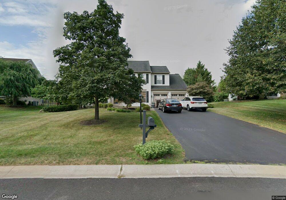
2240 Locust Dr Lansdale, PA 19446
Estimated Value: $762,290 - $837,000
4
Beds
3
Baths
2,784
Sq Ft
$287/Sq Ft
Est. Value
About This Home
This home is located at 2240 Locust Dr, Lansdale, PA 19446 and is currently estimated at $800,073, approximately $287 per square foot. 2240 Locust Dr is a home located in Montgomery County with nearby schools including Worcester Elementary School, Skyview Upper Elementary School, and Arcola Intermediate School.
Ownership History
Date
Name
Owned For
Owner Type
Purchase Details
Closed on
Mar 30, 2007
Sold by
Settefrati Thomas A and Settefrati Sophia
Bought by
Settefrati Thomas A
Current Estimated Value
Purchase Details
Closed on
Aug 26, 2005
Sold by
Dwyer Michael R and Dwyer Margaret S
Bought by
Settefrati Thomas A and Settefrati Sophia
Home Financials for this Owner
Home Financials are based on the most recent Mortgage that was taken out on this home.
Original Mortgage
$296,000
Outstanding Balance
$157,763
Interest Rate
5.79%
Mortgage Type
New Conventional
Estimated Equity
$642,310
Create a Home Valuation Report for This Property
The Home Valuation Report is an in-depth analysis detailing your home's value as well as a comparison with similar homes in the area
Home Values in the Area
Average Home Value in this Area
Purchase History
| Date | Buyer | Sale Price | Title Company |
|---|---|---|---|
| Settefrati Thomas A | -- | None Available | |
| Settefrati Thomas A | $480,000 | -- |
Source: Public Records
Mortgage History
| Date | Status | Borrower | Loan Amount |
|---|---|---|---|
| Open | Settefrati Thomas A | $296,000 |
Source: Public Records
Tax History Compared to Growth
Tax History
| Year | Tax Paid | Tax Assessment Tax Assessment Total Assessment is a certain percentage of the fair market value that is determined by local assessors to be the total taxable value of land and additions on the property. | Land | Improvement |
|---|---|---|---|---|
| 2025 | $8,720 | $230,210 | $71,430 | $158,780 |
| 2024 | $8,720 | $230,210 | $71,430 | $158,780 |
| 2023 | $8,364 | $230,210 | $71,430 | $158,780 |
| 2022 | $8,202 | $230,210 | $71,430 | $158,780 |
| 2021 | $8,040 | $230,210 | $71,430 | $158,780 |
| 2020 | $7,891 | $230,210 | $71,430 | $158,780 |
| 2019 | $7,814 | $230,210 | $71,430 | $158,780 |
| 2018 | $898 | $230,210 | $71,430 | $158,780 |
| 2017 | $7,514 | $230,210 | $71,430 | $158,780 |
| 2016 | $7,424 | $230,210 | $71,430 | $158,780 |
| 2015 | $7,161 | $230,210 | $71,430 | $158,780 |
| 2014 | $7,161 | $230,210 | $71,430 | $158,780 |
Source: Public Records
Map
Nearby Homes
- 2234 Locust Dr
- 3053 Sunny Ayre Dr
- 2015 Creek Way
- 1040 Hunter Hill Dr
- 1811 Hollow Rd
- 1808 Beth Ln
- 1959 Supplee Rd
- 2144 Schultz Rd
- 2806 Morris Rd
- 2203 Weber Rd
- 2785 Hedrick Rd
- 1653 Bridle Path Dr
- 172 Oberlin Terrace
- 1655 Kriebel Mill Rd
- 980 Jacks Ln
- 210 Berwick Place Unit 20E
- 144 Oberlin Terrace Unit 15-B
- 825 Morris Rd
- 177 Oberlin Terrace Unit 18-L
- 1627 Clearbrook Rd
- 2238 Locust Dr
- 2242 Locust Dr
- 2239 Locust Dr
- 2236 Locust Dr
- 2241 Locust Dr
- 2244 Locust Dr
- 2210 Ayreshire Dr
- 2243 Locust Dr
- 2246 Locust Dr
- 2221 Ayreshire Dr
- 2212 Ayreshire Dr
- 2245 Locust Dr
- 2232 Locust Dr
- 2235 Locust Dr
- 3111 Fisher Rd
- 2223 Ayreshire Dr
- 2247 Locust Dr
- 2230 Locust Dr
- 3208 Fisher Rd
- 2233 Locust Dr