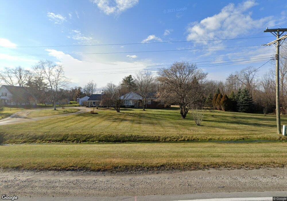
2240 S Range Rd Saint Clair, MI 48079
Estimated Value: $235,000 - $395,000
3
Beds
2
Baths
1,496
Sq Ft
$199/Sq Ft
Est. Value
About This Home
This home is located at 2240 S Range Rd, Saint Clair, MI 48079 and is currently estimated at $297,884, approximately $199 per square foot. 2240 S Range Rd is a home located in St. Clair County with nearby schools including Gearing Elementary School, St. Clair Middle School, and St. Clair High School.
Ownership History
Date
Name
Owned For
Owner Type
Purchase Details
Closed on
Aug 17, 2023
Sold by
Williams Jerold D
Bought by
Williams Jerold D and Rhadigan Shelly Ann
Current Estimated Value
Purchase Details
Closed on
Aug 16, 2023
Sold by
Jerold D Williams Revocable Living Trust and Williams Jerold D
Bought by
Williams Jerold D
Purchase Details
Closed on
Jul 25, 2019
Sold by
Williams Jerold D
Bought by
Jerold D Williams Revocable Li
Purchase Details
Closed on
Sep 20, 2006
Sold by
Williams Jerold D
Bought by
Williams Jerold D and Rhadigan Shelly Ann
Purchase Details
Closed on
Apr 7, 2006
Sold by
Williams Dorothy R
Bought by
Williams Jerold D
Home Financials for this Owner
Home Financials are based on the most recent Mortgage that was taken out on this home.
Original Mortgage
$82,000
Interest Rate
6.42%
Mortgage Type
New Conventional
Create a Home Valuation Report for This Property
The Home Valuation Report is an in-depth analysis detailing your home's value as well as a comparison with similar homes in the area
Home Values in the Area
Average Home Value in this Area
Purchase History
| Date | Buyer | Sale Price | Title Company |
|---|---|---|---|
| Williams Jerold D | -- | None Listed On Document | |
| Williams Jerold D | -- | None Listed On Document | |
| Williams Jerold D | -- | None Listed On Document | |
| Williams Jerold D | -- | None Listed On Document | |
| Jerold D Williams Revocable Li | -- | None Listed On Document | |
| Williams Jerold D | -- | None Available | |
| Williams Jerold D | -- | None Available |
Source: Public Records
Mortgage History
| Date | Status | Borrower | Loan Amount |
|---|---|---|---|
| Previous Owner | Williams Jerold D | $82,000 |
Source: Public Records
Tax History
| Year | Tax Paid | Tax Assessment Tax Assessment Total Assessment is a certain percentage of the fair market value that is determined by local assessors to be the total taxable value of land and additions on the property. | Land | Improvement |
|---|---|---|---|---|
| 2025 | $1,276 | $112,500 | $0 | $0 |
| 2024 | $1,238 | $114,700 | $0 | $0 |
| 2023 | $1,138 | $85,900 | $0 | $0 |
| 2022 | $1,182 | $80,900 | $0 | $0 |
| 2020 | $501 | $76,000 | $76,000 | $0 |
| 2019 | $521 | $83,700 | $0 | $0 |
| 2018 | $1,572 | $83,700 | $0 | $0 |
| 2016 | $1,058 | $68,600 | $0 | $0 |
| 2015 | -- | $65,200 | $65,200 | $0 |
| 2014 | -- | $62,800 | $62,800 | $0 |
| 2013 | -- | $57,900 | $0 | $0 |
Source: Public Records
Map
Nearby Homes
- 740 Highland Dr
- 4284 Scott B Dr
- 669 N Riverside Ave Unit 4
- 1810 Riley Rd
- 606 N 6th St
- 1924 Shelldrake Ln Unit 32
- 252 Shelldrake Ln
- 1931 Pug Rd
- 1932 Sheldrake Ln Unit 30
- 211 N Carney Dr
- 249 Shelldrake Ln
- 239 Shelldrake Ln Unit 40
- 409 N 5th St
- 3071 Regatta Ln
- 4147 River Pointe Dr
- 3059 Regatta Ln
- 412 Orchard St
- 3108 Regatta Ln
- 231 S Carney Dr
- 3072 Regatta Ln
- 2264 S Range Rd
- 2262 S Range Rd
- 2202 S Range Rd
- 2290 S Range Rd
- 2170 S Range Rd
- 0 Riley Unit 58050106895
- 0 Riley Unit 50106895
- 4538 Ketchum Rd
- 0 Bowman Rd Unit R218097075
- 0 Bowman Rd Unit 218097055
- 2007 S Range Rd
- 4566 Ketchum Rd
- 4610 Ketchum Rd
- 4590 Ketchum Rd
- 0 Ketchum Rd
- VL Range Rd
- 870 Birkdale Dr
- 877 Birkdale Dr
- 871 Birkdale Dr
- 1158 Highland Dr
Your Personal Tour Guide
Ask me questions while you tour the home.