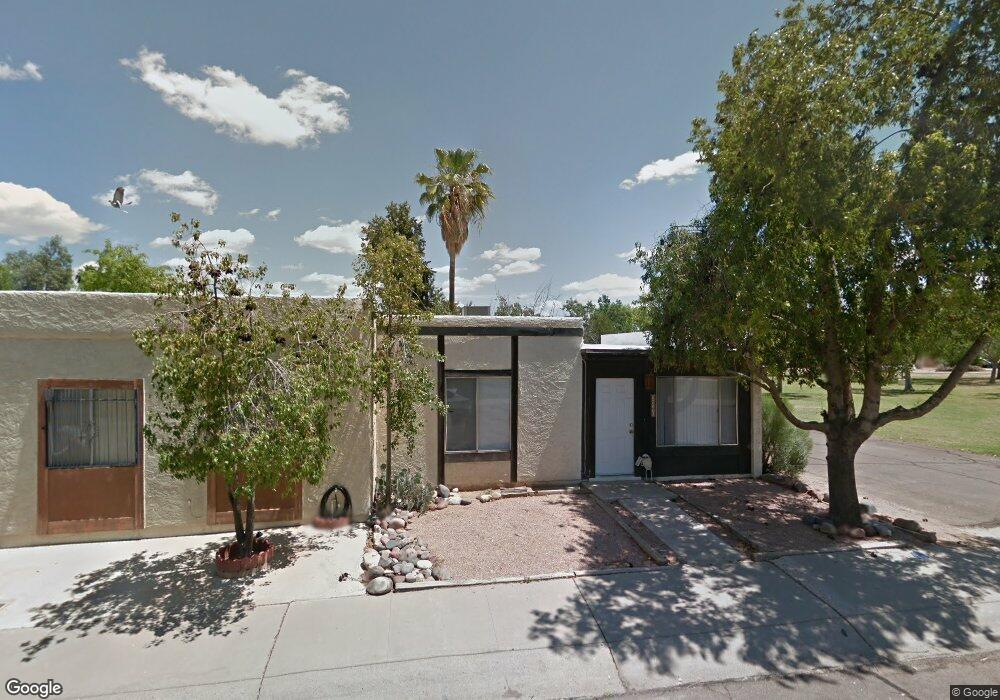
2240 W Carson Dr Tempe, AZ 85282
West Tempe NeighborhoodEstimated Value: $232,563 - $272,000
2
Beds
1
Bath
928
Sq Ft
$278/Sq Ft
Est. Value
About This Home
This home is located at 2240 W Carson Dr, Tempe, AZ 85282 and is currently estimated at $258,391, approximately $278 per square foot. 2240 W Carson Dr is a home located in Maricopa County with nearby schools including Frank Elementary School, Geneva Epps Mosley Middle School, and Tempe High School.
Ownership History
Date
Name
Owned For
Owner Type
Purchase Details
Closed on
Aug 2, 2016
Sold by
Bunts Lamar C
Bought by
Asumida Trust and Magallanes Edward Patrick
Current Estimated Value
Purchase Details
Closed on
Jan 31, 2005
Sold by
Hostetler William D and Hostetler Lorraine Y
Bought by
Bunts Lamar C
Home Financials for this Owner
Home Financials are based on the most recent Mortgage that was taken out on this home.
Original Mortgage
$82,425
Interest Rate
5.74%
Mortgage Type
New Conventional
Create a Home Valuation Report for This Property
The Home Valuation Report is an in-depth analysis detailing your home's value as well as a comparison with similar homes in the area
Home Values in the Area
Average Home Value in this Area
Purchase History
| Date | Buyer | Sale Price | Title Company |
|---|---|---|---|
| Asumida Trust | -- | None Available | |
| Bunts Lamar C | $109,900 | Fidelity National Title |
Source: Public Records
Mortgage History
| Date | Status | Borrower | Loan Amount |
|---|---|---|---|
| Previous Owner | Bunts Lamar C | $82,425 | |
| Closed | Bunts Lamar C | $16,485 |
Source: Public Records
Tax History
| Year | Tax Paid | Tax Assessment Tax Assessment Total Assessment is a certain percentage of the fair market value that is determined by local assessors to be the total taxable value of land and additions on the property. | Land | Improvement |
|---|---|---|---|---|
| 2025 | $643 | $5,362 | -- | -- |
| 2024 | $593 | $5,107 | -- | -- |
| 2023 | $593 | $17,260 | $3,450 | $13,810 |
| 2022 | $569 | $12,980 | $2,590 | $10,390 |
| 2021 | $573 | $12,320 | $2,460 | $9,860 |
| 2020 | $556 | $10,780 | $2,150 | $8,630 |
| 2019 | $545 | $9,830 | $1,960 | $7,870 |
| 2018 | $532 | $8,770 | $1,750 | $7,020 |
| 2017 | $516 | $6,300 | $1,260 | $5,040 |
| 2016 | $512 | $4,950 | $990 | $3,960 |
| 2015 | $492 | $4,280 | $850 | $3,430 |
Source: Public Records
Map
Nearby Homes
- 2205 W Desiree Ln
- 4901 S Calle Los Cerros Dr Unit 237
- 4901 S Calle Los Cerros Dr Unit 206
- 4901 S Calle Los Cerros Dr Unit 229
- 4901 S Calle Los Cerros Dr Unit 202
- 2401 W Southern Ave Unit 18
- 2401 W Southern Ave Unit 486
- 2401 W Southern Ave Unit 344
- 2401 W Southern Ave Unit 330
- 2401 W Southern Ave Unit 480
- 2401 W Southern Ave Unit 336
- 2401 W Southern Ave Unit 155
- 2401 W Southern Ave Unit 481
- 2401 W Southern Ave Unit 184
- 2401 W Southern Ave Unit 194
- 2401 W Southern Ave Unit 129
- 2401 W Southern Ave Unit 224
- 2401 W Southern Ave Unit 4
- 2401 W Southern Ave Unit 187
- 2401 W Southern Ave Unit 142
- 2246 W Carson Dr
- 2302 W Carson Dr
- 2306 W Carson Dr
- 2219 W Vineyard Rd
- 2215 W Vineyard Rd
- 2223 W Vineyard Rd
- 2227 W Vineyard Rd
- 2231 W Vineyard Rd
- 2314 W Carson Dr
- 2225 W Carson Dr
- 2235 W Vineyard Rd
- 2233 W Carson Dr
- 2229 W Carson Dr
- 2318 W Carson Dr
- 2237 W Carson Dr
- 2217 W Carson Dr
- 2221 W Carson Dr
- 2241 W Carson Dr
- 2239 W Vineyard Rd
- 2245 W Carson Dr
Your Personal Tour Guide
Ask me questions while you tour the home.