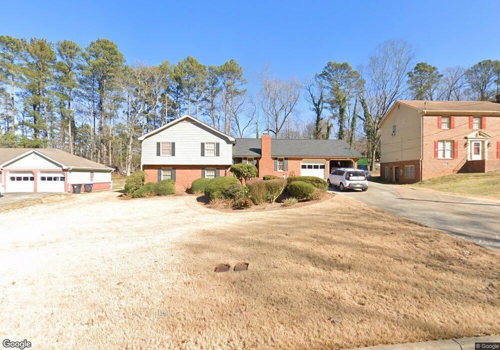
2242 Westridge Dr Snellville, GA 30078
Estimated Value: $332,000 - $371,000
3
Beds
2
Baths
2,487
Sq Ft
$145/Sq Ft
Est. Value
About This Home
This home is located at 2242 Westridge Dr, Snellville, GA 30078 and is currently estimated at $359,470, approximately $144 per square foot. 2242 Westridge Dr is a home located in Gwinnett County with nearby schools including Britt Elementary School, Snellville Middle School, and South Gwinnett High School.
Ownership History
Date
Name
Owned For
Owner Type
Purchase Details
Closed on
Oct 11, 2021
Sold by
Warren Vic B
Bought by
Warren Vic B and Warren Vicki R
Current Estimated Value
Purchase Details
Closed on
May 21, 2007
Sold by
Brueckner Lawrence T
Bought by
Warren Vic B
Home Financials for this Owner
Home Financials are based on the most recent Mortgage that was taken out on this home.
Original Mortgage
$160,000
Interest Rate
6.17%
Mortgage Type
FHA
Purchase Details
Closed on
Jun 8, 2001
Sold by
Brueckner Mary E
Bought by
Brueckner Lawrence T
Create a Home Valuation Report for This Property
The Home Valuation Report is an in-depth analysis detailing your home's value as well as a comparison with similar homes in the area
Home Values in the Area
Average Home Value in this Area
Purchase History
| Date | Buyer | Sale Price | Title Company |
|---|---|---|---|
| Warren Vic B | -- | -- | |
| Warren Vic B | $160,000 | -- | |
| Brueckner Lawrence T | -- | -- |
Source: Public Records
Mortgage History
| Date | Status | Borrower | Loan Amount |
|---|---|---|---|
| Previous Owner | Warren Vic B | $160,000 |
Source: Public Records
Tax History Compared to Growth
Tax History
| Year | Tax Paid | Tax Assessment Tax Assessment Total Assessment is a certain percentage of the fair market value that is determined by local assessors to be the total taxable value of land and additions on the property. | Land | Improvement |
|---|---|---|---|---|
| 2025 | $721 | $154,920 | $18,000 | $136,920 |
| 2024 | $716 | $153,440 | $18,000 | $135,440 |
| 2023 | $716 | $148,080 | $27,080 | $121,000 |
| 2022 | $3,206 | $124,880 | $20,000 | $104,880 |
| 2021 | $2,445 | $85,240 | $13,200 | $72,040 |
| 2020 | $2,864 | $83,840 | $12,000 | $71,840 |
| 2019 | $2,858 | $83,840 | $12,000 | $71,840 |
| 2018 | $2,586 | $73,040 | $10,000 | $63,040 |
| 2016 | $2,157 | $61,080 | $10,000 | $51,080 |
| 2015 | $2,161 | $61,080 | $10,000 | $51,080 |
| 2014 | $1,783 | $50,880 | $8,800 | $42,080 |
Source: Public Records
Map
Nearby Homes
- 0 Cambridge St Unit 7681233
- 2312 Westridge Dr
- 2292 Cambridge St
- 2930 Spruce Cir
- 2329 Valley Way
- 2067 Crescent Dr SW
- 2729 Lanier Dr
- 2101 Bankston Cir
- 2699 Greenbelt Rd
- 1916 Oakwood Grove Dr Unit 1
- 2429 Scenic Hwy S
- 2430 Bankston Cir
- 2529 Britt Rd
- 2500 Rosedale Rd Unit I
- 2141 Slick Stone Dr
- 2845 Long Shadow Ct
- Kenwood Plan at Watson Park
- Stockbridge Plan at Watson Park
- Aiken Plan at Watson Park
- Lawrence Plan at Watson Park
- 2232 Westridge Dr
- 2252 Westridge Dr
- 2265 Sussex Ct
- 2262 Westridge Dr
- 2222 Westridge Dr
- 2275 Sussex Ct
- 2241 Westridge Dr
- 2255 Sussex Ct
- 2231 Westridge Dr
- 2251 Westridge Dr
- 2272 Westridge Dr
- 2221 Westridge Dr
- 2261 Westridge Dr
- 2295 Sussex Ct
- 2271 Westridge Dr
- 0 Westridge Dr Unit 7462195
- 0 Westridge Dr Unit 7367764
- 0 Westridge Dr Unit 3230070
- 0 Westridge Dr Unit 8900796
- 0 Westridge Dr Unit 8699109