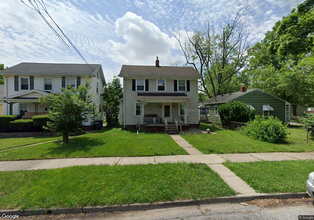
2243 Dunham St Toledo, OH 43609
Southside NeighborhoodEstimated Value: $92,193 - $112,000
3
Beds
1
Bath
1,128
Sq Ft
$89/Sq Ft
Est. Value
About This Home
This home is located at 2243 Dunham St, Toledo, OH 43609 and is currently estimated at $100,048, approximately $88 per square foot. 2243 Dunham St is a home located in Lucas County with nearby schools including Burroughs Elementary School, Bowsher High School, and Explorers Academy of Science and Technology.
Ownership History
Date
Name
Owned For
Owner Type
Purchase Details
Closed on
Sep 21, 2005
Sold by
Bender Thomas
Bought by
Pietz Gabriela E
Current Estimated Value
Home Financials for this Owner
Home Financials are based on the most recent Mortgage that was taken out on this home.
Original Mortgage
$67,467
Outstanding Balance
$36,457
Interest Rate
6.01%
Mortgage Type
FHA
Estimated Equity
$63,591
Purchase Details
Closed on
Aug 22, 2003
Sold by
Milford Daniel P and Milford Krista
Bought by
Branch Christopher W and Branch Erica L
Purchase Details
Closed on
Jan 11, 2001
Sold by
Summit Diversified Investments Corp
Bought by
Milford Daniel P
Home Financials for this Owner
Home Financials are based on the most recent Mortgage that was taken out on this home.
Original Mortgage
$74,825
Interest Rate
7.58%
Mortgage Type
FHA
Purchase Details
Closed on
Dec 21, 2000
Sold by
Rudski Joseph J
Bought by
Summit Diversified Investments Corp and 2243 Dunham Land Trust
Home Financials for this Owner
Home Financials are based on the most recent Mortgage that was taken out on this home.
Original Mortgage
$74,825
Interest Rate
7.58%
Mortgage Type
FHA
Purchase Details
Closed on
Jun 1, 2000
Sold by
Northwest Title Agency Of Ohio & Michiga
Bought by
Rudski Joseph J and Rudski Enterprises
Home Financials for this Owner
Home Financials are based on the most recent Mortgage that was taken out on this home.
Original Mortgage
$38,509
Interest Rate
8.14%
Purchase Details
Closed on
Apr 17, 2000
Sold by
Estate Of George A Payne
Bought by
Northwest Title Agency Of Ohio & Michiga
Home Financials for this Owner
Home Financials are based on the most recent Mortgage that was taken out on this home.
Original Mortgage
$38,509
Interest Rate
8.14%
Purchase Details
Closed on
Aug 7, 1992
Sold by
Payne George A and Payne Barbara
Create a Home Valuation Report for This Property
The Home Valuation Report is an in-depth analysis detailing your home's value as well as a comparison with similar homes in the area
Home Values in the Area
Average Home Value in this Area
Purchase History
| Date | Buyer | Sale Price | Title Company |
|---|---|---|---|
| Pietz Gabriela E | $68,000 | -- | |
| Branch Christopher W | $77,200 | Northwest Title Agency Of Oh | |
| Milford Daniel P | $76,000 | Northwest Title Agency Of Oh | |
| Summit Diversified Investments Corp | -- | Northwest Title Agency Of Oh | |
| Rudski Joseph J | -- | Northwest Title Agency Of Oh | |
| Northwest Title Agency Of Ohio & Michiga | $42,850 | -- | |
| -- | -- | -- |
Source: Public Records
Mortgage History
| Date | Status | Borrower | Loan Amount |
|---|---|---|---|
| Open | Pietz Gabriela E | $67,467 | |
| Previous Owner | Milford Daniel P | $74,825 | |
| Previous Owner | Rudski Joseph J | $38,509 |
Source: Public Records
Tax History Compared to Growth
Tax History
| Year | Tax Paid | Tax Assessment Tax Assessment Total Assessment is a certain percentage of the fair market value that is determined by local assessors to be the total taxable value of land and additions on the property. | Land | Improvement |
|---|---|---|---|---|
| 2024 | $790 | $23,695 | $6,020 | $17,675 |
| 2023 | $1,331 | $18,655 | $3,885 | $14,770 |
| 2022 | $1,302 | $18,655 | $3,885 | $14,770 |
| 2021 | $1,300 | $18,655 | $3,885 | $14,770 |
| 2020 | $1,377 | $17,290 | $3,570 | $13,720 |
| 2019 | $1,331 | $17,290 | $3,570 | $13,720 |
| 2018 | $1,323 | $17,290 | $3,570 | $13,720 |
| 2017 | $1,389 | $16,905 | $3,500 | $13,405 |
| 2016 | $1,359 | $48,300 | $10,000 | $38,300 |
| 2015 | $1,315 | $48,300 | $10,000 | $38,300 |
| 2014 | $1,063 | $16,910 | $3,500 | $13,410 |
| 2013 | $1,063 | $16,910 | $3,500 | $13,410 |
Source: Public Records
Map
Nearby Homes
- 304 Mayberry St
- 321 Mayberry St
- 2126 Airport Hwy
- 226 Somerset St
- 221 Somerset St
- 440 Somerset St
- 224 S Fearing Blvd
- 556 Apple Ave
- 142 S Detroit Ave
- 531 Shasta Dr
- 576 Bronx Dr
- 140 Whiting Ave
- 512 Woodsdale Ave
- 1754 Finch St
- 1777 South Ave
- 710 Durango Dr
- 2828 South Ave
- 649 Wright Ave
- 705 Wright Ave
- 323 Champion St