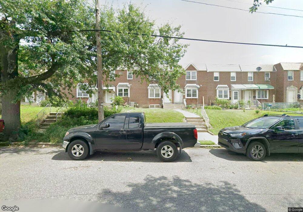
2243 Longshore Ave Philadelphia, PA 19149
Castor Gardens NeighborhoodEstimated Value: $240,443 - $259,000
3
Beds
1
Bath
1,222
Sq Ft
$205/Sq Ft
Est. Value
About This Home
This home is located at 2243 Longshore Ave, Philadelphia, PA 19149 and is currently estimated at $250,611, approximately $205 per square foot. 2243 Longshore Ave is a home located in Philadelphia County with nearby schools including Solomon Solis-Cohen School, Castor Gardens Middle School, and Northeast High School.
Ownership History
Date
Name
Owned For
Owner Type
Purchase Details
Closed on
Feb 1, 2025
Sold by
Lei Qiu Ming and Huang Xue Juan
Bought by
Huang Joan and Allen Lei
Current Estimated Value
Purchase Details
Closed on
Feb 14, 2011
Sold by
Koch Abraham and Estate Of Bernard Koch
Bought by
Huang Xue Juan and Lei Qiu Ming
Home Financials for this Owner
Home Financials are based on the most recent Mortgage that was taken out on this home.
Original Mortgage
$89,000
Interest Rate
4.77%
Mortgage Type
New Conventional
Create a Home Valuation Report for This Property
The Home Valuation Report is an in-depth analysis detailing your home's value as well as a comparison with similar homes in the area
Home Values in the Area
Average Home Value in this Area
Purchase History
| Date | Buyer | Sale Price | Title Company |
|---|---|---|---|
| Huang Joan | $125,000 | None Listed On Document | |
| Huang Xue Juan | $119,000 | None Available |
Source: Public Records
Mortgage History
| Date | Status | Borrower | Loan Amount |
|---|---|---|---|
| Previous Owner | Huang Xue Juan | $89,000 |
Source: Public Records
Tax History Compared to Growth
Tax History
| Year | Tax Paid | Tax Assessment Tax Assessment Total Assessment is a certain percentage of the fair market value that is determined by local assessors to be the total taxable value of land and additions on the property. | Land | Improvement |
|---|---|---|---|---|
| 2025 | $3,011 | $254,200 | $50,840 | $203,360 |
| 2024 | $3,011 | $254,200 | $50,840 | $203,360 |
| 2023 | $3,011 | $215,100 | $43,020 | $172,080 |
| 2022 | $2,107 | $215,100 | $43,020 | $172,080 |
| 2021 | $2,107 | $0 | $0 | $0 |
| 2020 | $2,107 | $0 | $0 | $0 |
| 2019 | $2,021 | $0 | $0 | $0 |
| 2018 | $1,838 | $0 | $0 | $0 |
| 2017 | $1,838 | $0 | $0 | $0 |
| 2016 | $1,838 | $0 | $0 | $0 |
| 2015 | $1,759 | $0 | $0 | $0 |
| 2014 | -- | $131,300 | $27,652 | $103,648 |
| 2012 | -- | $15,968 | $2,076 | $13,892 |
Source: Public Records
Map
Nearby Homes
- 2248 Disston St
- 2257 Disston St
- 2171 Disston St
- 2241 Knorr St
- 2249 Knorr St
- 2169 Knorr St
- 7017 Calvert St
- 2119 Glenview St
- 2110 Longshore Ave
- 2206 Princeton Ave
- 6749 E Roosevelt Blvd
- 2162 Princeton Ave
- 2712 Knorr St
- 2140 Princeton Ave
- 2240 Friendship St
- 2711 Unruh Ave
- 2731 Unruh Ave
- 2720 Unruh Ave
- 2141 Fanshawe St
- 2105 Friendship St
- 2241 Longshore Ave
- 2245 Longshore Ave
- 2247 Longshore Ave
- 2237 Longshore Ave
- 2249 Longshore Ave
- 2235 Longshore Ave
- 2251 Longshore Ave Unit Longshore Ave. 2nd Fl.
- 2251 Longshore Ave
- 2233 Longshore Ave
- 2252 Disston St
- 2246 Disston St
- 2250 Disston St
- 2242 Disston St
- 2254 Disston St
- 2231 Longshore Ave
- 2238 Disston St
- 2240 Disston St
- 2256 Disston St
- 2229 Longshore Ave
- 2236 Disston St