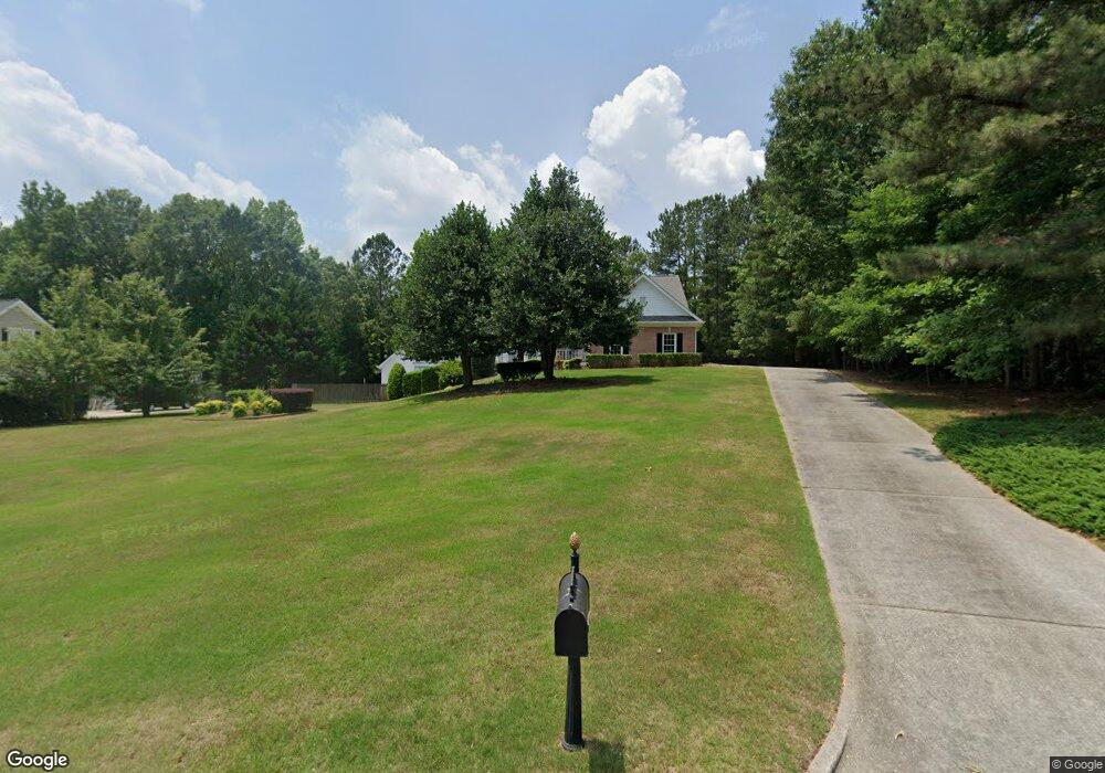
2244 Duncans Shore Dr Buford, GA 30519
Estimated Value: $405,000 - $541,288
3
Beds
3
Baths
2,415
Sq Ft
$193/Sq Ft
Est. Value
About This Home
This home is located at 2244 Duncans Shore Dr, Buford, GA 30519 and is currently estimated at $467,072, approximately $193 per square foot. 2244 Duncans Shore Dr is a home located in Gwinnett County with nearby schools including Duncan Creek Elementary School, Frank N. Osborne Middle School, and Mill Creek High School.
Ownership History
Date
Name
Owned For
Owner Type
Purchase Details
Closed on
May 14, 2004
Sold by
Neu Robert A and Neu Susan
Bought by
King Patrick B
Current Estimated Value
Home Financials for this Owner
Home Financials are based on the most recent Mortgage that was taken out on this home.
Original Mortgage
$286,000
Outstanding Balance
$125,003
Interest Rate
4.75%
Mortgage Type
New Conventional
Estimated Equity
$342,069
Purchase Details
Closed on
Sep 29, 1998
Sold by
Plansouth Inc
Bought by
Neu Rbt A and Neu Susan
Home Financials for this Owner
Home Financials are based on the most recent Mortgage that was taken out on this home.
Original Mortgage
$215,000
Interest Rate
6.95%
Mortgage Type
New Conventional
Purchase Details
Closed on
Mar 6, 1997
Sold by
Duluth Serv Inc
Bought by
Plansouth Inc
Create a Home Valuation Report for This Property
The Home Valuation Report is an in-depth analysis detailing your home's value as well as a comparison with similar homes in the area
Home Values in the Area
Average Home Value in this Area
Purchase History
| Date | Buyer | Sale Price | Title Company |
|---|---|---|---|
| King Patrick B | $357,500 | -- | |
| Neu Rbt A | $268,800 | -- | |
| Plansouth Inc | $34,500 | -- |
Source: Public Records
Mortgage History
| Date | Status | Borrower | Loan Amount |
|---|---|---|---|
| Open | King Patrick B | $286,000 | |
| Previous Owner | Neu Rbt A | $215,000 | |
| Closed | Plansouth Inc | $0 |
Source: Public Records
Tax History Compared to Growth
Tax History
| Year | Tax Paid | Tax Assessment Tax Assessment Total Assessment is a certain percentage of the fair market value that is determined by local assessors to be the total taxable value of land and additions on the property. | Land | Improvement |
|---|---|---|---|---|
| 2025 | $2,010 | $225,760 | $59,840 | $165,920 |
| 2024 | $2,034 | $211,280 | $50,000 | $161,280 |
| 2023 | $2,034 | $192,080 | $44,000 | $148,080 |
| 2022 | $1,991 | $179,120 | $41,200 | $137,920 |
| 2021 | $1,968 | $134,720 | $32,000 | $102,720 |
| 2020 | $1,965 | $134,720 | $32,000 | $102,720 |
| 2019 | $1,816 | $134,720 | $32,000 | $102,720 |
| 2018 | $1,798 | $134,720 | $32,000 | $102,720 |
| 2016 | $1,831 | $134,720 | $32,000 | $102,720 |
| 2015 | $4,181 | $108,000 | $20,000 | $88,000 |
| 2014 | -- | $91,400 | $20,000 | $71,400 |
Source: Public Records
Map
Nearby Homes
- 4785 Nolans Ridge
- 4602 Shay Terrace
- 2171 Spring Sound Ln
- 2200 Spring Sound Ln
- 4645 Spout Springs Rd
- 2206 Spring Stone Ct
- 4657 Water Mill Dr NE
- 2235 Well Springs Dr
- 4162 Wyndham Ridge Ct Unit 3
- 2264 Oak Falls Ln
- 4457 Water Mill Dr
- 2424 Pinnae Place
- 3475 Duncan Bridge Dr Unit 2
- 4271 Haywater Cove
- 6096 Apple Grove Rd
- 4777 Waxwing St
- 2726 Talley Ln
- 2732 Thompson Mill Rd
- 4335 Magpie Dr
- 2234 Duncans Shore Dr
- 2254 Duncans Shore Dr
- 2235 Duncans Shore Dr
- 2245 Duncans Shore Dr
- 2264 Duncans Shore Dr
- 2224 Duncans Shore Dr
- 2265 Duncan Shores Dr
- 0 Duncan Shores Dr Unit 8161584
- 2265 Duncans Shore Dr
- 2225 Duncans Shore Dr
- 2274 Duncans Shore Dr
- 4717 Spout Springs Rd
- 2285 Duncans Shore Dr
- 2214 Duncans Shore Dr
- 4805 Nolans Ridge
- 4765 Brandon Acres Ln
- 4775 Brandon Acres Ln
- 4755 Brandon Acres Ln
- 4795 Nolans Ridge
- 4785 Brandon Acres Ln