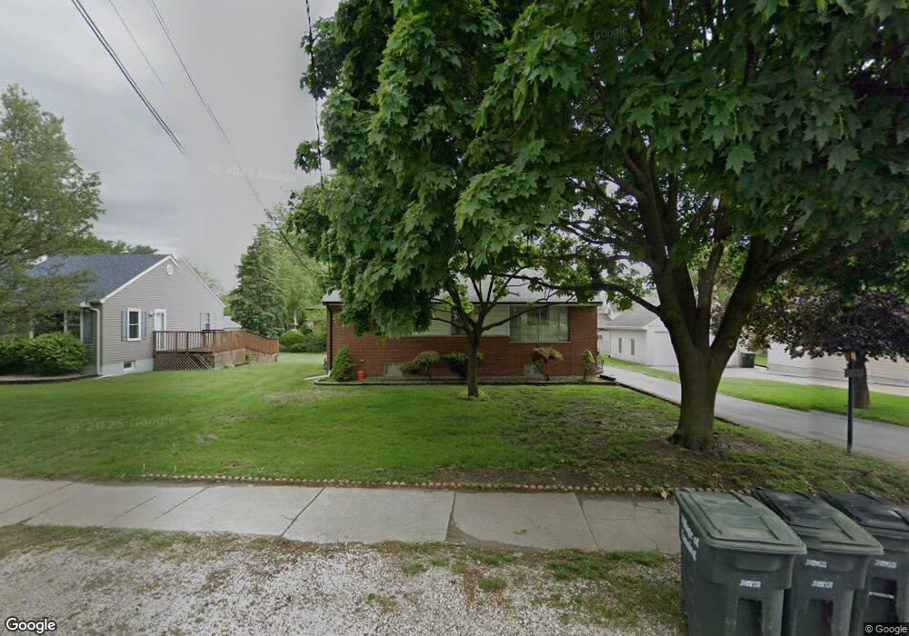
2244 Thornton Lansing Rd Lansing, IL 60438
Estimated Value: $168,000 - $203,310
3
Beds
2
Baths
1,120
Sq Ft
$169/Sq Ft
Est. Value
About This Home
This home is located at 2244 Thornton Lansing Rd, Lansing, IL 60438 and is currently estimated at $188,828, approximately $168 per square foot. 2244 Thornton Lansing Rd is a home located in Cook County with nearby schools including Oak Glen Elementary School, Memorial Jr High School, and Thornton Fractnl So High School.
Ownership History
Date
Name
Owned For
Owner Type
Purchase Details
Closed on
Aug 15, 2023
Sold by
Village Of Lansing
Bought by
Jp Lansing Llc
Current Estimated Value
Home Financials for this Owner
Home Financials are based on the most recent Mortgage that was taken out on this home.
Original Mortgage
$1,290,000
Outstanding Balance
$1,261,416
Interest Rate
6.96%
Estimated Equity
-$1,072,588
Purchase Details
Closed on
Dec 11, 2003
Sold by
Avila Dolores
Bought by
Avila Dolores and Dolores Avila Revocable Living Trust
Create a Home Valuation Report for This Property
The Home Valuation Report is an in-depth analysis detailing your home's value as well as a comparison with similar homes in the area
Home Values in the Area
Average Home Value in this Area
Purchase History
| Date | Buyer | Sale Price | Title Company |
|---|---|---|---|
| Jp Lansing Llc | -- | None Listed On Document | |
| Avila Dolores | -- | -- |
Source: Public Records
Mortgage History
| Date | Status | Borrower | Loan Amount |
|---|---|---|---|
| Open | Jp Lansing Llc | $1,290,000 |
Source: Public Records
Tax History Compared to Growth
Tax History
| Year | Tax Paid | Tax Assessment Tax Assessment Total Assessment is a certain percentage of the fair market value that is determined by local assessors to be the total taxable value of land and additions on the property. | Land | Improvement |
|---|---|---|---|---|
| 2024 | $3,596 | $13,401 | $3,443 | $9,958 |
| 2023 | $2,144 | $13,401 | $3,443 | $9,958 |
| 2022 | $2,144 | $9,457 | $3,038 | $6,419 |
| 2021 | $2,188 | $9,456 | $3,037 | $6,419 |
| 2020 | $2,271 | $9,456 | $3,037 | $6,419 |
| 2019 | $2,447 | $10,471 | $2,835 | $7,636 |
| 2018 | $2,396 | $10,471 | $2,835 | $7,636 |
| 2017 | $2,480 | $10,471 | $2,835 | $7,636 |
| 2016 | $2,698 | $9,216 | $2,632 | $6,584 |
| 2015 | $2,398 | $9,216 | $2,632 | $6,584 |
| 2014 | $2,411 | $9,216 | $2,632 | $6,584 |
| 2013 | $2,932 | $11,019 | $2,632 | $8,387 |
Source: Public Records
Map
Nearby Homes
- 2201 Thornton Lansing Rd
- 2036 Thornton Lansing Rd
- 17934 Locust St
- 17871 Locust St
- 17001 Glen Oak Ave
- 2290 182nd Place
- 18005 Arcadia Ave
- 2307 177th St
- 18307 Locust St
- 18309 Bock Rd
- 17750 Clyde Ave
- 1943 182nd St
- 17825 Oakley Ave
- 2606 Ridge Rd
- 18340 Glen Oak Ave Unit 1D
- 18340 Glen Oak Ave Unit 3C
- 2616 Ridge Rd
- 2306 Holiday Terrace Unit 144
- 2306 Holiday Terrace Unit 163
- 2306 Holiday Terrace Unit 146
- 2250 Thornton Lansing Rd
- 17954 Hickory St
- 17945 Rose St
- 17945 Rose St
- 2256 Thornton Lansing Rd
- 17950 Hickory St
- 17946 Hickory St
- 17939 Rose St
- 2239 Thornton Lansing Rd
- 17958 Rose St
- 17964 Rose St
- 2243 Thornton Lansing Rd
- 17944 Hickory St
- 2229 Thornton Lansing Rd
- 2300 Thornton Lansing Rd
- 17933 Rose St
- 17942 Hickory St
- 2225 Thornton Lansing Rd
- 17952 Rose St
- 17951 Hickory St