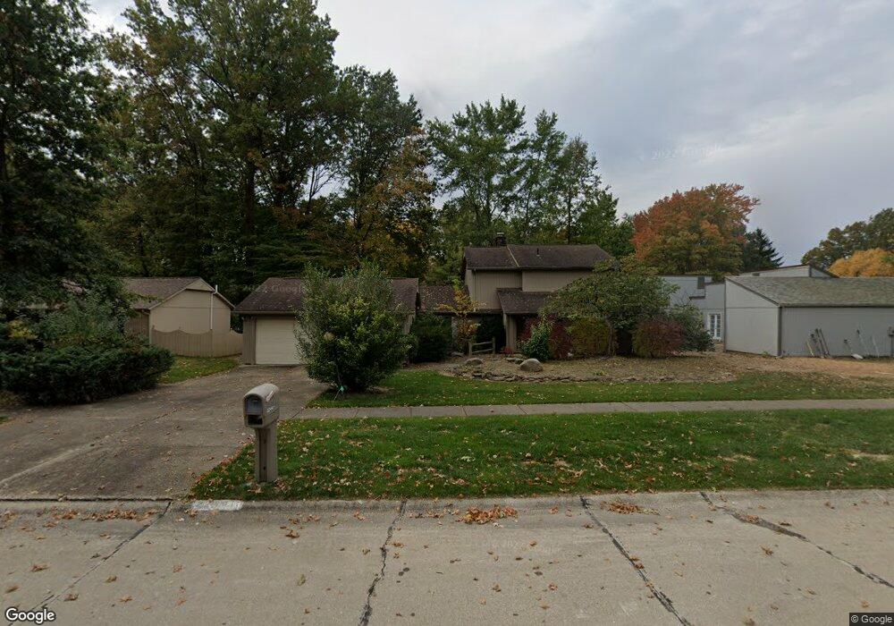
22441 Rock Creek Cir Strongsville, OH 44149
Estimated Value: $317,689 - $361,000
3
Beds
2
Baths
2,582
Sq Ft
$132/Sq Ft
Est. Value
About This Home
This home is located at 22441 Rock Creek Cir, Strongsville, OH 44149 and is currently estimated at $341,922, approximately $132 per square foot. 22441 Rock Creek Cir is a home located in Cuyahoga County with nearby schools including Strongsville High School, St Mary School, and Sts Joseph & John Interparochial School.
Ownership History
Date
Name
Owned For
Owner Type
Purchase Details
Closed on
Oct 12, 2022
Sold by
Stephens Robert C
Bought by
Kleem and Kleem
Current Estimated Value
Purchase Details
Closed on
Mar 30, 1984
Sold by
Volpe Arthur M
Bought by
Stephens Robert C
Purchase Details
Closed on
Nov 3, 1978
Bought by
Volpe Arthur M
Purchase Details
Closed on
Jan 1, 1978
Bought by
Bob Schmitt Homes Inc
Create a Home Valuation Report for This Property
The Home Valuation Report is an in-depth analysis detailing your home's value as well as a comparison with similar homes in the area
Home Values in the Area
Average Home Value in this Area
Purchase History
| Date | Buyer | Sale Price | Title Company |
|---|---|---|---|
| Kleem | $234,300 | Common Law Title | |
| Stephens Robert C | $137,000 | -- | |
| Volpe Arthur M | $127,700 | -- | |
| Bob Schmitt Homes Inc | -- | -- |
Source: Public Records
Tax History Compared to Growth
Tax History
| Year | Tax Paid | Tax Assessment Tax Assessment Total Assessment is a certain percentage of the fair market value that is determined by local assessors to be the total taxable value of land and additions on the property. | Land | Improvement |
|---|---|---|---|---|
| 2024 | $3,937 | $81,900 | $19,565 | $62,335 |
| 2023 | $5,246 | $82,010 | $17,080 | $64,930 |
| 2022 | $4,554 | $82,010 | $17,080 | $64,930 |
| 2021 | $4,518 | $82,010 | $17,080 | $64,930 |
| 2020 | $4,404 | $71,930 | $14,980 | $56,950 |
| 2019 | $4,275 | $205,500 | $42,800 | $162,700 |
| 2018 | $3,817 | $71,930 | $14,980 | $56,950 |
| 2017 | $3,824 | $66,400 | $13,340 | $53,060 |
| 2016 | $3,793 | $66,400 | $13,340 | $53,060 |
| 2015 | $3,718 | $66,400 | $13,340 | $53,060 |
| 2014 | $3,718 | $64,470 | $12,950 | $51,520 |
Source: Public Records
Map
Nearby Homes
- 22300 Rock Creek Cir
- 9829 Plum Brook Ln
- 0 Priem Rd
- 9598 Pebble Brook Ln
- 10001 N Marks Rd
- 10824 Watercress Rd
- 10800 Meadow Trail
- 10842 Fence Row Dr
- 8746 Barton Dr
- 11030 Southwind Ct
- 10353 Oak Branch Trail
- 9384 N Marks Rd
- 8902 Lincolnshire Blvd
- 21292 Creekside Dr
- 21176 Hickory Branch Trail
- 21359 Briar Bush Ln
- 8627 Courtland Dr
- 8981 Leatherleaf Dr
- 8896 Firethorne Dr
- 8960 Leatherleaf Dr
- 22419 Rock Creek Cir
- 22397 Rock Creek Cir
- 10741 Waterfall Rd
- 22432 Rock Creek Cir
- 10737 Waterfall Rd
- 22454 Rock Creek Cir
- 22375 Rock Creek Cir
- 22410 Rock Creek Cir
- 10745 Waterfall Rd
- 10733 Waterfall Rd
- 9918 Pebble Brook Ln
- 22398 Rock Creek Cir
- 10749 Waterfall Rd
- 22353 Rock Creek Cir
- 9854 Pebble Brook Ln
- 22386 Rock Creek Cir
- 10729 Waterfall Rd
- 9837 Pebble Brook Ln
- 10753 Waterfall Rd
- 22364 Rock Creek Cir