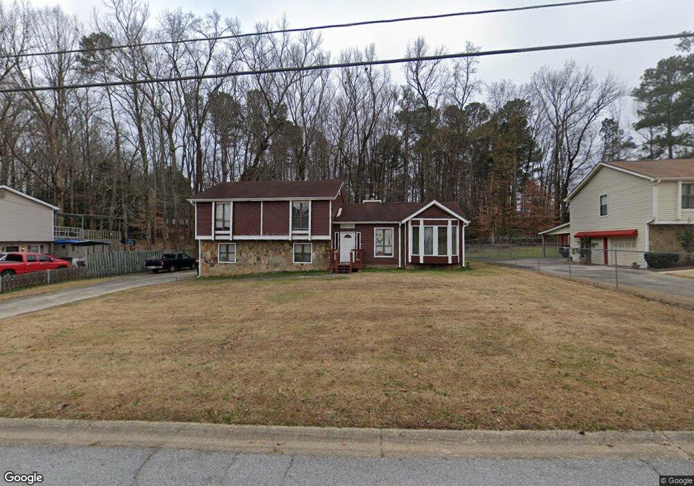
2245 Brookstone Dr Unit 1 Lithia Springs, GA 30122
Lithia Springs NeighborhoodEstimated Value: $222,000 - $282,000
3
Beds
2
Baths
1,588
Sq Ft
$167/Sq Ft
Est. Value
About This Home
This home is located at 2245 Brookstone Dr Unit 1, Lithia Springs, GA 30122 and is currently estimated at $264,981, approximately $166 per square foot. 2245 Brookstone Dr Unit 1 is a home located in Douglas County with nearby schools including Sweetwater Elementary School, Factory Shoals Middle School, and Lithia Springs Comprehensive High School.
Ownership History
Date
Name
Owned For
Owner Type
Purchase Details
Closed on
Aug 4, 2005
Sold by
Rowe Michael J
Bought by
Phillips Kevin L
Current Estimated Value
Home Financials for this Owner
Home Financials are based on the most recent Mortgage that was taken out on this home.
Original Mortgage
$132,650
Outstanding Balance
$68,875
Interest Rate
5.48%
Mortgage Type
VA
Estimated Equity
$196,106
Purchase Details
Closed on
Nov 30, 2001
Sold by
Mckinnor Deidre W
Bought by
Rowe Michael S
Home Financials for this Owner
Home Financials are based on the most recent Mortgage that was taken out on this home.
Original Mortgage
$108,300
Interest Rate
7.12%
Mortgage Type
FHA
Purchase Details
Closed on
Oct 28, 1997
Sold by
Moore C Alton
Bought by
Mckinnor Deidre W
Home Financials for this Owner
Home Financials are based on the most recent Mortgage that was taken out on this home.
Original Mortgage
$90,750
Interest Rate
7.19%
Mortgage Type
VA
Create a Home Valuation Report for This Property
The Home Valuation Report is an in-depth analysis detailing your home's value as well as a comparison with similar homes in the area
Home Values in the Area
Average Home Value in this Area
Purchase History
| Date | Buyer | Sale Price | Title Company |
|---|---|---|---|
| Phillips Kevin L | $129,900 | -- | |
| Rowe Michael S | $110,000 | -- | |
| Mckinnor Deidre W | $89,000 | -- |
Source: Public Records
Mortgage History
| Date | Status | Borrower | Loan Amount |
|---|---|---|---|
| Open | Phillips Kevin L | $132,650 | |
| Previous Owner | Rowe Michael S | $108,300 | |
| Previous Owner | Mckinnor Deidre W | $90,750 |
Source: Public Records
Tax History Compared to Growth
Tax History
| Year | Tax Paid | Tax Assessment Tax Assessment Total Assessment is a certain percentage of the fair market value that is determined by local assessors to be the total taxable value of land and additions on the property. | Land | Improvement |
|---|---|---|---|---|
| 2024 | $2,892 | $91,920 | $23,200 | $68,720 |
| 2023 | $2,892 | $91,920 | $23,200 | $68,720 |
| 2022 | $2,137 | $65,640 | $16,000 | $49,640 |
| 2021 | $1,565 | $48,000 | $8,960 | $39,040 |
| 2020 | $1,592 | $48,000 | $8,960 | $39,040 |
| 2019 | $1,454 | $46,960 | $8,960 | $38,000 |
| 2018 | $1,413 | $45,400 | $8,960 | $36,440 |
| 2017 | $1,302 | $41,040 | $8,960 | $32,080 |
| 2016 | $1,518 | $47,040 | $8,960 | $38,080 |
| 2015 | $898 | $30,600 | $6,040 | $24,560 |
| 2014 | $1,001 | $33,160 | $7,040 | $26,120 |
| 2013 | -- | $33,040 | $7,040 | $26,000 |
Source: Public Records
Map
Nearby Homes
- 2255 Brookstone Dr
- 2235 Brookstone Dr
- 0 Brookstone Dr Unit 7501512
- 0 Brookstone Dr Unit 7451448
- 0 Brookstone Dr Unit 8555039
- 0 Brookstone Dr Unit 8436441
- 0 Brookstone Dr Unit 8529124
- 0 Brookstone Dr Unit 7599403
- 0 Brookstone Dr Unit 8033099
- 0 Brookstone Dr Unit 8963480
- 0 Brookstone Dr Unit 3132389
- 0 Brookstone Dr Unit 3199149
- 0 Brookstone Dr Unit 3224632
- 0 Brookstone Dr Unit 7014874
- 0 Brookstone Dr
- 2265 Brookstone Dr Unit 1
- 1735 Clearstone Dr
- 2225 Brookstone Dr
- 2260 Brookstone Dr Unit 1
- 1730 Clearstone Dr