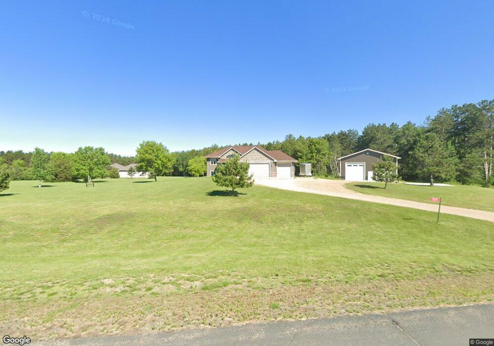
2246 71st St Somerset, WI 54025
Estimated Value: $522,000 - $589,000
--
Bed
--
Bath
--
Sq Ft
3.02
Acres
About This Home
This home is located at 2246 71st St, Somerset, WI 54025 and is currently estimated at $550,652. 2246 71st St is a home located in St. Croix County with nearby schools including Somerset Elementary School, Somerset Middle School, and Somerset High School.
Ownership History
Date
Name
Owned For
Owner Type
Purchase Details
Closed on
May 25, 2011
Sold by
Associated Bank Na
Bought by
Ball Mark
Current Estimated Value
Home Financials for this Owner
Home Financials are based on the most recent Mortgage that was taken out on this home.
Original Mortgage
$220,000
Interest Rate
4.96%
Mortgage Type
New Conventional
Purchase Details
Closed on
May 10, 2010
Sold by
P C Collova Builders Inc
Bought by
Associated Bank National Association
Create a Home Valuation Report for This Property
The Home Valuation Report is an in-depth analysis detailing your home's value as well as a comparison with similar homes in the area
Home Values in the Area
Average Home Value in this Area
Purchase History
| Date | Buyer | Sale Price | Title Company |
|---|---|---|---|
| Ball Mark | $13,400 | None Available | |
| Associated Bank National Association | $180,000 | None Available |
Source: Public Records
Mortgage History
| Date | Status | Borrower | Loan Amount |
|---|---|---|---|
| Closed | Ball Mark | $220,000 |
Source: Public Records
Tax History Compared to Growth
Tax History
| Year | Tax Paid | Tax Assessment Tax Assessment Total Assessment is a certain percentage of the fair market value that is determined by local assessors to be the total taxable value of land and additions on the property. | Land | Improvement |
|---|---|---|---|---|
| 2024 | $45 | $451,400 | $90,100 | $361,300 |
| 2023 | $4,534 | $451,400 | $90,100 | $361,300 |
| 2022 | $3,574 | $451,400 | $90,100 | $361,300 |
| 2021 | $3,575 | $242,900 | $55,100 | $187,800 |
| 2020 | $3,591 | $242,900 | $55,100 | $187,800 |
| 2019 | $3,294 | $242,900 | $55,100 | $187,800 |
| 2018 | $3,243 | $242,900 | $55,100 | $187,800 |
| 2017 | $3,213 | $242,900 | $55,100 | $187,800 |
| 2016 | $3,213 | $192,300 | $25,100 | $167,200 |
| 2015 | $3,076 | $192,300 | $25,100 | $167,200 |
| 2014 | $2,920 | $192,300 | $25,100 | $167,200 |
| 2013 | $3,056 | $192,300 | $25,100 | $167,200 |
Source: Public Records
Map
Nearby Homes
- Lot #1 xxx 74th St
- Lot #19 xxx 74th St
- Lot #14 xxx 74th St
- 2113 80th St
- 2136 62nd St
- 6XX 205th Ave
- 931 218th Ave
- 2276 44th St
- 462 210th Ave
- 1986 57th St
- XXX 100th St
- Lot 6 220th Ave
- 2118 100th St
- 1932 64th St
- 2771 County Line Ave
- 413 210th Ave
- 315 Harriman St
- The Rockport Plan at Pine Vale
- The Newport Plan at Pine Vale
- The Brook View Plan at Pine Vale