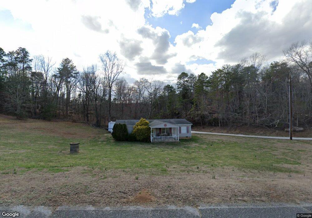
2246 O G Lail Rd Unit 1 Shelby, NC 28152
Estimated Value: $171,297 - $248,000
--
Bed
--
Bath
1,568
Sq Ft
$131/Sq Ft
Est. Value
About This Home
This home is located at 2246 O G Lail Rd Unit 1, Shelby, NC 28152 and is currently estimated at $205,824, approximately $131 per square foot. 2246 O G Lail Rd Unit 1 is a home located in Cleveland County with nearby schools including Boiling Springs Elementary School, Crest Middle School, and Crest High School.
Ownership History
Date
Name
Owned For
Owner Type
Purchase Details
Closed on
Jun 12, 2015
Sold by
Smith Julie Lail and Smith Patrick G
Bought by
Smith Julie Lail and Smith Patrick G
Current Estimated Value
Home Financials for this Owner
Home Financials are based on the most recent Mortgage that was taken out on this home.
Original Mortgage
$48,450
Interest Rate
3.88%
Mortgage Type
New Conventional
Purchase Details
Closed on
Feb 7, 2008
Sold by
Parker Paul Vincent and Parker Carmen Smith
Bought by
Lail Julie A
Home Financials for this Owner
Home Financials are based on the most recent Mortgage that was taken out on this home.
Original Mortgage
$37,500
Interest Rate
5.85%
Mortgage Type
Purchase Money Mortgage
Create a Home Valuation Report for This Property
The Home Valuation Report is an in-depth analysis detailing your home's value as well as a comparison with similar homes in the area
Home Values in the Area
Average Home Value in this Area
Purchase History
| Date | Buyer | Sale Price | Title Company |
|---|---|---|---|
| Smith Julie Lail | -- | None Available | |
| Lail Julie A | -- | None Available |
Source: Public Records
Mortgage History
| Date | Status | Borrower | Loan Amount |
|---|---|---|---|
| Closed | Smith Julie Lail | $48,450 | |
| Closed | Lail Julie A | $37,500 |
Source: Public Records
Tax History Compared to Growth
Tax History
| Year | Tax Paid | Tax Assessment Tax Assessment Total Assessment is a certain percentage of the fair market value that is determined by local assessors to be the total taxable value of land and additions on the property. | Land | Improvement |
|---|---|---|---|---|
| 2025 | $921 | $144,983 | $27,389 | $117,594 |
| 2024 | $677 | $75,033 | $22,906 | $52,127 |
| 2023 | $674 | $75,033 | $22,906 | $52,127 |
| 2022 | $674 | $75,033 | $22,906 | $52,127 |
| 2021 | $675 | $75,033 | $22,906 | $52,127 |
| 2020 | $658 | $70,616 | $22,906 | $47,710 |
| 2019 | $658 | $70,616 | $22,906 | $47,710 |
| 2018 | $654 | $70,616 | $22,906 | $47,710 |
| 2017 | $651 | $70,616 | $22,906 | $47,710 |
| 2016 | $620 | $70,616 | $22,906 | $47,710 |
| 2015 | $597 | $67,660 | $14,541 | $53,119 |
| 2014 | $597 | $67,660 | $14,541 | $53,119 |
Source: Public Records
Map
Nearby Homes
- 000 Oak St E
- 0000 Oak St E
- 1815 Gaffney Rd
- 118 Southern Pine Dr
- 107 Southern Pines Dr
- 1622 Patrick Ave
- 231 Pineland Ave Unit 1
- TBD Patrick Ave
- 125 Flint Hill Church Rd
- 2139 Mccraw Rd
- 0 Patrick Ave Unit LotWP001
- 322 S Main St
- 133 Brookview Dr
- 106 Riverview Dr
- 105 River View Dr
- 111 River View Dr
- 301 Oak Ave
- 1336 Mount Sinai Church Rd
- 00 Broad River Highlands Dr Unit 3-C
- Lot 3B Broad River Highlands Dr
- 2246 O G Lail Rd
- 2240 O G Lail Rd
- 2242 O G Lail Rd
- 2262 O G Lail Rd
- 2238 O G Lail Rd
- - O G Lail Rd
- 2226 O G Lail Rd
- 2288 O G Lail Rd
- 2229 O G Lail Rd
- 0 Riverside Rd Unit 3419320
- 2278 O G Lail Rd
- 2277 O G Lail Rd
- 2222 O G Lail Rd
- 111 Anthony Lake Dr
- 107 Anthony Lake Dr
- 2141 Riverside Rd
- 2142 Honey Haven Farm Rd
- 2291 O G Lail Rd
- 2244 Honey Haven Farm Rd
- 2236 Honey Haven Farm Rd