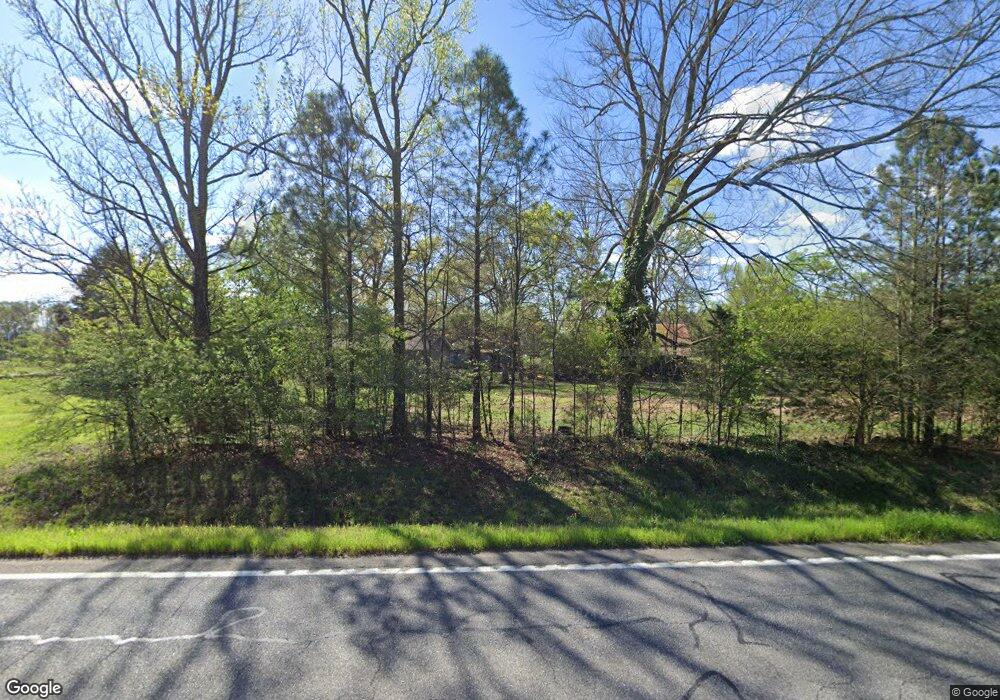
2246 Roland Hayes Pkwy SW Calhoun, GA 30701
Estimated Value: $114,982 - $159,000
2
Beds
1
Bath
882
Sq Ft
$160/Sq Ft
Est. Value
About This Home
This home is located at 2246 Roland Hayes Pkwy SW, Calhoun, GA 30701 and is currently estimated at $141,327, approximately $160 per square foot. 2246 Roland Hayes Pkwy SW is a home located in Gordon County.
Ownership History
Date
Name
Owned For
Owner Type
Purchase Details
Closed on
Oct 2, 2020
Sold by
Roberts Poultry & Rental Properties Llc
Bought by
Lopez Sinecio and Rolon Amalia
Current Estimated Value
Purchase Details
Closed on
Nov 8, 2010
Sold by
Roberts Alfred L and Dymple Revo
Bought by
Roberts Poultry & Rental Properties Llc
Purchase Details
Closed on
Aug 31, 2001
Sold by
Roberts A L
Bought by
Roberts Alfred L & Dymple Revocable
Create a Home Valuation Report for This Property
The Home Valuation Report is an in-depth analysis detailing your home's value as well as a comparison with similar homes in the area
Home Values in the Area
Average Home Value in this Area
Purchase History
| Date | Buyer | Sale Price | Title Company |
|---|---|---|---|
| Lopez Sinecio | $55,000 | -- | |
| Roberts Poultry & Rental Properties Llc | -- | -- | |
| Roberts Alfred L & Dymple Revocable | -- | -- |
Source: Public Records
Tax History Compared to Growth
Tax History
| Year | Tax Paid | Tax Assessment Tax Assessment Total Assessment is a certain percentage of the fair market value that is determined by local assessors to be the total taxable value of land and additions on the property. | Land | Improvement |
|---|---|---|---|---|
| 2024 | $419 | $16,480 | $3,200 | $13,280 |
| 2023 | $400 | $15,760 | $3,200 | $12,560 |
| 2022 | $410 | $15,160 | $3,200 | $11,960 |
| 2021 | $279 | $12,280 | $3,200 | $9,080 |
| 2020 | $352 | $12,280 | $3,200 | $9,080 |
| 2019 | $354 | $12,280 | $3,200 | $9,080 |
| 2018 | $342 | $11,880 | $3,200 | $8,680 |
| 2017 | $337 | $11,360 | $3,200 | $8,160 |
| 2016 | $337 | $11,360 | $3,200 | $8,160 |
| 2015 | $335 | $11,160 | $3,200 | $7,960 |
| 2014 | $309 | $10,610 | $3,218 | $7,392 |
Source: Public Records
Map
Nearby Homes
- The Braselton II Plan at Fair Oak
- The Reynolds Plan at Fair Oak
- The Buford II Plan at Fair Oak
- The Lawson Plan at Fair Oak
- The Caldwell Plan at Fair Oak
- The Benson II Plan at Fair Oak
- The Greenbrier II Plan at Fair Oak
- 176 Village Way SW
- 515 Hunt Bend Rd NW
- 301 Switch Rd SW
- 413 Beamer Rd SW
- 210 Madison Dr SW
- 130 Brookstone Dr SW
- 1943 Rome Rd SW
- 0 Reeves Station Rd SW Unit 10548197
- 0 Reeves Station Rd SW Unit 7601645
- 137 Regency Row SW
- 0 Highway 53 Spur SW Unit 7529096
- 121 Foxhall Dr SW
- 821 Everett Springs Rd NE
- 2246 Roland Hayes Pkwy SW
- 2246 Roland Hayes Pkwy SW
- 2246 Roland Hayes Pkwy SW
- 2246 Roland Hayes Pkwy SW
- 2246 Roland Hayes Pkwy SW
- 2246 Roland Hayes Pkwy SW
- 2246 Roland Hayes Pkwy SW
- 2246 Roland Hayes Pkwy SW
- 2329 Roland Hayes Pkwy NW
- 0 Holbrook Rd NW Unit 3854647
- 0 Old Rome Dalton Rd NW
- 00 Old Rome Dalton Rd NW
- 0 Old Rome Dalton Rd NW Unit RTC2729648
- 0 Old Rome Dalton Rd NW Unit 1270614
- 0 Old Rome Dalton Rd NW Unit 110884
- 0 Old Rome Dalton Rd NW Unit 8759968
- 0 Old Rome Dalton Rd NW Unit 8840528
- 0 Old Rome Dalton Rd NW Unit 8631296
- 0 Old Rome Dalton Rd NW Unit 8654257
- 0 Old Rome Dalton Rd NW Unit 8530311
