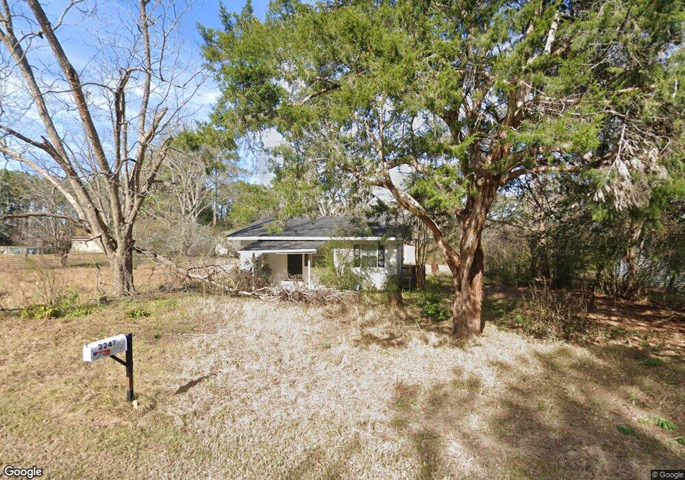
2247 Clark Cir Ochlocknee, GA 31773
Estimated Value: $73,000 - $155,000
3
Beds
2
Baths
1,342
Sq Ft
$74/Sq Ft
Est. Value
About This Home
This home is located at 2247 Clark Cir, Ochlocknee, GA 31773 and is currently estimated at $98,696, approximately $73 per square foot. 2247 Clark Cir is a home located in Thomas County with nearby schools including Hand in Hand Primary School, Cross Creek Elementary School, and Garrison-Pilcher Elementary School.
Ownership History
Date
Name
Owned For
Owner Type
Purchase Details
Closed on
Dec 30, 2025
Sold by
Watson Cleveland
Bought by
Smith Kameron Adam and Stewart Aubree Kate
Current Estimated Value
Home Financials for this Owner
Home Financials are based on the most recent Mortgage that was taken out on this home.
Original Mortgage
$112,917
Outstanding Balance
$112,700
Interest Rate
6.19%
Mortgage Type
FHA
Estimated Equity
-$14,004
Purchase Details
Closed on
Dec 29, 2025
Sold by
Glass J Ross
Bought by
Watson Cleveland
Home Financials for this Owner
Home Financials are based on the most recent Mortgage that was taken out on this home.
Original Mortgage
$112,917
Outstanding Balance
$112,700
Interest Rate
6.19%
Mortgage Type
FHA
Estimated Equity
-$14,004
Purchase Details
Closed on
Aug 20, 2025
Sold by
Glass J Ross
Bought by
Watson Cleveland
Purchase Details
Closed on
Feb 26, 2002
Sold by
Smith James D and Smith Mari
Bought by
Smith James Dean
Purchase Details
Closed on
Dec 22, 1999
Sold by
Thomas County Fed S
Bought by
Smith James D and Smith Mari
Purchase Details
Closed on
Nov 2, 1999
Sold by
Blount Kevin B
Bought by
Thomas County Fed S
Purchase Details
Closed on
Feb 16, 1998
Bought by
Blount Kevin B
Create a Home Valuation Report for This Property
The Home Valuation Report is an in-depth analysis detailing your home's value as well as a comparison with similar homes in the area
Purchase History
| Date | Buyer | Sale Price | Title Company |
|---|---|---|---|
| Smith Kameron Adam | $115,000 | -- | |
| Watson Cleveland | -- | -- | |
| Watson Cleveland | $75,000 | -- | |
| Smith James Dean | -- | -- | |
| Smith James D | $32,000 | -- | |
| Thomas County Fed S | -- | -- | |
| Blount Kevin B | $30,000 | -- |
Source: Public Records
Mortgage History
| Date | Status | Borrower | Loan Amount |
|---|---|---|---|
| Open | Watson Cleveland | $112,917 |
Source: Public Records
Tax History
| Year | Tax Paid | Tax Assessment Tax Assessment Total Assessment is a certain percentage of the fair market value that is determined by local assessors to be the total taxable value of land and additions on the property. | Land | Improvement |
|---|---|---|---|---|
| 2025 | $673 | $24,205 | $4,195 | $20,010 |
| 2024 | $695 | $24,047 | $4,195 | $19,852 |
| 2023 | $641 | $22,550 | $4,195 | $18,355 |
| 2022 | $475 | $19,789 | $3,496 | $16,293 |
| 2021 | $445 | $16,880 | $3,496 | $13,384 |
| 2020 | $451 | $16,705 | $3,496 | $13,209 |
| 2019 | $454 | $16,705 | $3,496 | $13,209 |
| 2018 | $458 | $16,728 | $3,496 | $13,232 |
| 2017 | $453 | $16,298 | $3,112 | $13,186 |
| 2016 | $453 | $16,249 | $3,112 | $13,137 |
| 2015 | $512 | $18,197 | $2,902 | $15,295 |
| 2014 | $504 | $17,824 | $2,902 | $14,922 |
| 2013 | -- | $17,824 | $2,901 | $14,922 |
Source: Public Records
Map
Nearby Homes
- 3021 Church St
- 27286 U S Highway 19
- 27286 U S 19
- 5801 State Route 188
- 116 Yellow Pine Ln
- 415 Jane's Ln
- 23481 N Us 19 (7 46 Ac) Hwy
- 23481 N Us Hwy 19 (7 46 Ac)
- 23481 N Us Hwy 19 (7 46 Acres)
- 2542 Maddox Rd
- 00 Rupp Rd
- 108 Quail Ridge St
- 127 Quail Ridge
- 210 Egg and Butter Rd N
- 210 Egg & Butter Rd
- 124 Quail Ridge
- 107 Mossy Creek Way
- 105 Mossy Creek Way
- 755 Dixie Chastain Rd
- 5488 Bulloch Rd
- 2049 Clark Cir
- 2067 Clark Cir
- 2267 Clark Cir
- 2129 Clark Cir
- 2283 Clark Cir
- 6859 Stewart Rd
- 13.69 Ac Stewart Rd
- 5236 Stewart Rd
- 2290 Stewart Rd
- 2064 Clark Cir
- 2050 Clark Cir
- 1086 3rd St
- 2100 Clark Cir
- 6834 Stewart Rd
- 6902 Stewart Rd
- 3091 Church St Unit CK
- 3073 Church St
- 2033 Ellen St
- 3079 Church St Unit CK
- 3079 Church St Unit CK
Your Personal Tour Guide
Ask me questions while you tour the home.